Bodengo, from Gordona

Edited by:
Marco Bonati
Updated at: 16/09/2024
Introduction
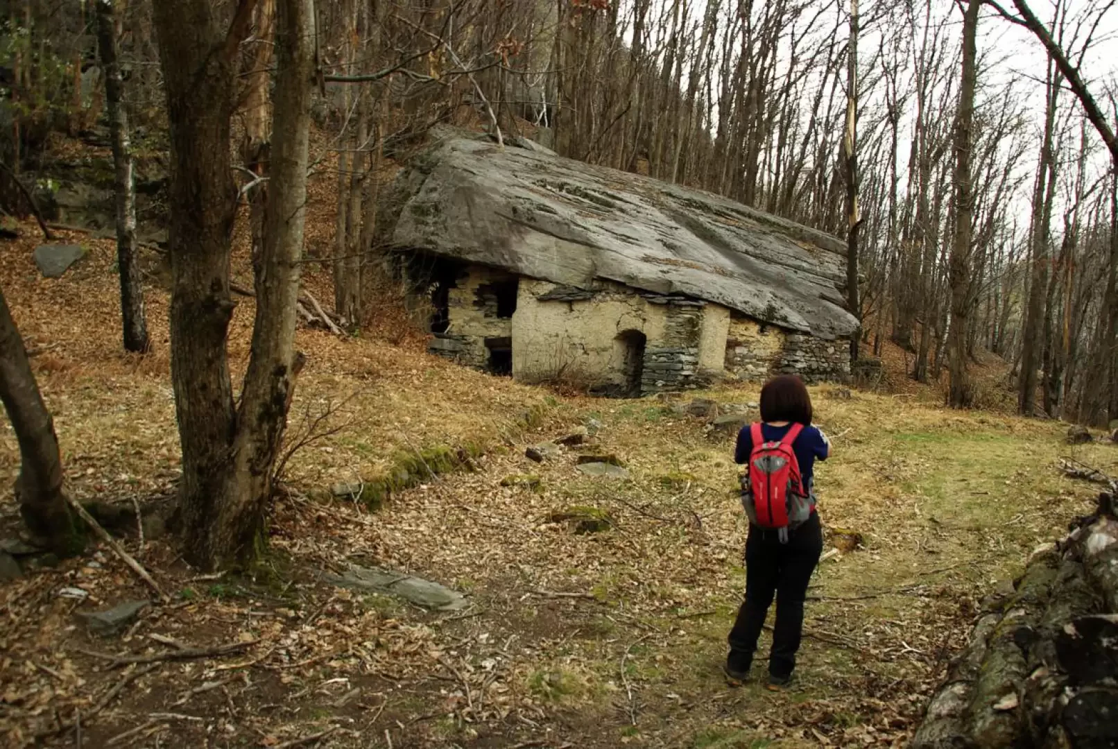
Since 1987, the village of Bodengo can be reached comfortably by car (toll road): this excursion, on the other hand, retraces the old pedestrian access routes from the valley floor on either side of the Boggia stream. You cross abandoned alpine pastures and hamlets that have now been transformed into agglomerations of holiday homes, but the natural environment - just around the corner - prevails intensively. In fine weather, the valley is popular with canyoning enthusiasts due to the presence of some very challenging routes; there are also numerous rock structures explored in the 1990s as climbing walls, well equipped but now somewhat out of fashion.
Description
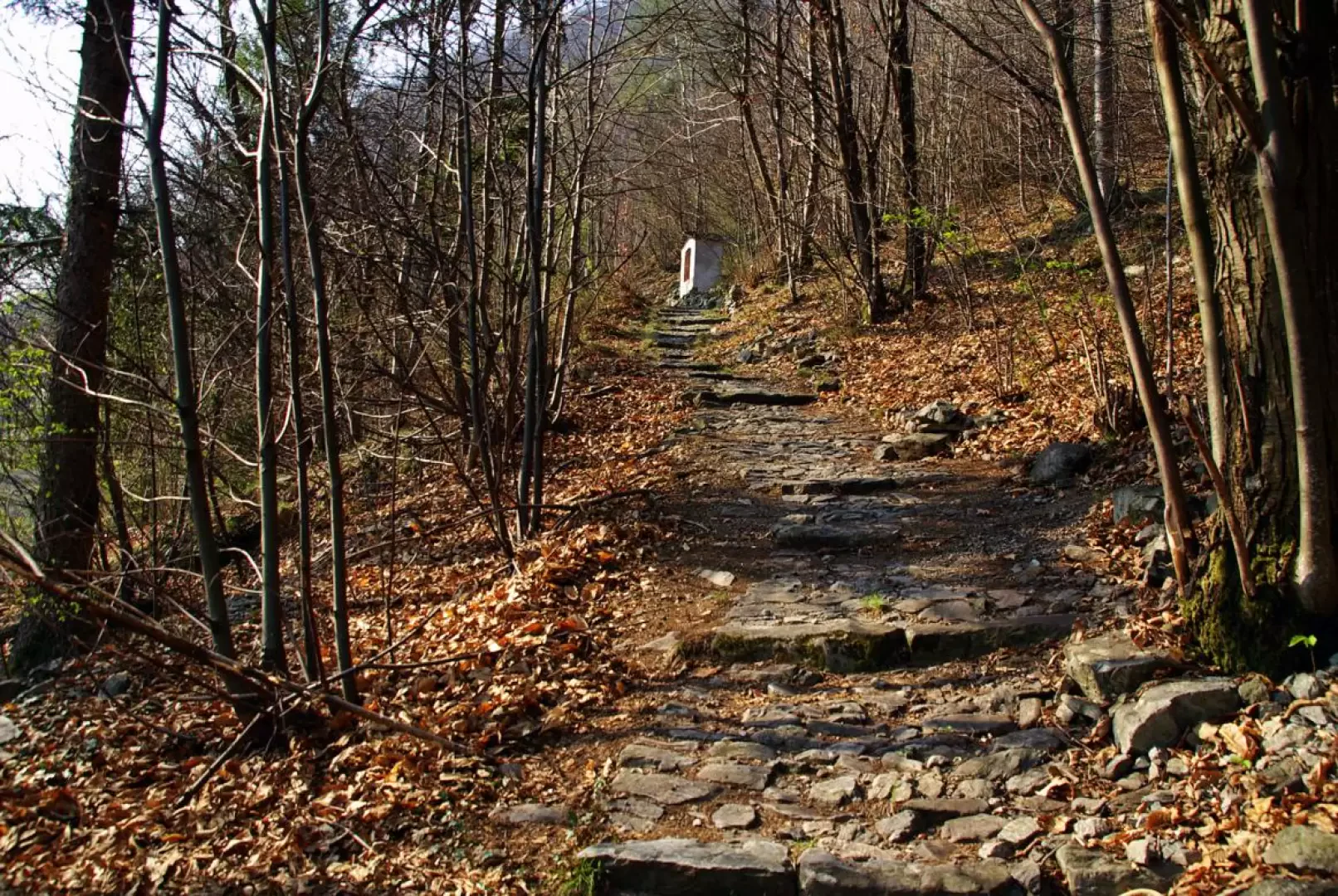
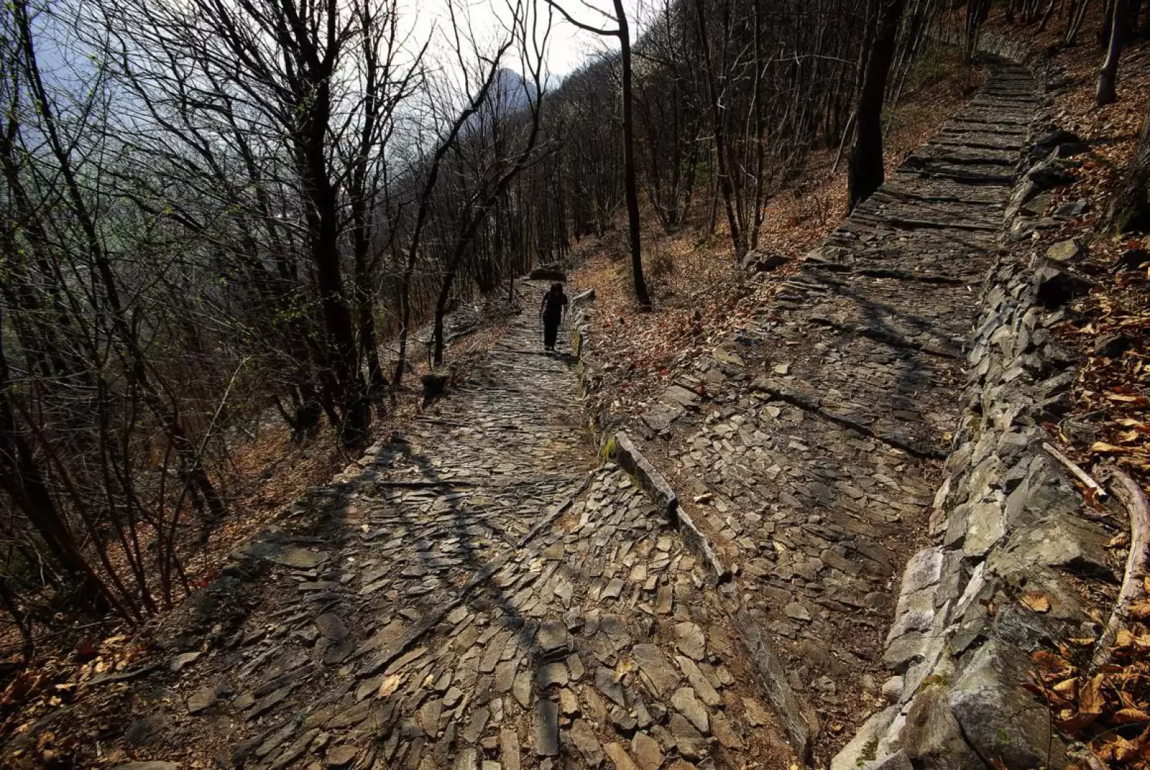
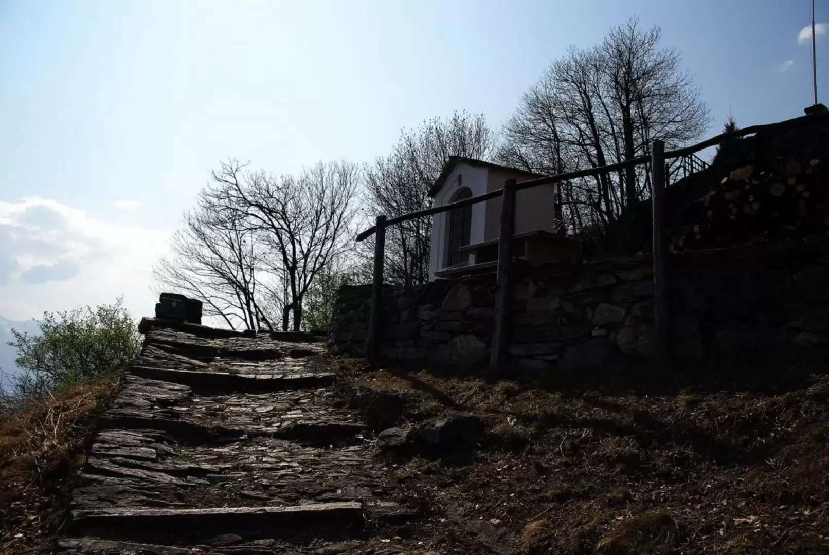
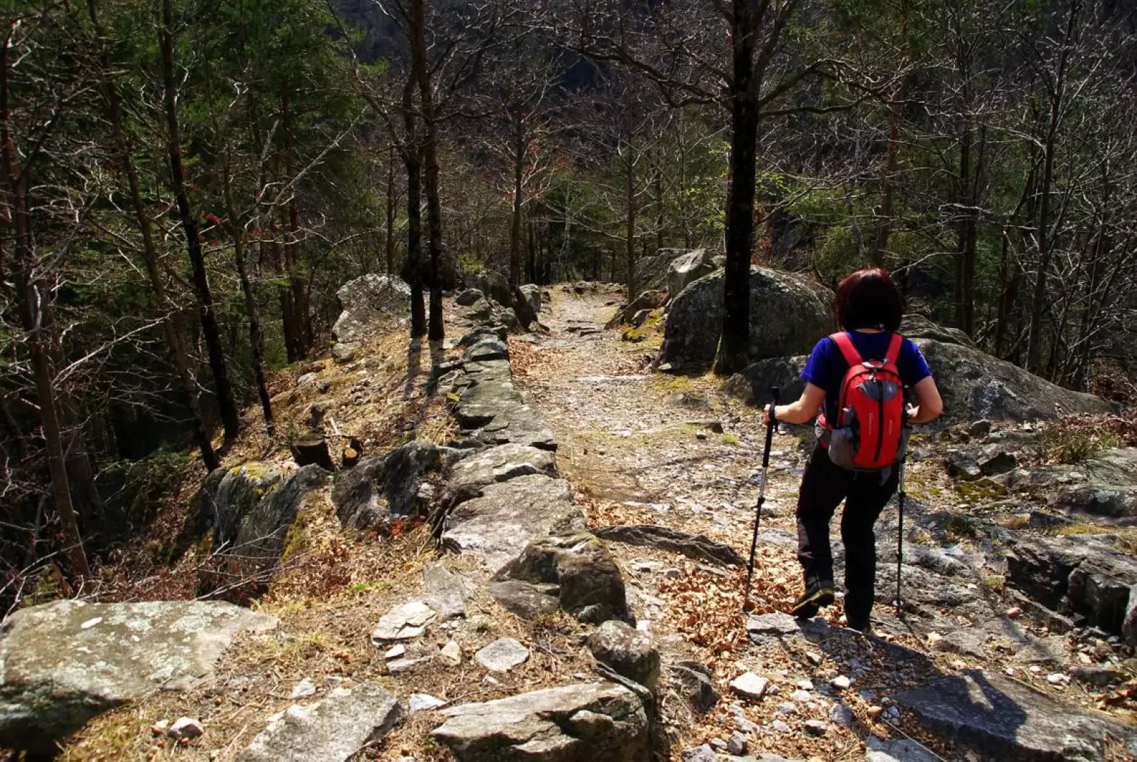
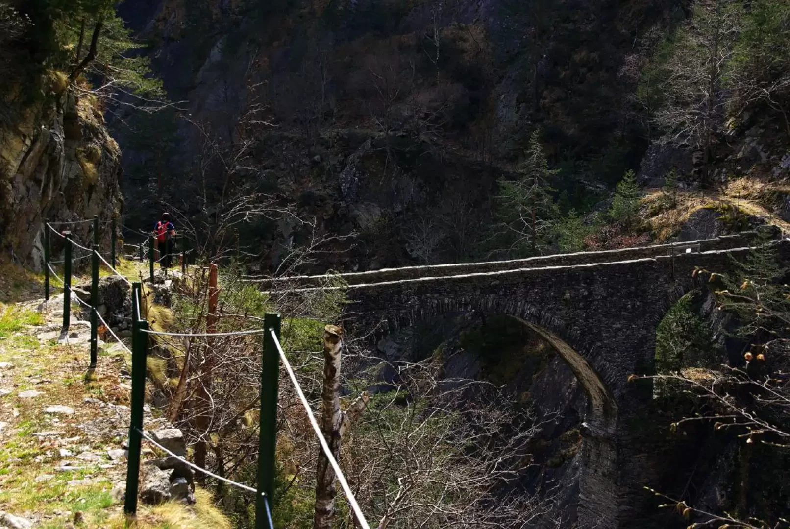
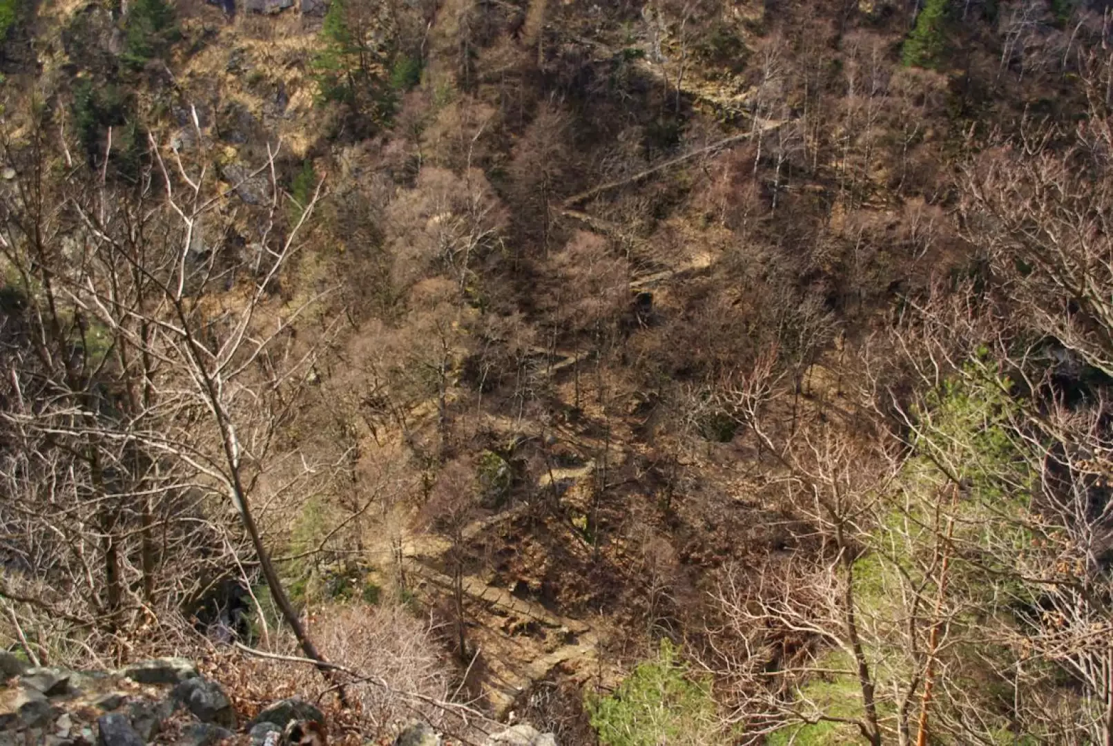
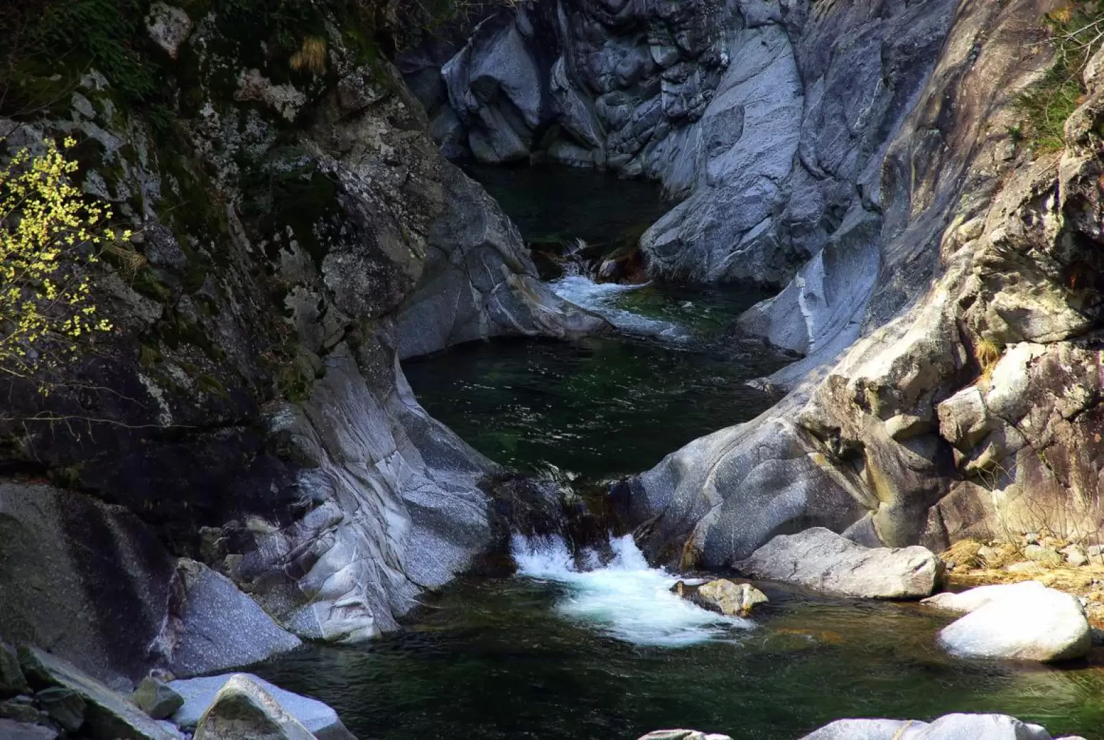
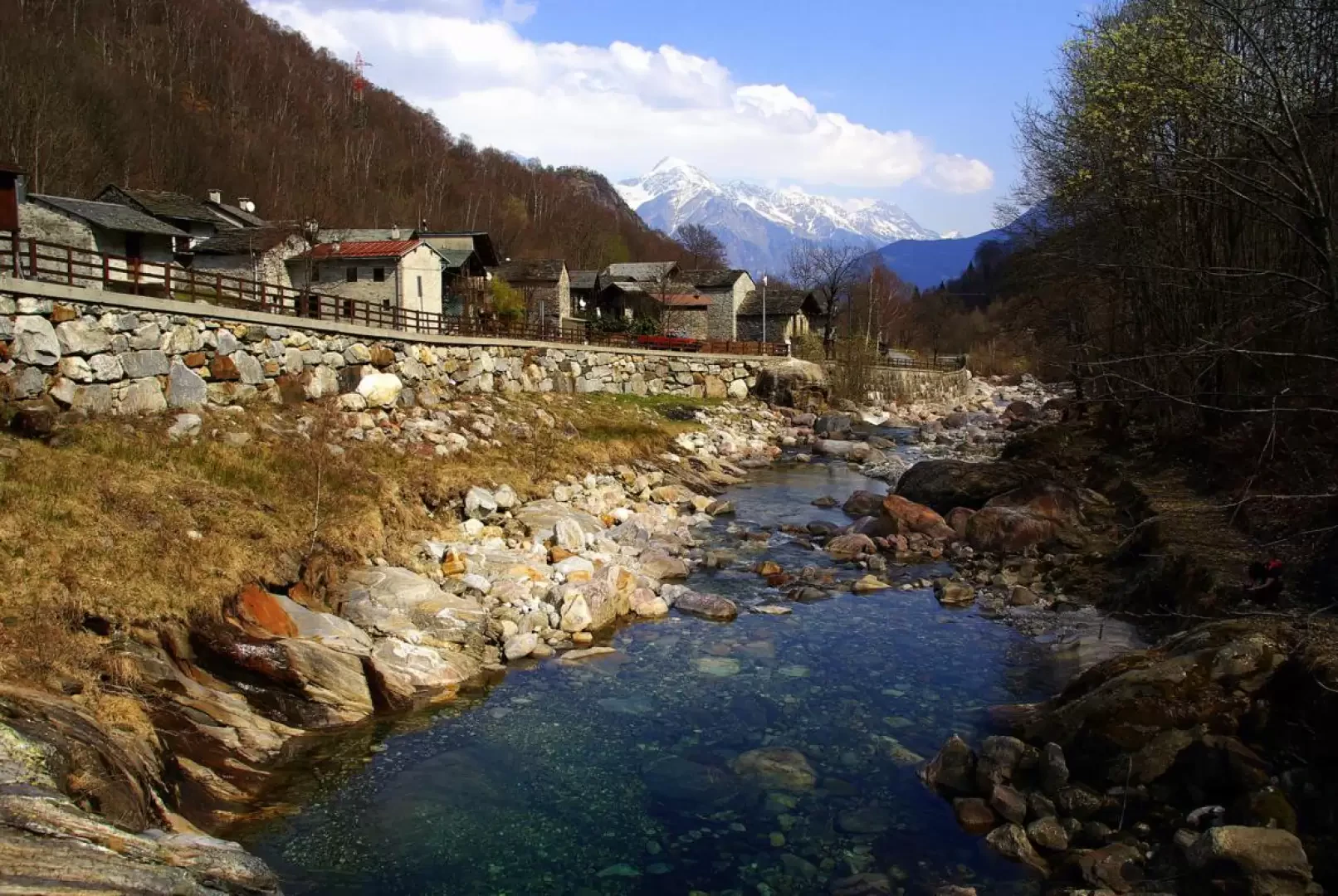
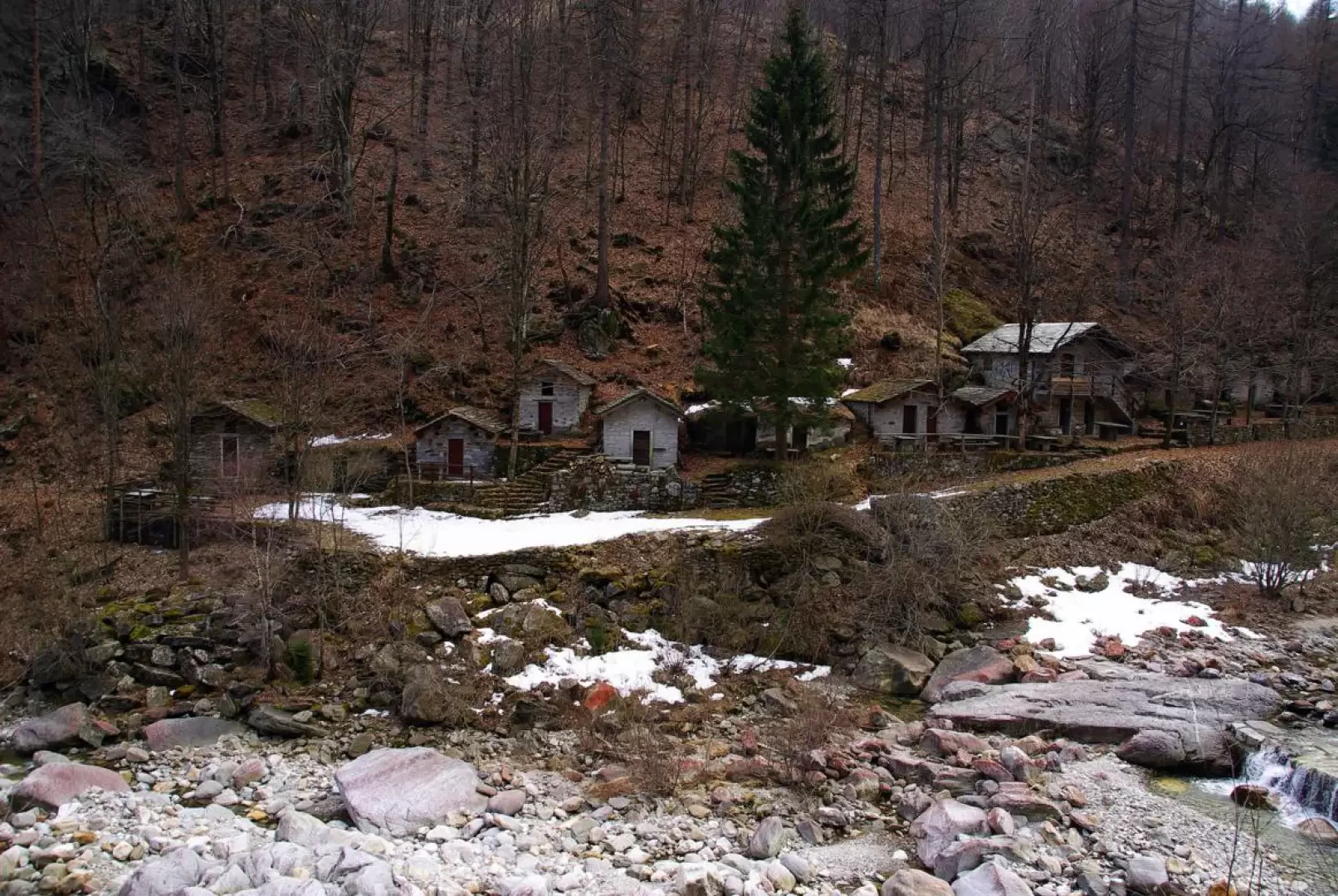
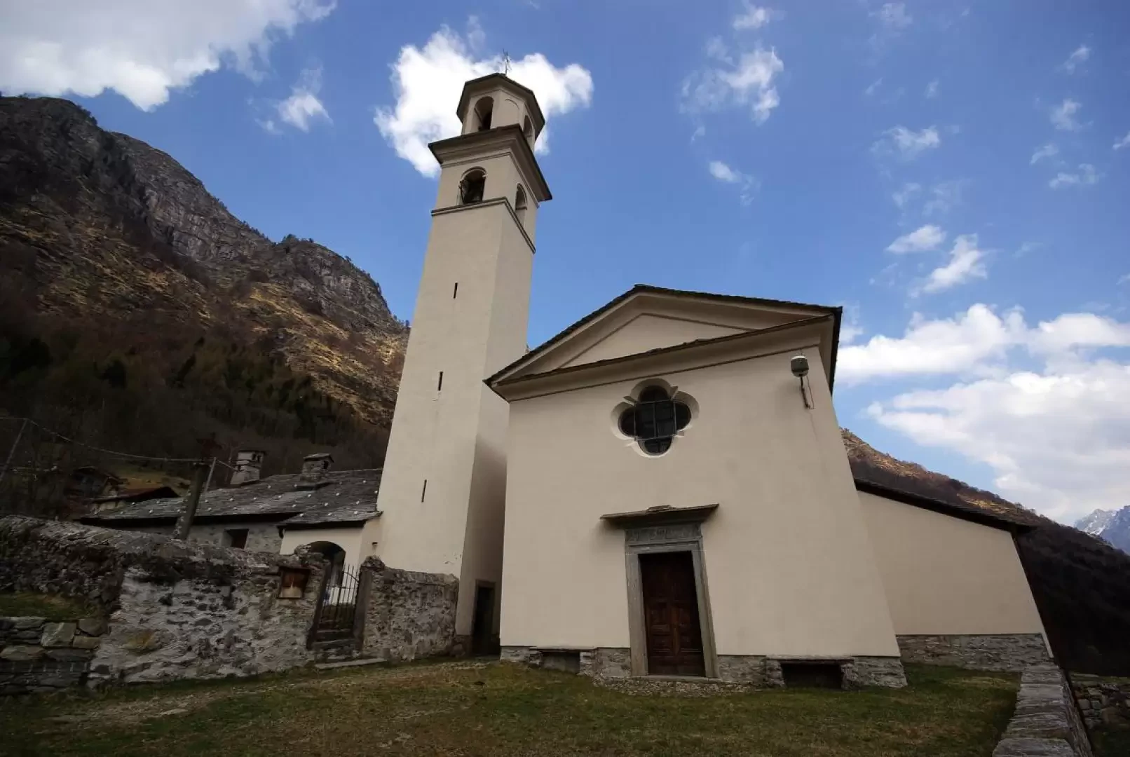
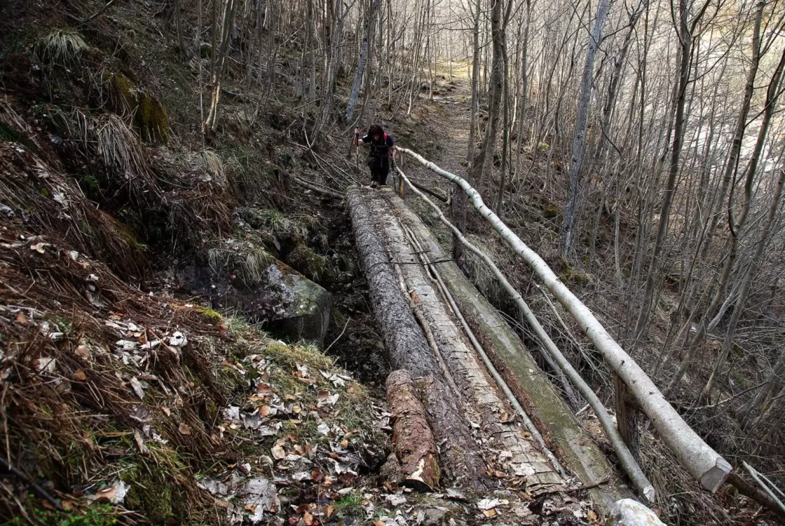
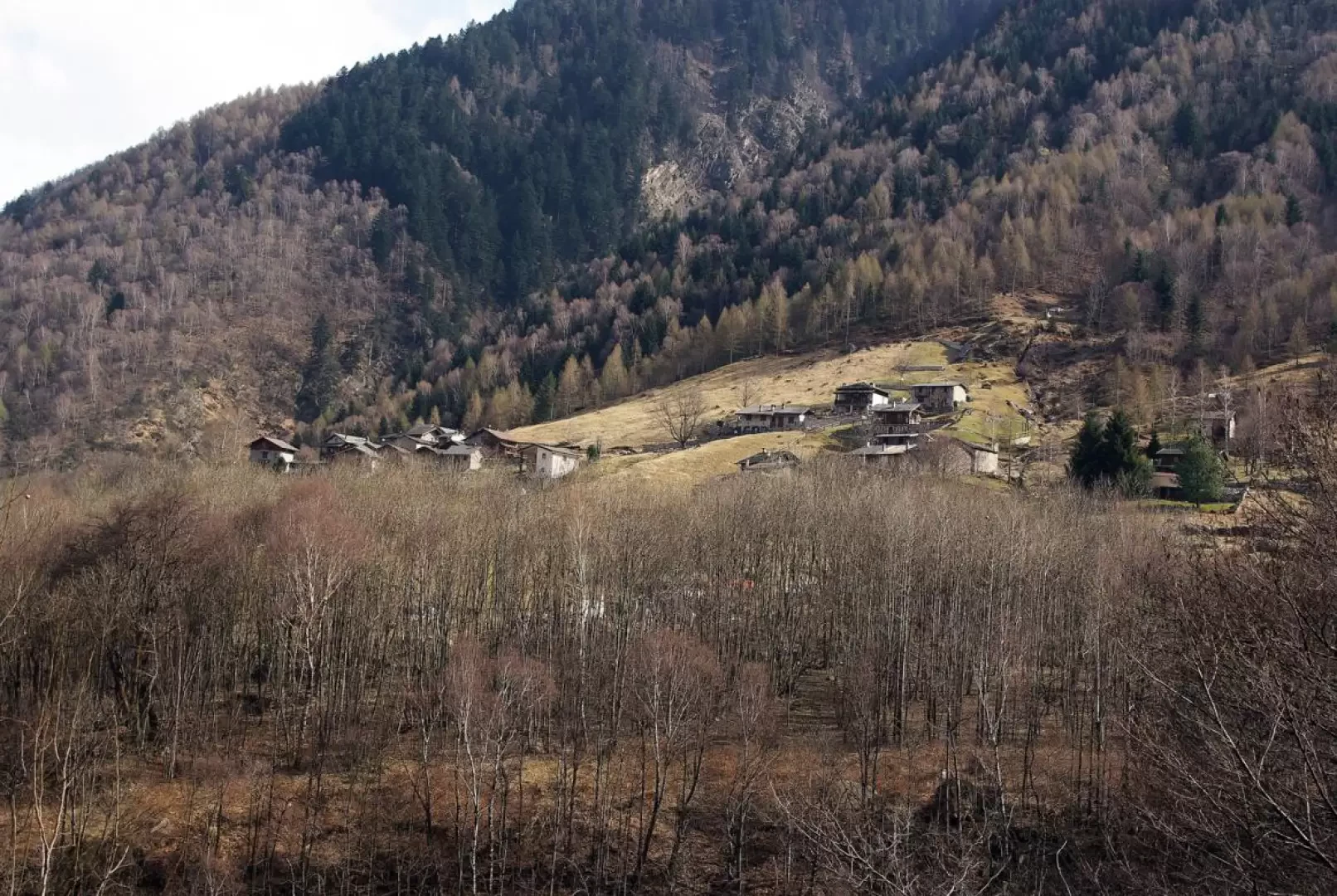
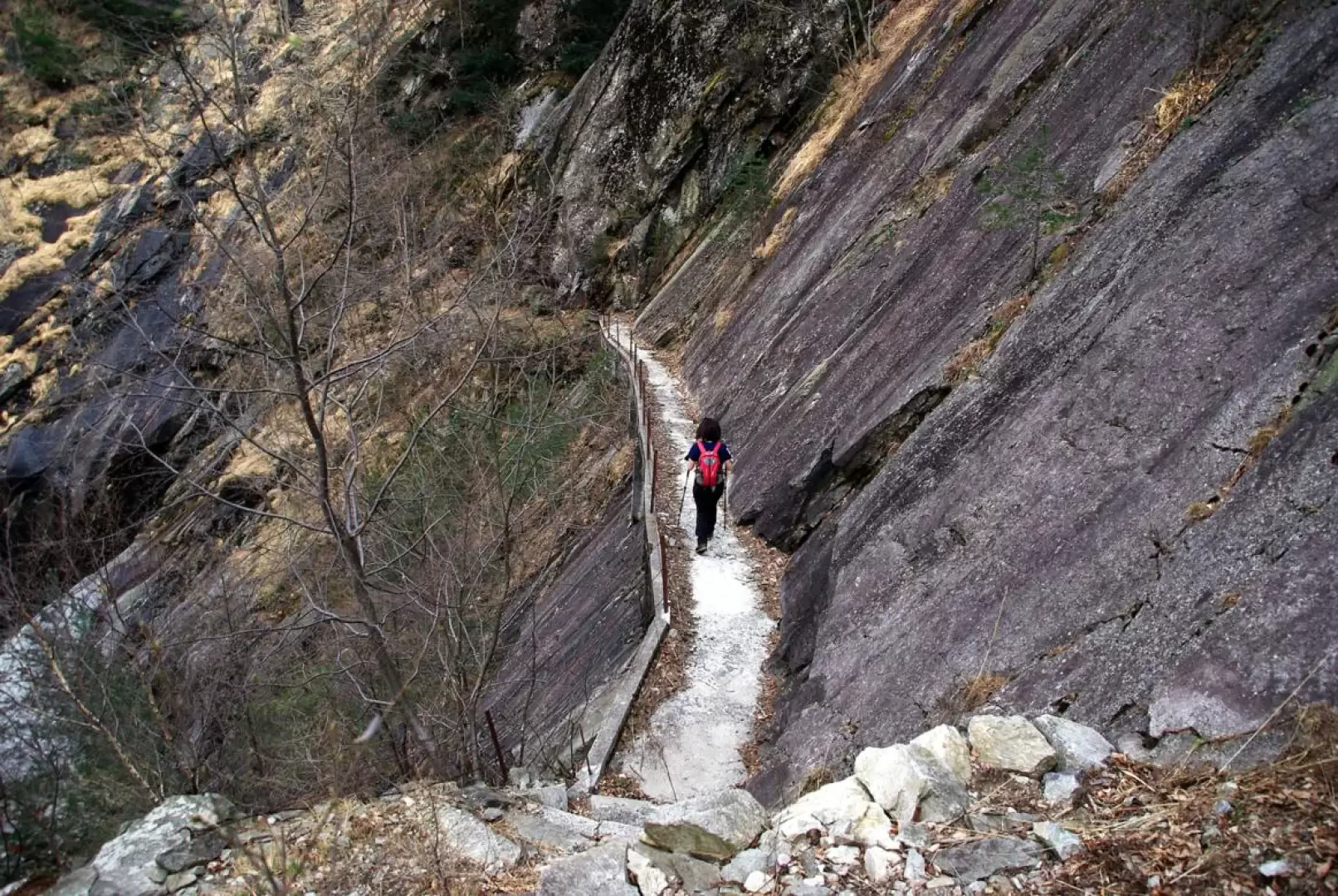
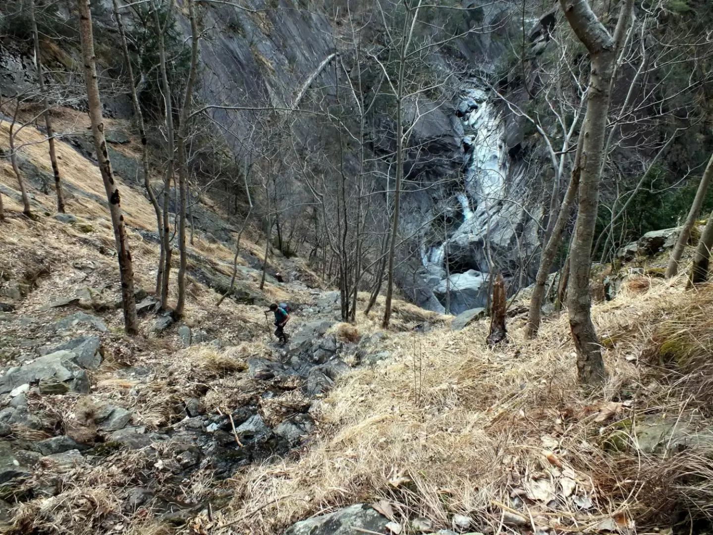
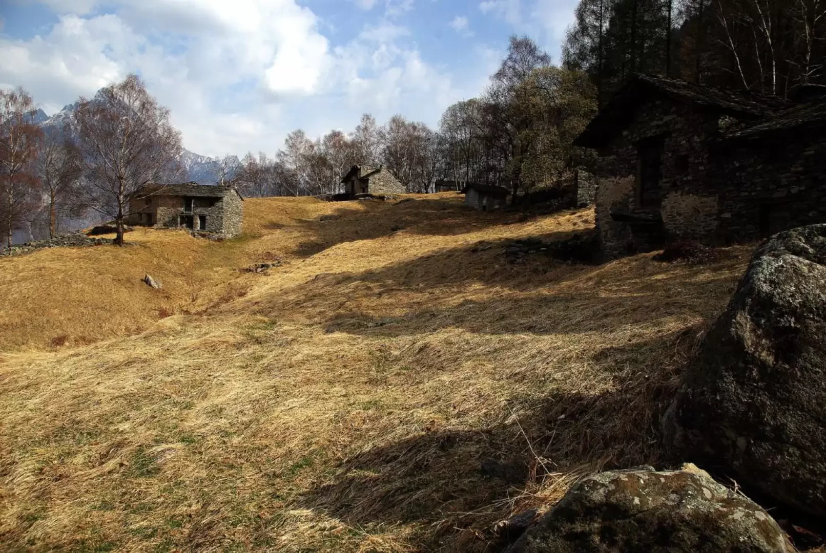
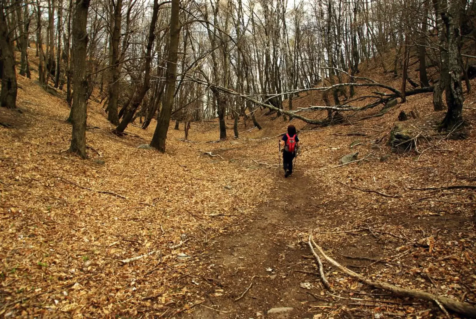
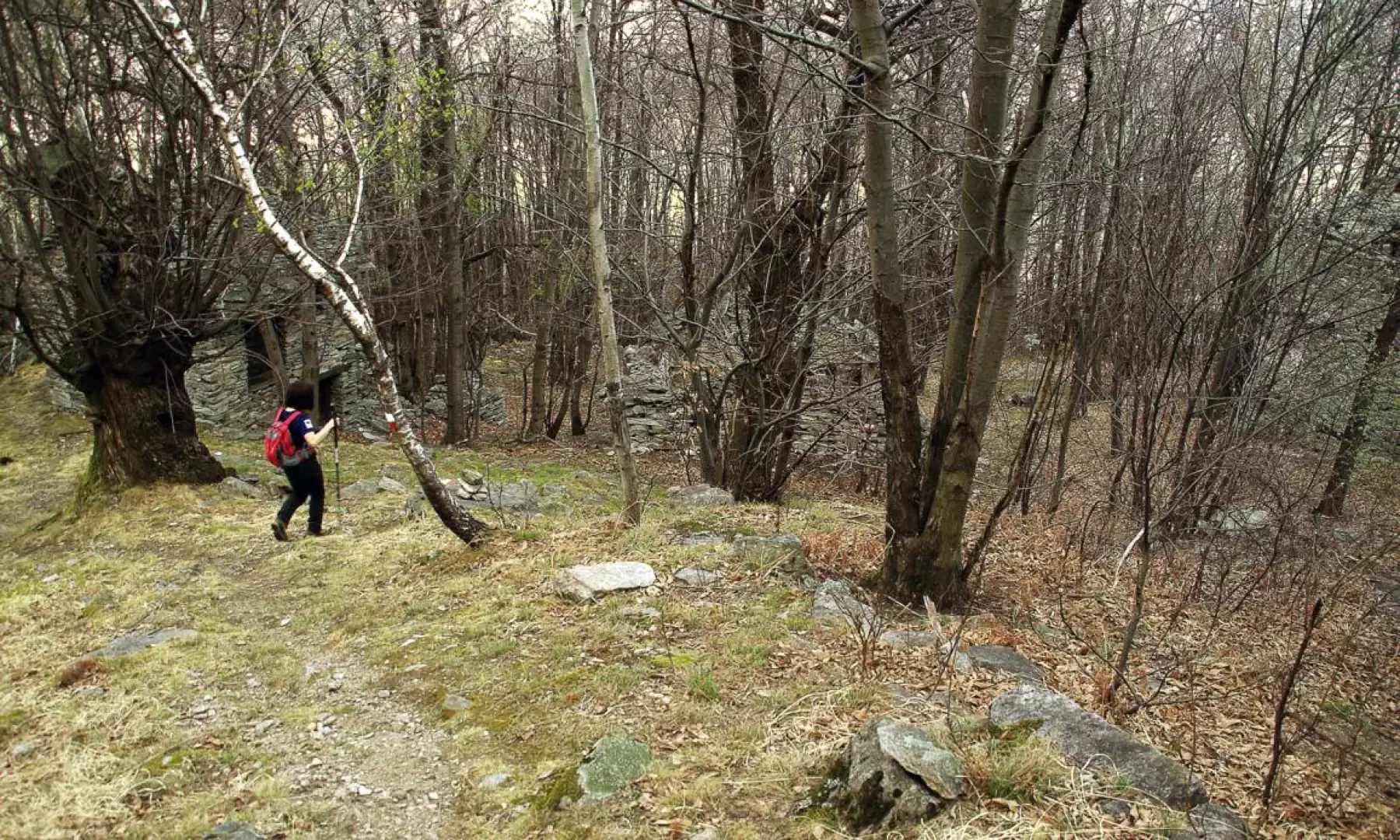
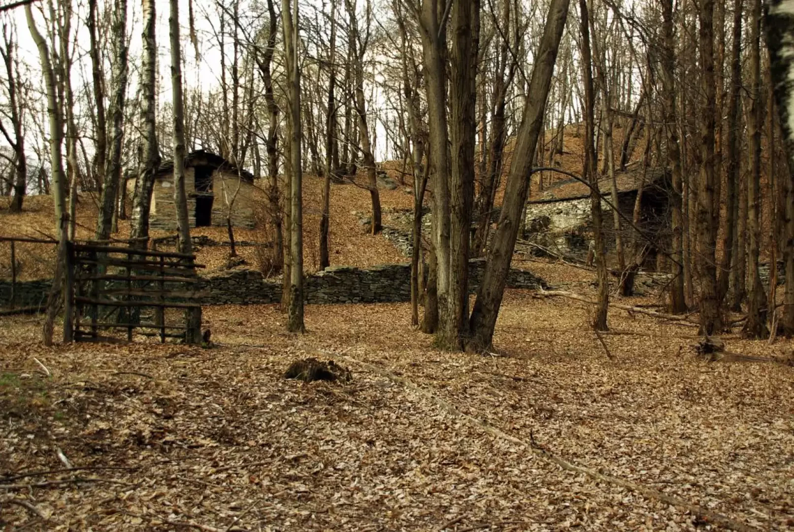
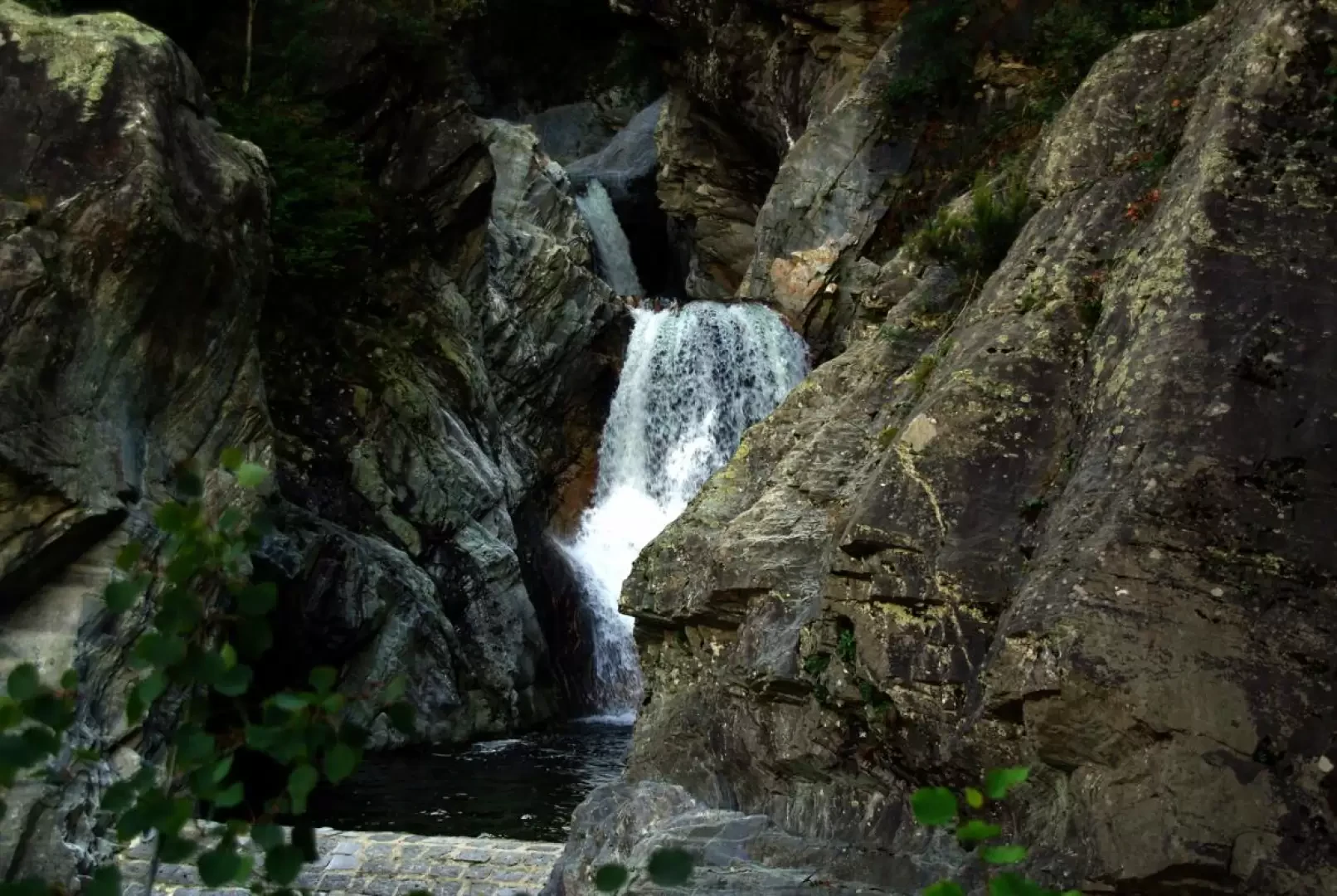
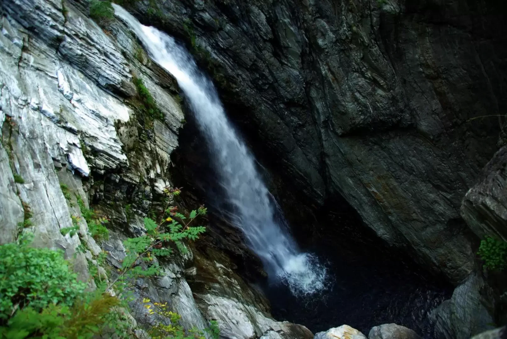
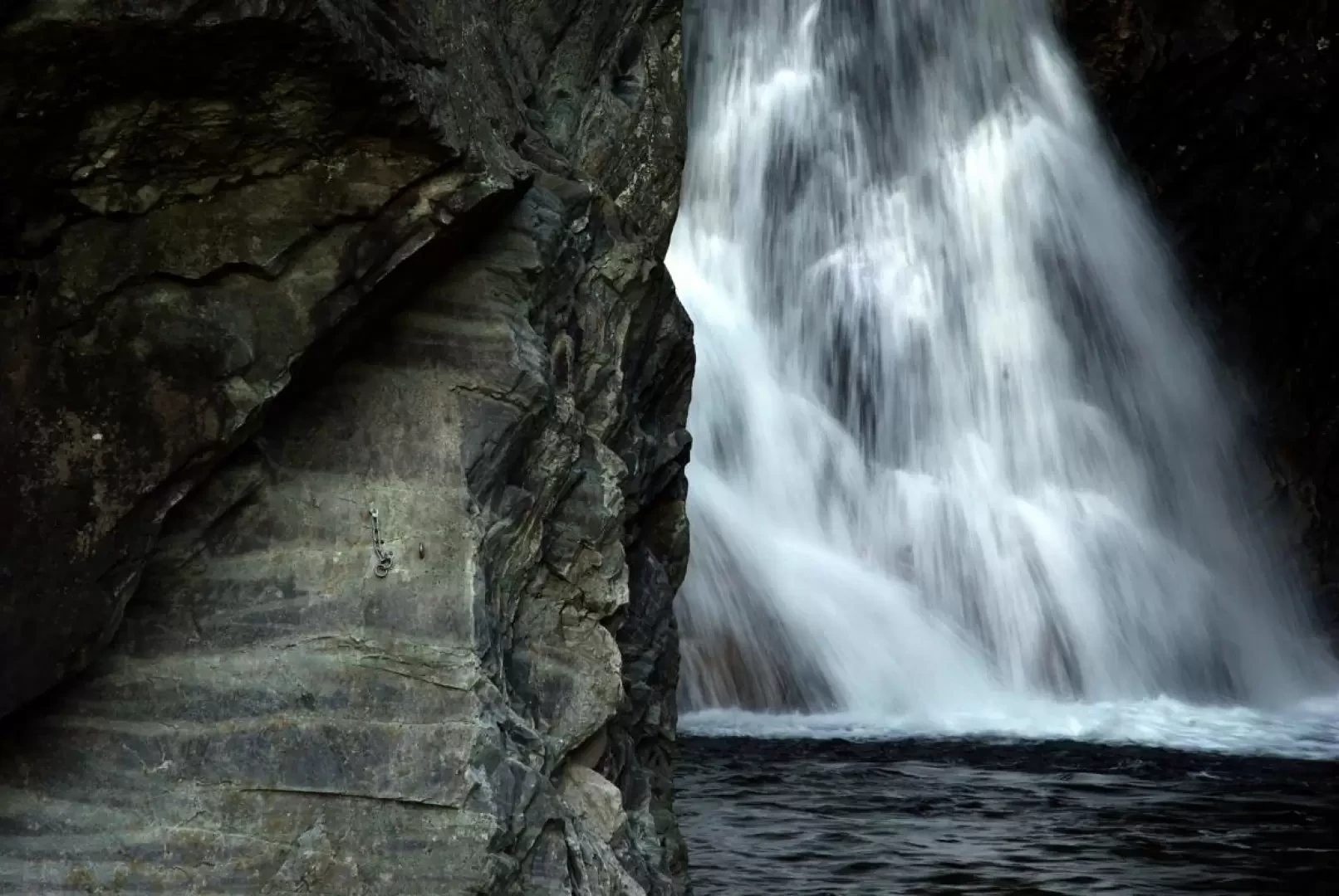
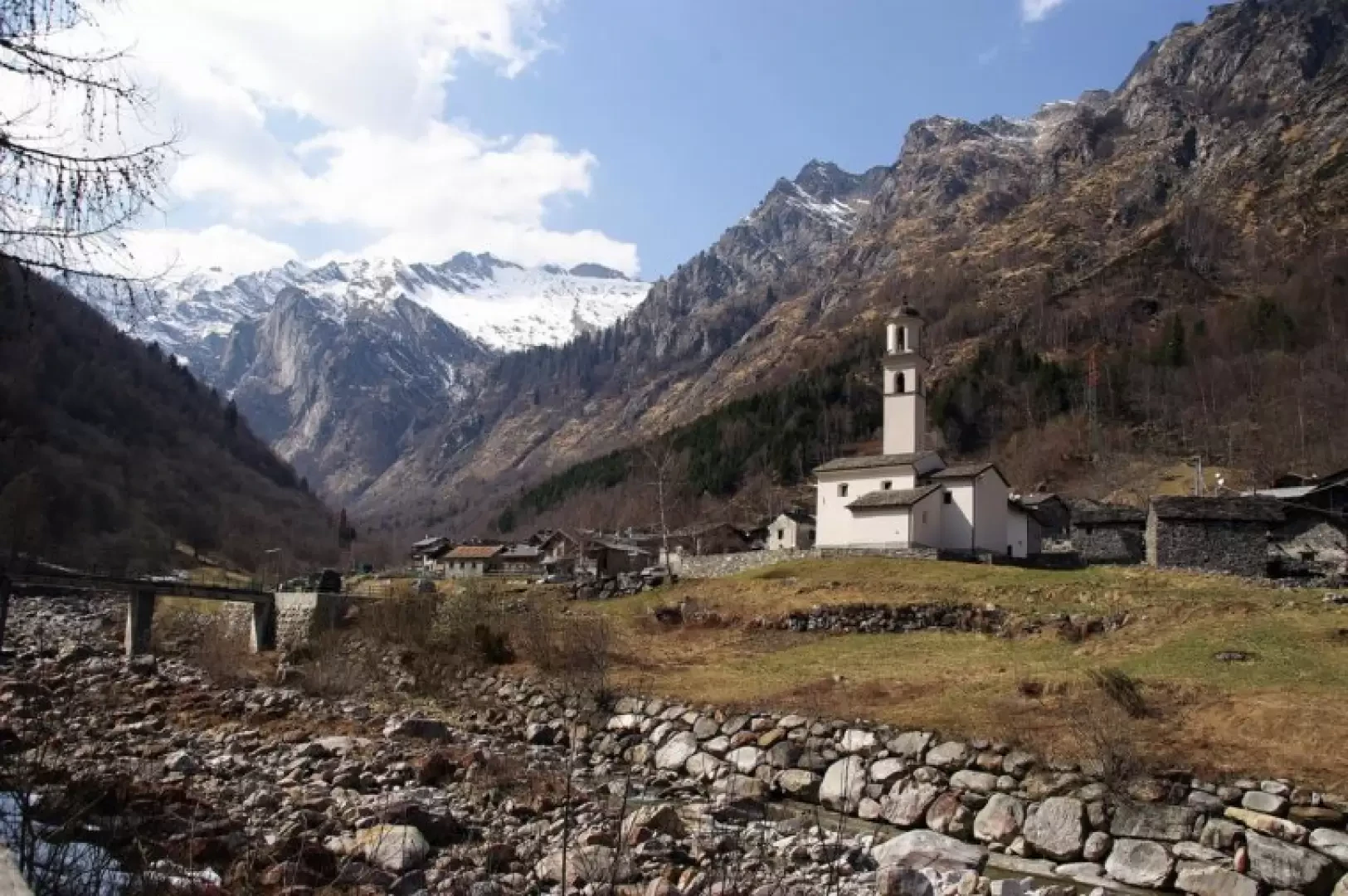
From Gordona 283m, follow the route of the carriage road to Val Bodengo (a couple of steps can be used as shortcuts) as far as the parking area for vehicles not authorised to climb. After a few dozen metres - on the right - the Val Bodengo mule track comes off, dominated by a small chapel: a masterpiece of cobbled steps, perfectly maintained and very panoramic over the valley floor. It climbs up the slope with long hairpin bends, until a stretch of artificial ledge supported by drystone walls through a "pioda" (smooth monolithic wall) leads to the terrace of Donadivo ("Dunadìif")737m: a resting place with an alpine chapel and an incomparable view over the valley. In a few steps, you reach the carriage road again, which you follow past a third chapel and - overhanging the precipice - the abseil anchorages for the "Paradisdican" climbing structure below (maximum difficulty 6b+) to an opening where you take the mule track to the left (signposted). A steep descent begins immediately, at times protected downstream by handrails, until crossing the Boggia stream on the "Punt de la Val" 770m approx.: on the other side is the junction with the return route. Turn right and a tight series of hairpin bends leads to the "Maggenghi" meadows of Bedolina 946m, where the numerous mountain huts have almost all been restored to holiday homes; continue past a small church and reach the vehicular access track: when you reach the stream, do not cross its driveway bridge and take the continuation of the mule track to the right, neglecting the section of track to the left directed to Monte Garzelli above. We briefly follow the track parallel to the water, until we cross the Boggia at Prà Pincèe 947m via a footbridge. Go back along the tarmac road for a short distance, until you notice a second footbridge on the left: the new crossing leads to a narrow path that, on the right, climbs up the torrent in a damp and shady environment (a few small landslides and some temporary passages on logs placed side by side) to an area of crotti, just opposite the village of Bodengo 1030m. For the return, follow the outward route to the "Punt de la Val" and, without crossing it, continue on a concrete footbridge along a smooth rock face. We continue up a damp little valley via a long and delicate winding staircase (always assisted by a safety cable): we come out on the wonderful terrace of Sorboggia 884m. Continue on the only other access path to the alp, the one coming from San Pietro di Samolaco. This is a good, steeply descending track (with only one long ascent up a flight of steps) through a thick chestnut grove: you slowly move southwards until the path is interrupted by a very recent forest track (not yet mapped). Follow it downhill until you come to a marked path on the left: it is a point that is difficult to identify, located just downstream of two very close hairpin bends of the track, and about a hundred metres before a wooden notice board. Follow the path steeply downhill and you will find yourself among the ruins of some huts where you will notice a crossroads with a signpost: continue in the direction of "Cà Pipeta". A long up-and-down traverse among woods, small valleys and a few ruins leads to Cà Pipeta, an extraordinary example of a two-storey dwelling built under a cyclopean boulder. In the same direction, we come to the bottom of a dark little valley, which we follow uphill, ignoring the paths to Ronscione and the Torre del Signame on the right. At the end of the little valley, you cross the huts of the Avert Signame 543m (Avert = Alpe) and continue for a long time on a sparse, tree-lined ridge, traversed by a steep, gravel path down to the bridge over the Boggia stream. The spectacle is impressive: the waters, after a series of consecutive jumps into the rocky gorge, plunge some fifty metres into an enormous giants' pot, now in sight of the final outlet of the Mera river. After crossing the bridge, follow a shady lane that leads, past hydroelectric plants, to the first houses of Gordona: the area of the church - the initial car park - is easily reached by following the yellow signs (poles and stretches of paint on the walls of the houses) of the "Via Francisca", a route along the valley floor between Chiavenna and Lake Como.
Galleria fotografica