Bocchel del Cane, from San Giuseppe

Edited by:
Marco Bonati
Updated at: 04/12/2025
Access
From Milan to Sondrio along state roads 36 and 38; at the roundabout at the entrance to the town, turn left towards Valmalenco. Follow the provincial road to the main junction a few hundred metres after the roundabout for Caspoggio: follow the direction to the left - towards Chiareggio - and, with a few hairpin bends between the houses of the village, set off between the serpentine quarries towards the upper Valmalenco. A few hairpin bends between meadows and looming rocks lead to San Giuseppe: about two hundred metres after the junction - take a left - for the ski lifts you park in a grassy widening with a Malmalenco hiking board.
Introduction
A wide-ranging excursion that connects the last two hamlets of the Valmalenco through a difficult but not difficult to access pass, traversing ever-changing environments: from fir and larch forest to rhododendron meadows, to a stony high-altitude "desert" and snowfields. The views are unforgettable, with the highlight being the north face of Monte Disgrazia.
.Description
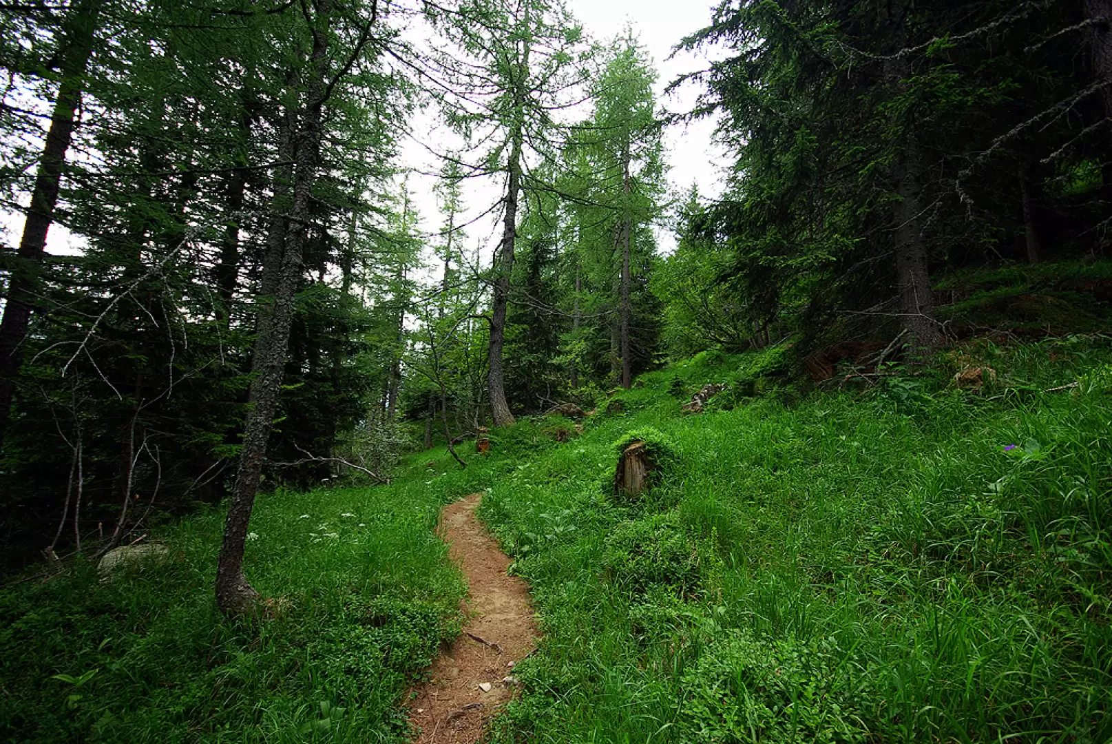
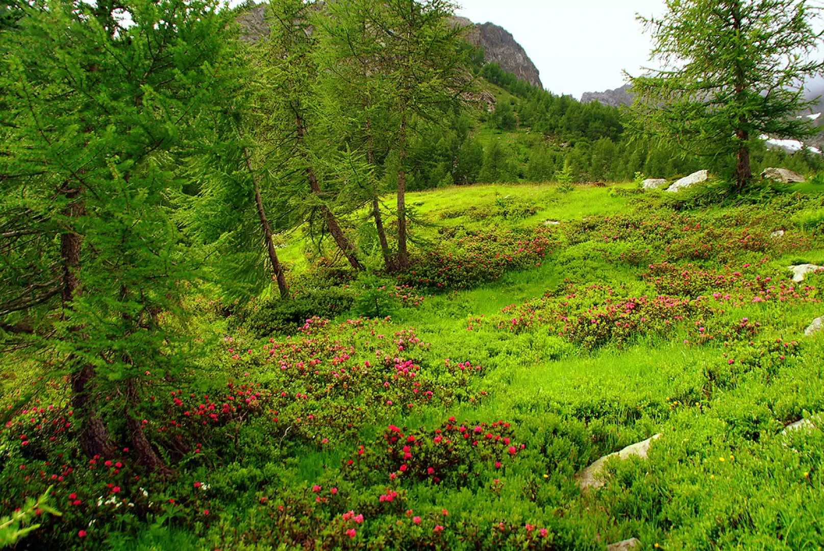
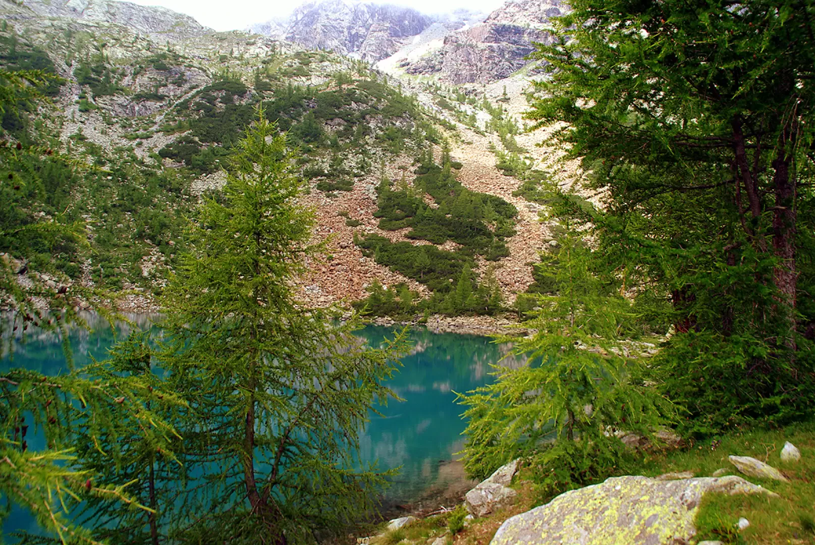
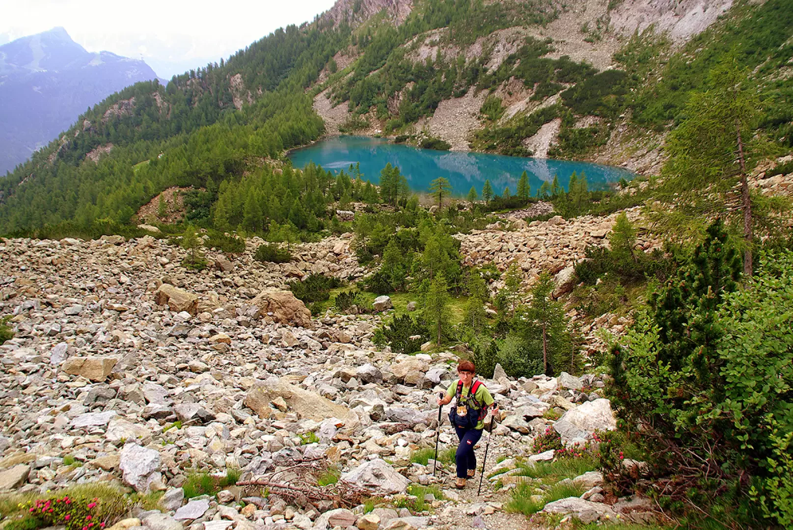
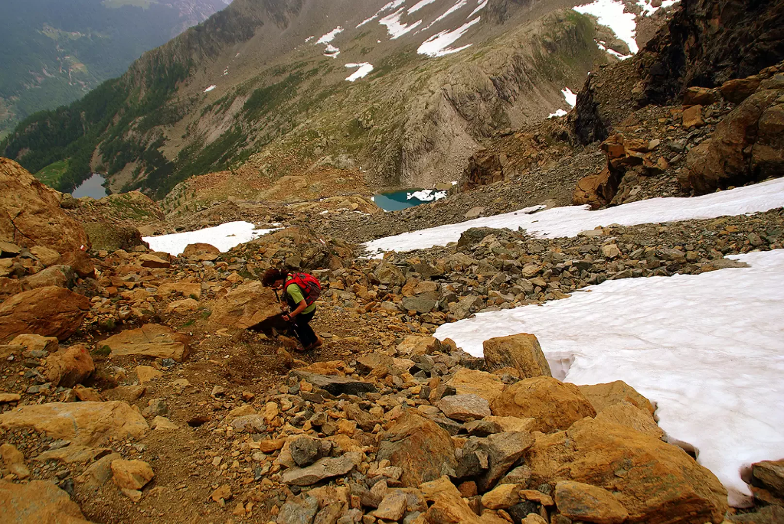
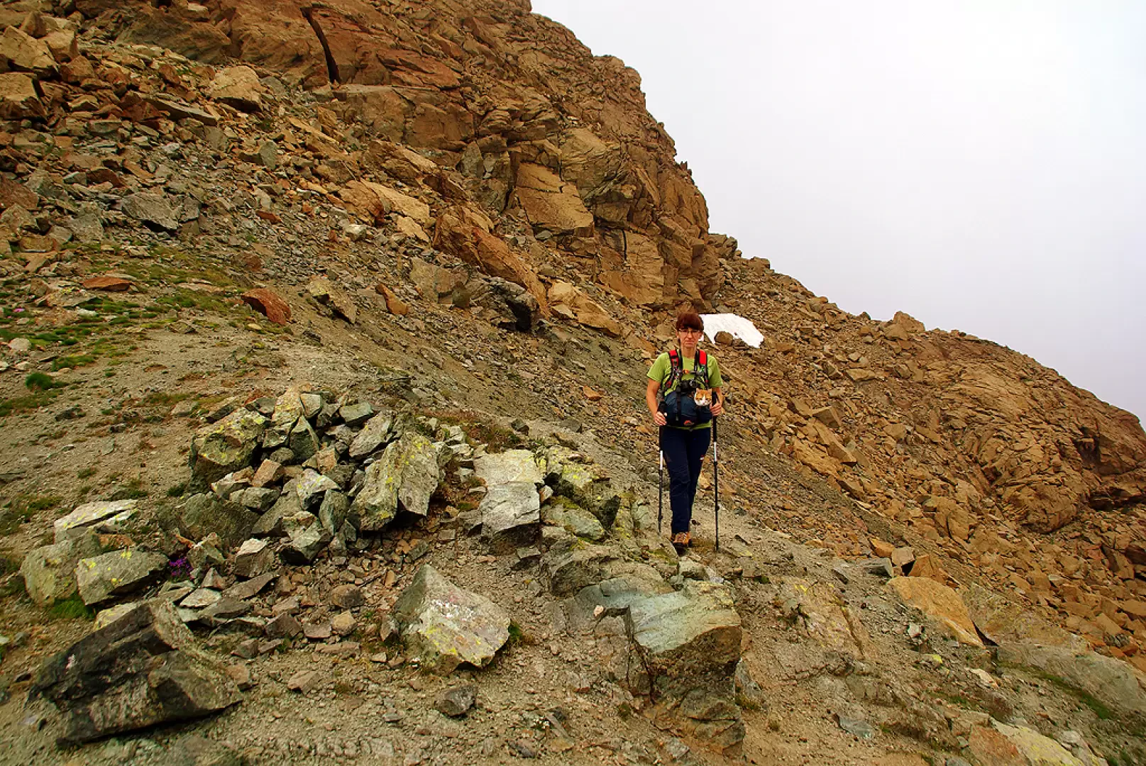
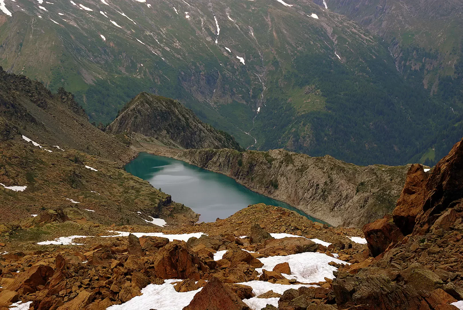
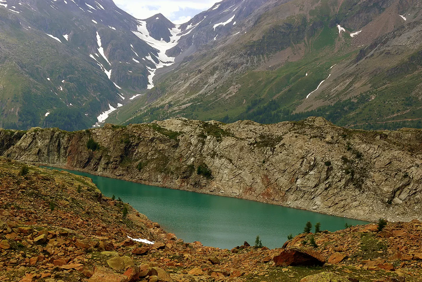
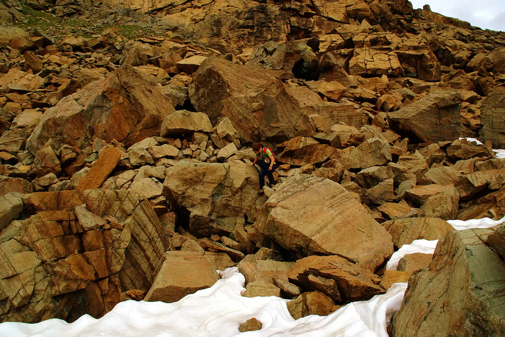
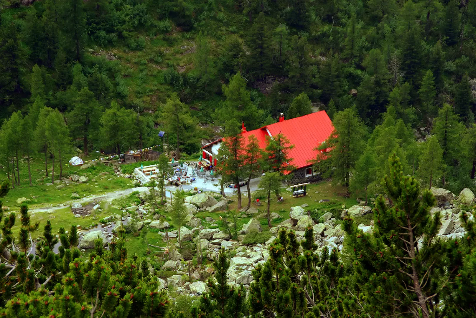
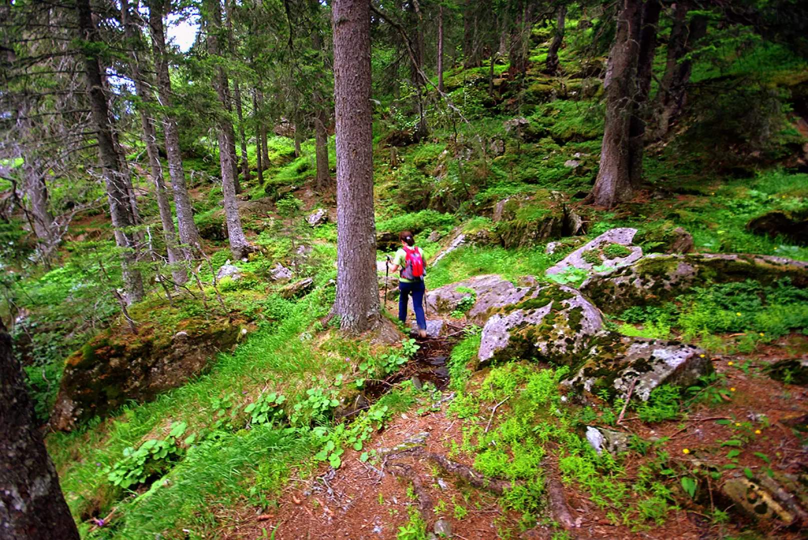
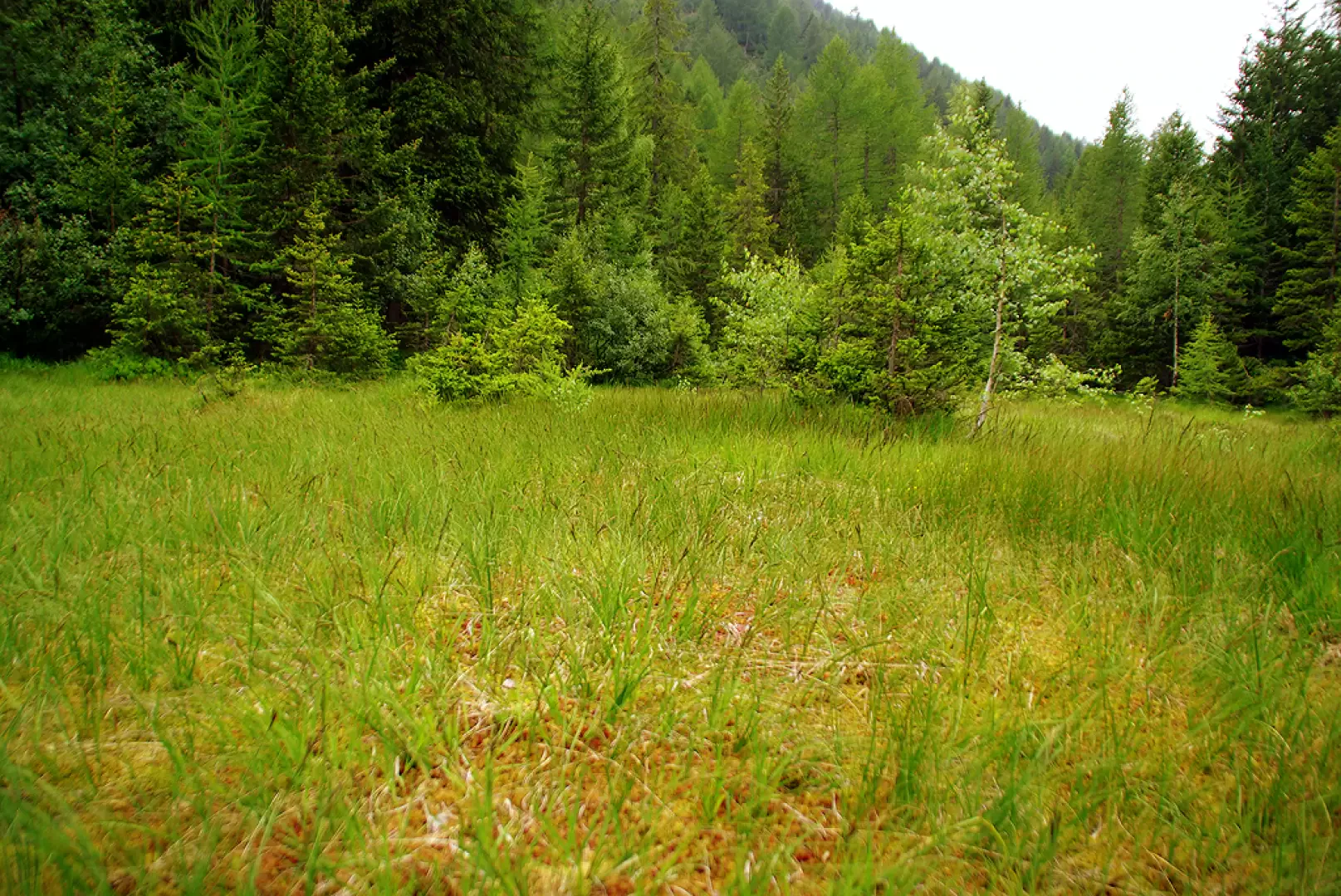
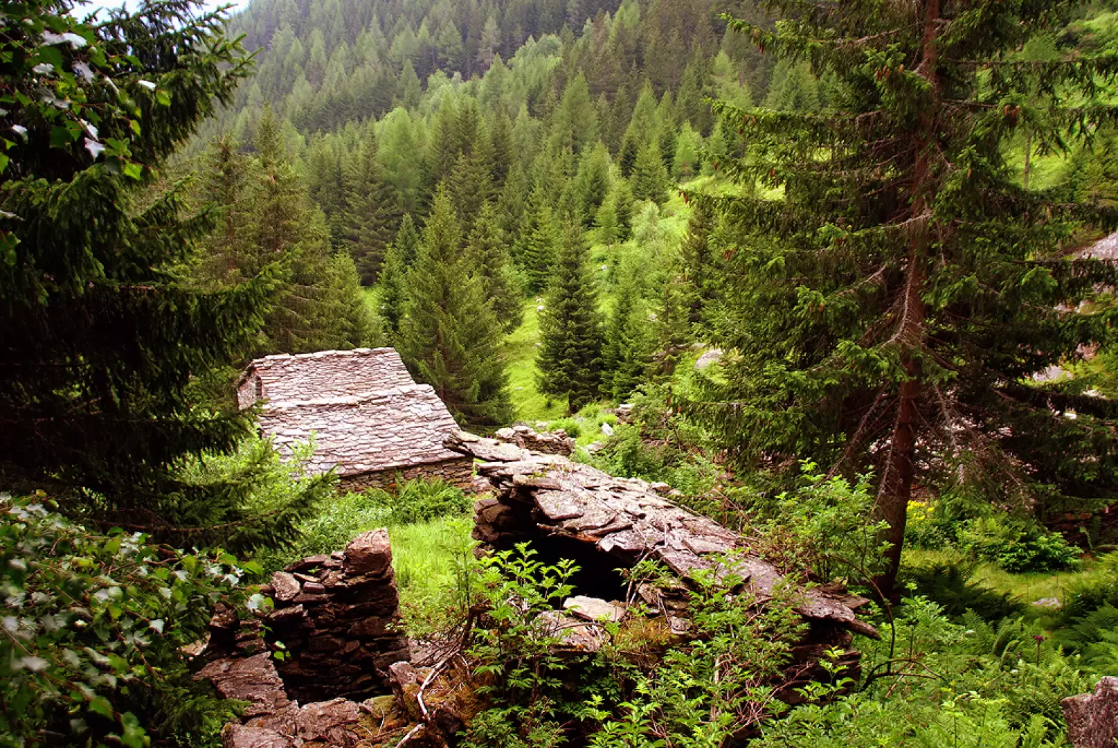
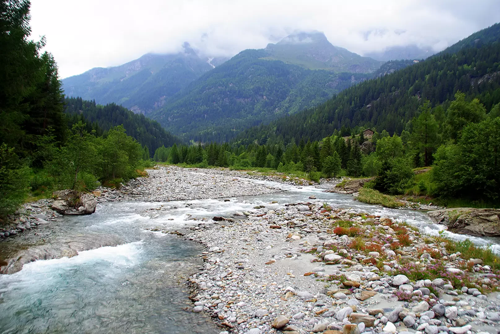
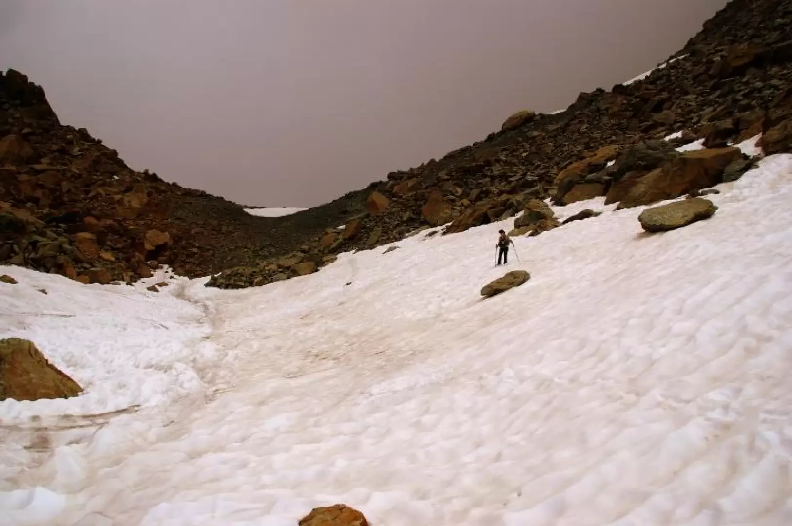
From the car park, in just a few steps, we descend via a steep little path to cross the Mallero stream on a bridge; on the other bank the path, always well signposted but constantly steep, climbs in hairpin bends through the dense fir forest. After about an hour, the vegetation thins out and the larches replace all the other trees: you cross, still climbing, the clearings - now covered with rhododendrons and blueberries - of the Alpe Lagazzuolo (1974m): the old huts in disuse (but intact) have been replaced by the modern * chalet "Bivacco degli Alpini". Continue on and, passing the edge of the valley, you will reach Lake Lagazzuolo 1992m ("Lagusc" in dialect); the track continues flat to the right and, after crossing the small outlet, begins to climb among the red boulders of serpentine a pasture rib beaten by avalanches and covered with debris. The steep ascent leads to flanking the basal rocks of the wall above, where the path - up and down - changes direction to enter the valley leading to the pass. Past a small nameless pond, frozen until late in the season, the trail disappears; but following it, the precise signposting in paint leads us to choose the least tiring passages over the very steep and unstable terrain; in the last stretch, we ascend wide residual snowfields. When you reach Bocchel del Cane (2551m), the panorama is sweeping towards the highest peaks of the Disgrazia group, but your gaze is attracted by the turquoise water of Lake Pirola (2284m), at the foot of the descent gully, immersed in an expanse of orange-brown boulders. The signs lead quickly downhill to a pastureland shelf - unique in this area - and then back to a labyrinth of unstable boulders not far from the shores of the lake, which is not reached. The path, which is more visible, leaves the track to the right for Torrione Porro (a climbing gym) and descends steeply with loose boulders and steps to reach the first plants; but before reaching the woods in view of the Porro hut, it crosses another area of boulder-strewn landslide. Amidst the centuries-old pine trees, we reach an incredible * path of recent landslides that descends in hairpin bends across the steep slope to the Val Ventina esplanade 1960m (Rifugio Gerli-Porro and Ventina huts). From the hut, descend to Chiareggio 1612m along the forest service track in about 40 minutes. When you reach the bridge over the Mallero torrent, do not cross it and, at the fork, choose the path to the left; the beautiful track climbs a rocky shoulder covered with a dense and damp fir forest for about 150m. You reach a sort of plateau with blueberry and rhododendron glades and traverse it, also flanking a couple of peat bog wetlands; then with a very steep descent through uneven woodland, you reach the abandoned hamlet of Senevedo Inferiore 1485m. The path, now level with the stream bed, runs alongside it for a few hundred metres until it crosses over a double bridge; on the other bank, after a very short climb, we reach Carot 1462m. From here, unfortunately, there is nothing left to do but follow the provincial road for about a couple of kilometres to the car park.
The bivouac, built in rustic style, as well as being completely useless from an excursionist point of view, has totally ruined an alp that - although abandoned - maintained a testimony of ancient and suffered mountain work. Now we have a yard of building debris, a prefabricated toilet made of resin panels, and an exposed aqueduct that fishes in the lake with a visible pump.
The newly opened slope, even a couple of metres wide, has the virtue of destabilising a landslide slope to nowhere: it stops against a metric-sized boulder slope, after having destroyed a forest of centuries-old mugho trees.
Objective Danger:unstable boulders
Sun exposure: northeast
Galleria fotografica