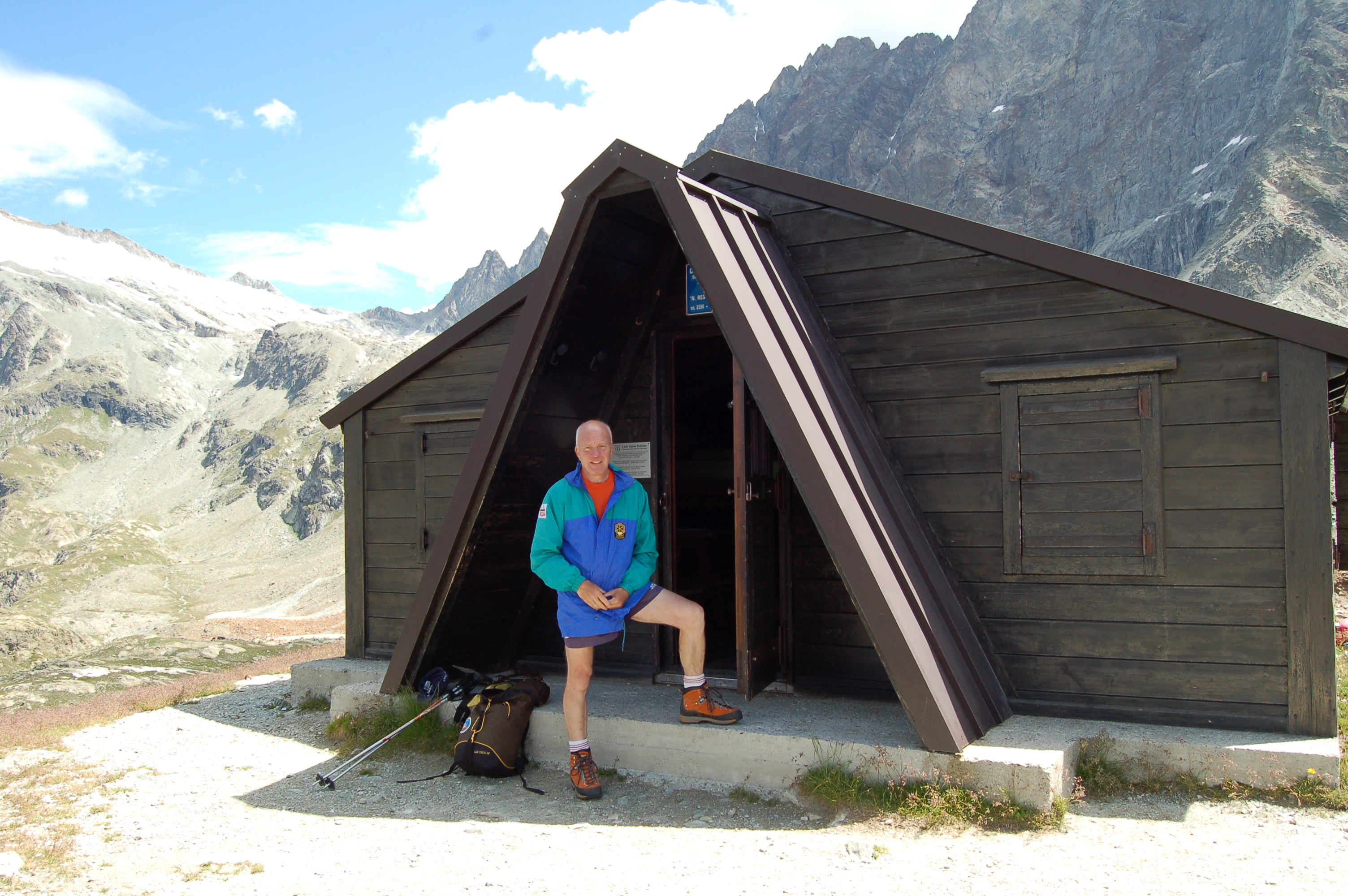
Regondi-Gavazzi bivouac, from Glassier

Edited by:
Massimo Martini
Updated at: 25/08/2025
Access
Lasciare l'autostrada alla barriera di Aosta Est, svoltare a destra e imboccare la superstrada , da seguire per 8,4 chilometri. All’uscita della galleria, dopo 130 metri, svoltare leggermente a destra per imboccare la strada regionale per Bionaz. Alla rotonda, prendere la seconda uscita e proseguire lungo la regionale, superando i villaggi di Signayes e Rhins, e l’abitato di Valpelline. Dopo 16,9 chilometri, svoltare a sinistra e prendere la strada regionale per Ollomont. Risalire la regionale attraversando il capoluogo di Ollomont e i villaggi di Voueces e Vaud, fino a giungere, dopo 23,8 chilometri, a Glassier. Poco prima del villaggio, sulla sinistra, si trova un parcheggio 🅿️ gratuito con una stazione di ricarica per veicoli elettrici.
Distanza e tempo di percorrenza
🕒 Tempo di percorrenza: 29 minuti
📏 Distanza: 23,8 km
Navigazione GPS
📍 Come arrivare con Google Maps
📍 Come arrivare con Apple Maps
Nota importante
Le indicazioni fornite sono state verificate alla data del rilievo dell’itinerario. Prima della partenza, è consigliabile verificare eventuali variazioni del percorso. Per ottenere indicazioni aggiornate e dettagliate, si consiglia l’uso di Google Maps o Apple Maps.
Introduction
Walking is beautiful, this slogan is very appropriate for hikes such as the one described below; in fact, it is a perfect combination of the pleasure of walking and the extraordinary scenery in which this action is performed.
Description
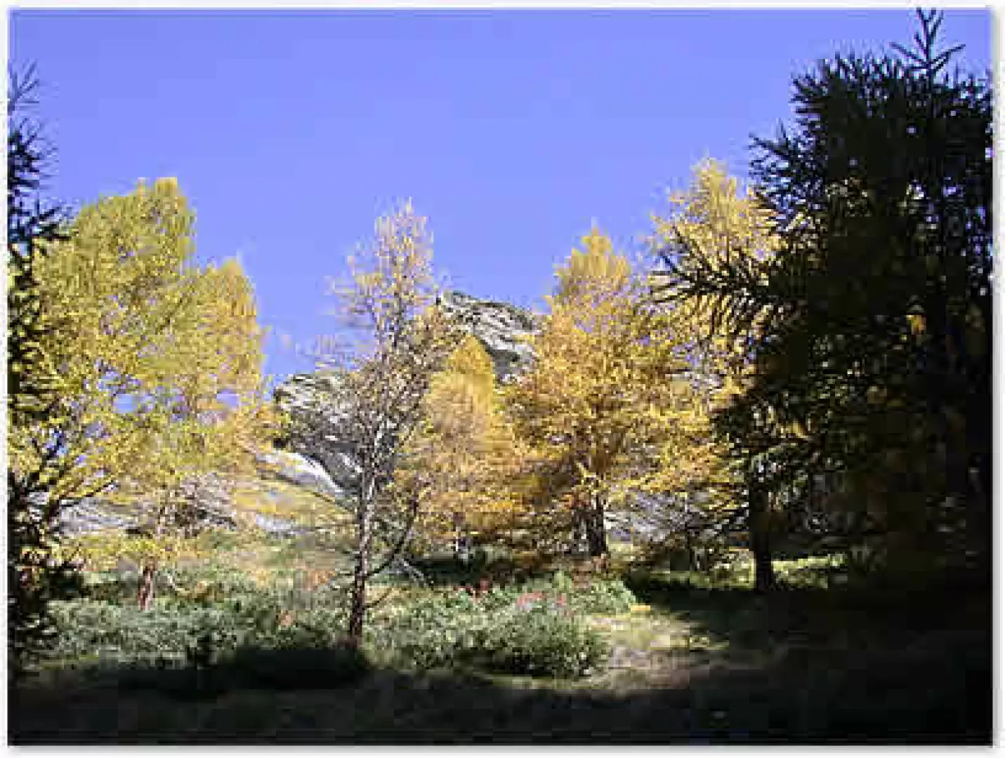
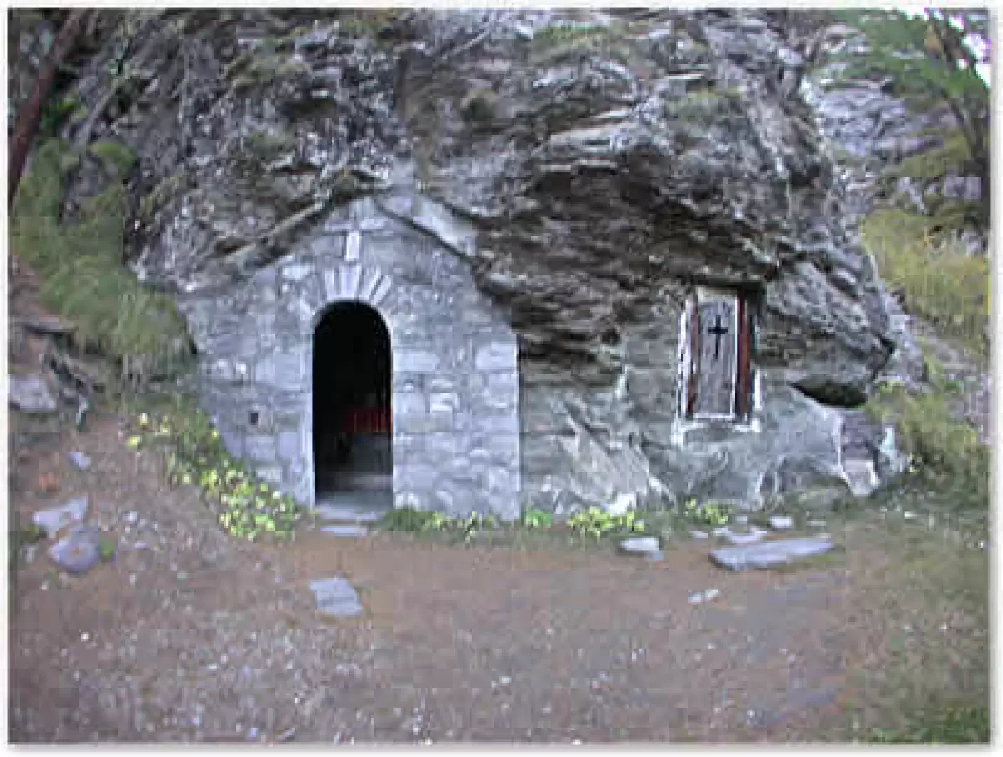
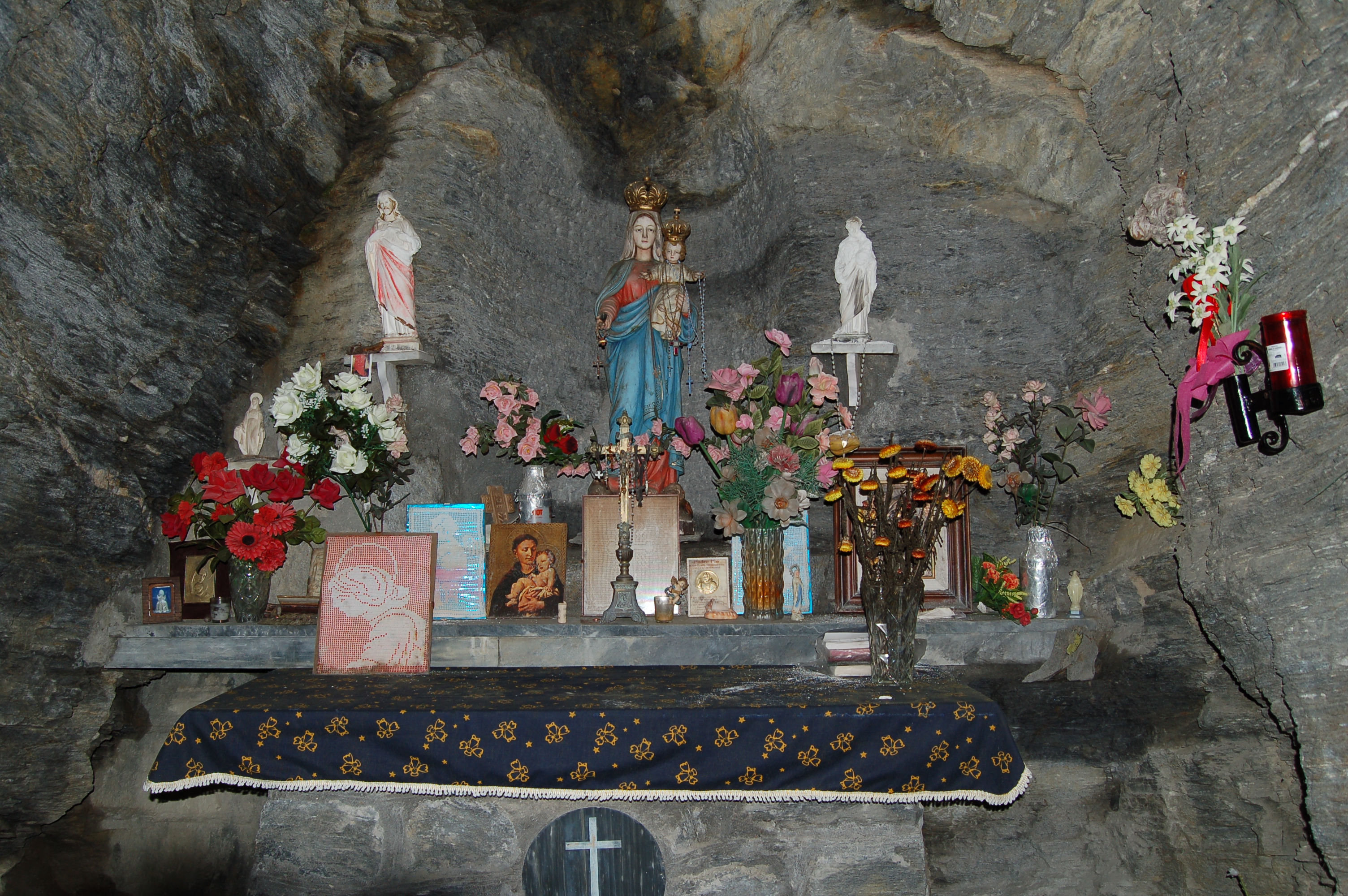
Leaving the car in the large forecourt of Glassier (1549 m), we cross a small bridge and set off along an agricultural road, to our comfort the trail signpost . After a couple of hairpin bends, the road reaches an alpine pasture, skirts it and at the end of the road takes the path, which, after crossing a stretch of meadow, enters the larch forest. After about a hundred metres into the forest, the path forks: take a left (follow the yellow arrow). The path ascends the forest with steep hairpin bends, approaching a gorge that was visibly damaged by the flood of 2000, skirting it and finally crossing it (0h25'). The condition of the path is in any case excellent and at times from the wood one begins to glimpse the panorama of the surrounding peaks. Once past the landslide, the path enters a narrow valley, in which a stream flows, surrounded by rocks topped by larches, and in a few minutes reaches a chapel set into the rock (0h30', 1863m); this is an ex-voto chapel built in 1954.
Continue on and cross the stream bed heading to the left, here the path flattens out slightly and then begins to climb again; on a large stone a red inscription with the name of the bivouac is clearly visible. After ascending the orographic right of the stream that crosses the gorge, the path crosses it again under a large rock. Once past this section, the path enters the upper part of the little valley, which opens up and the first pastures appear.
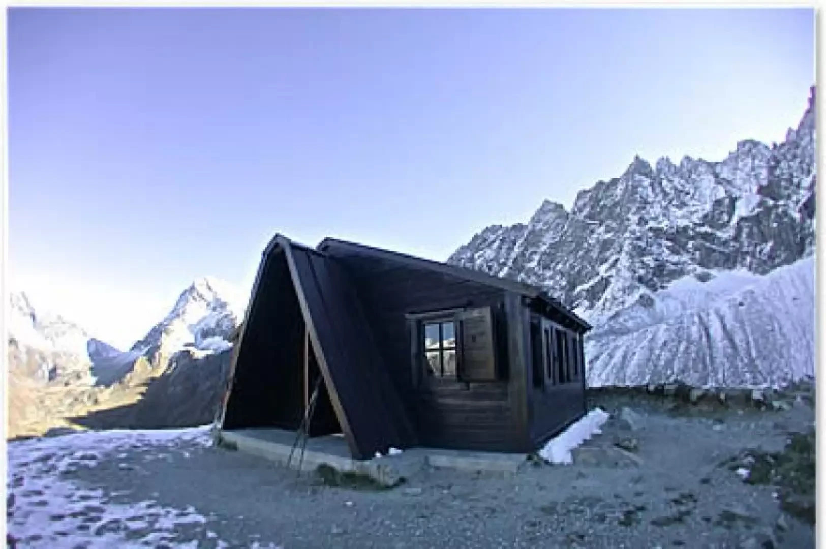
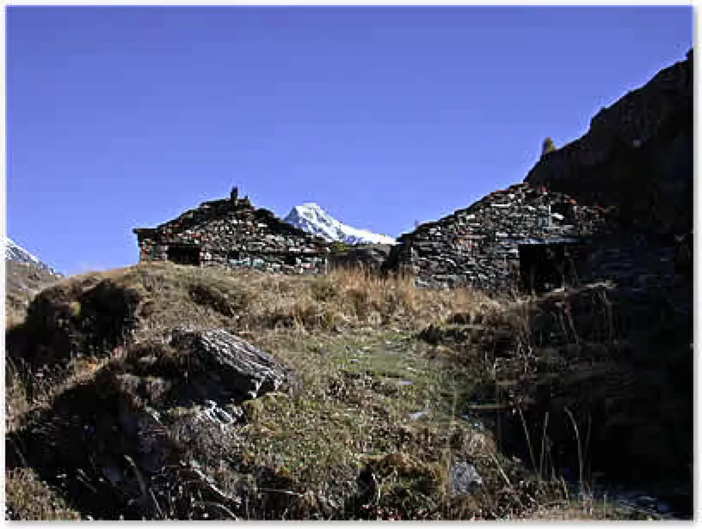
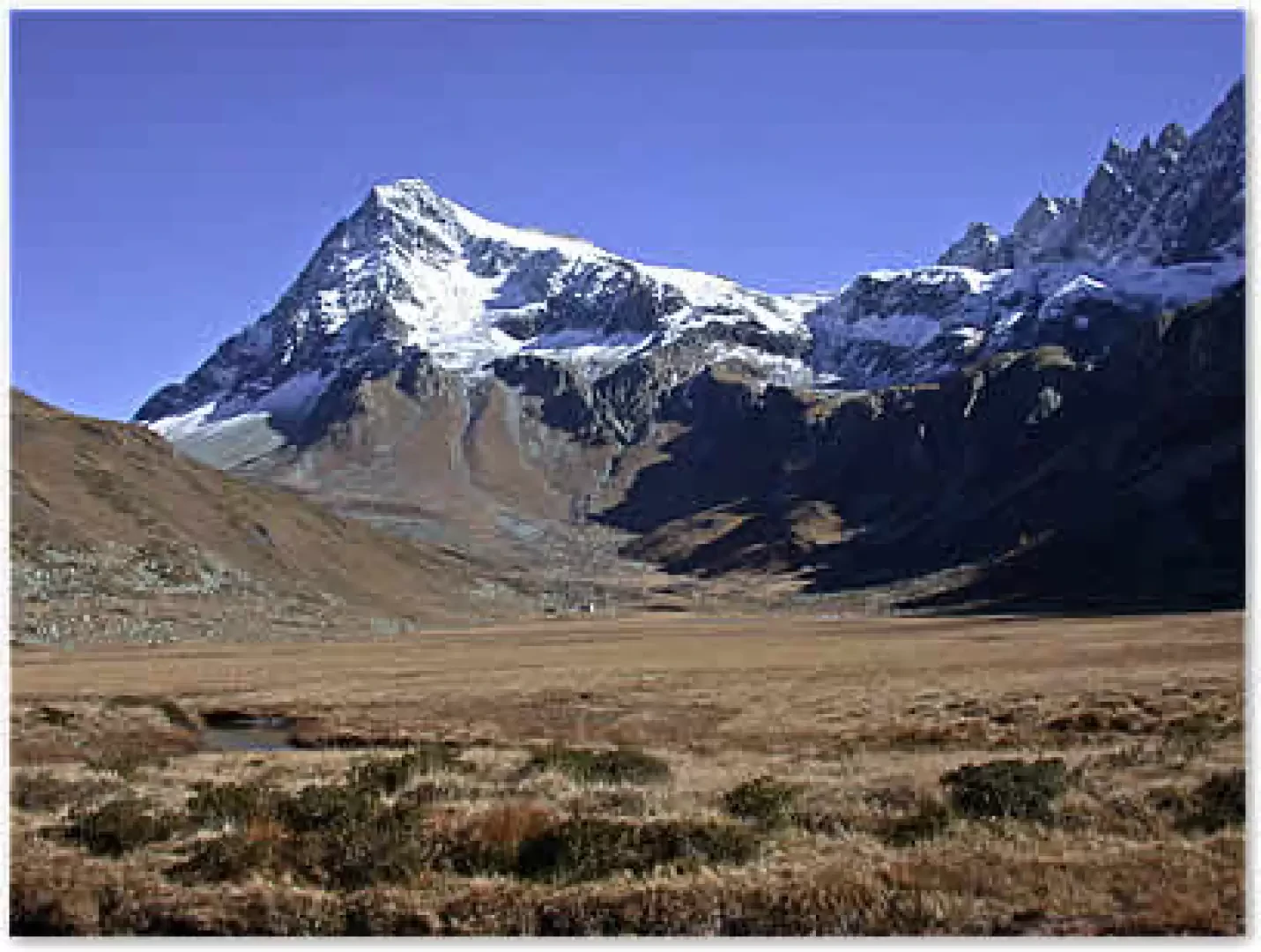
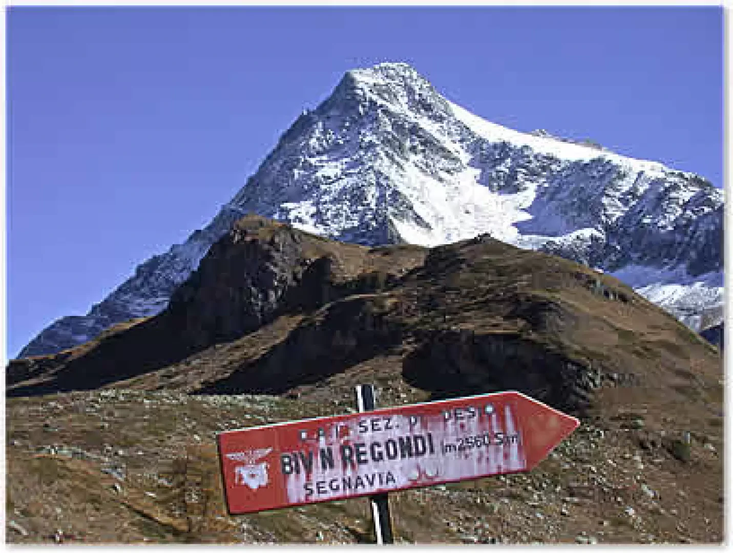
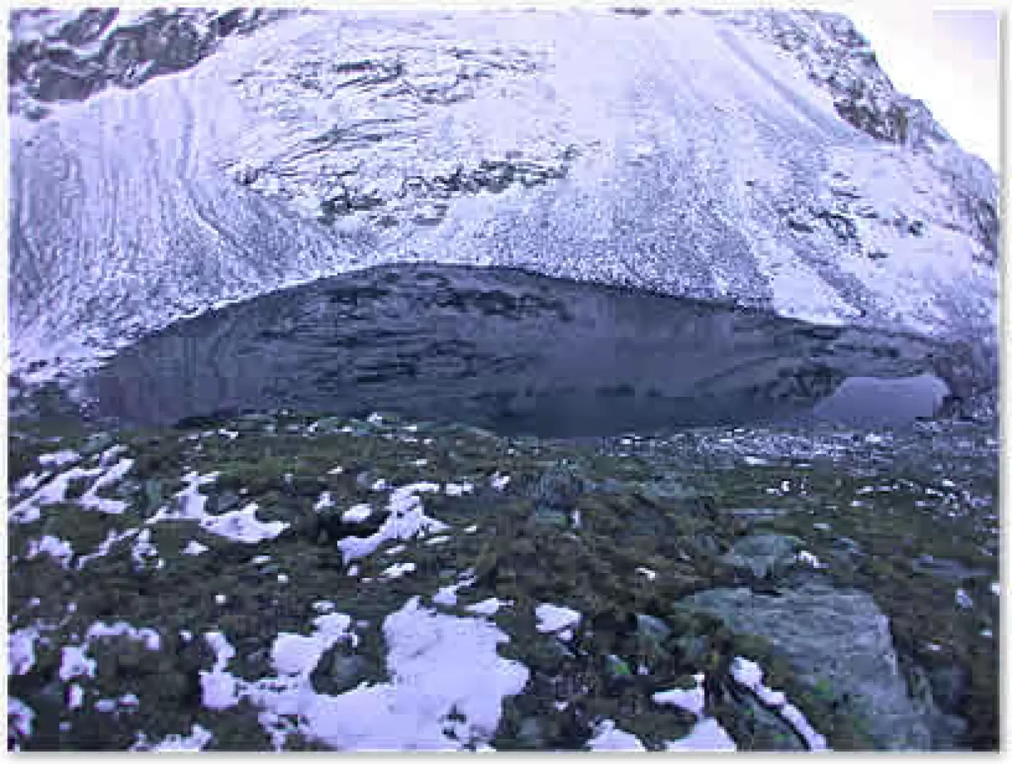
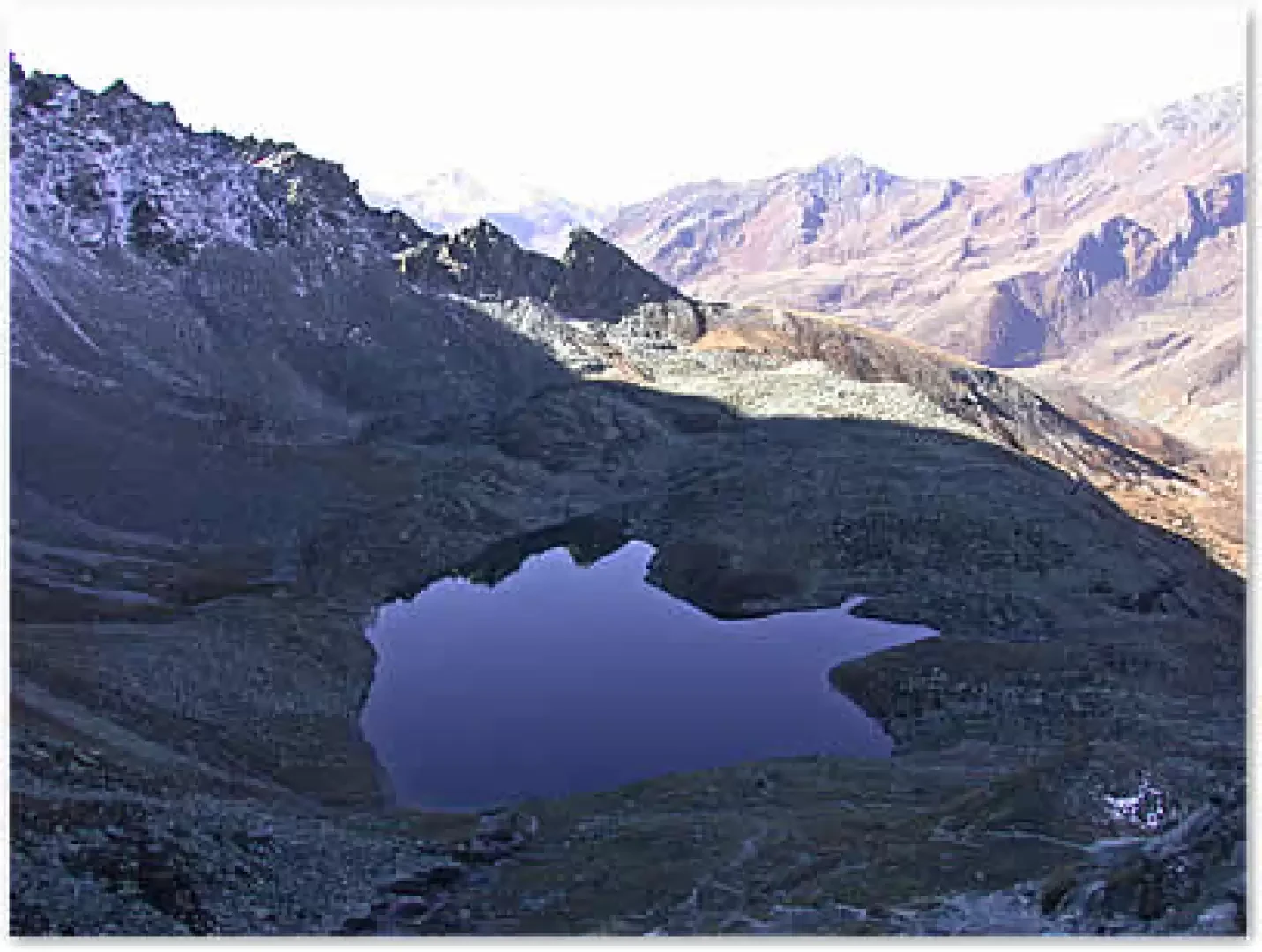
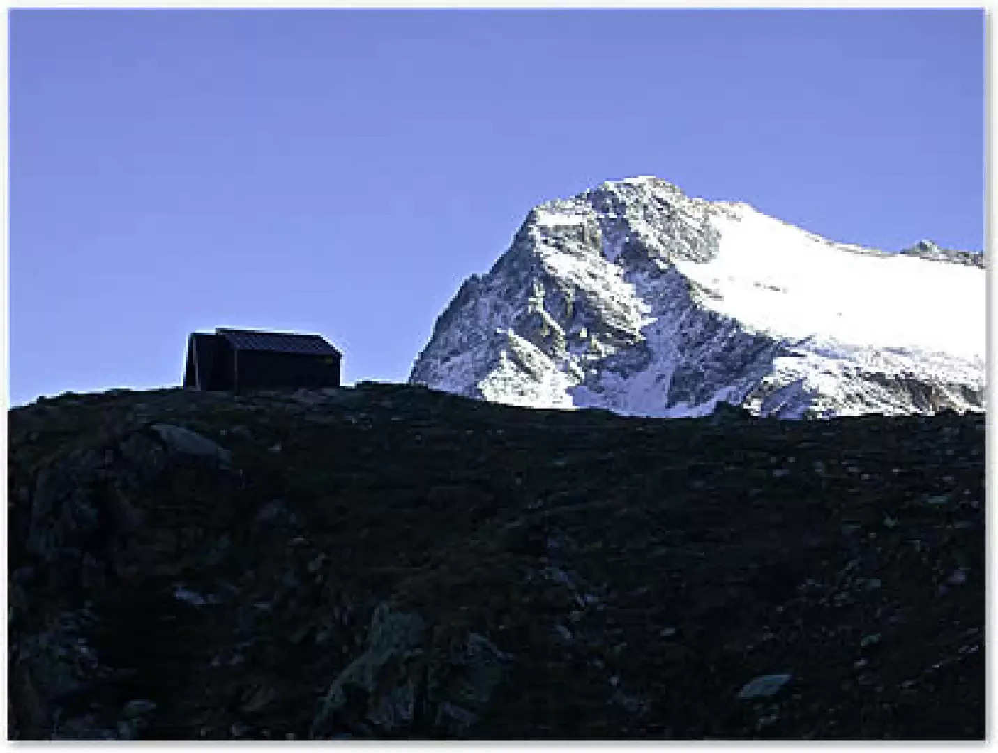
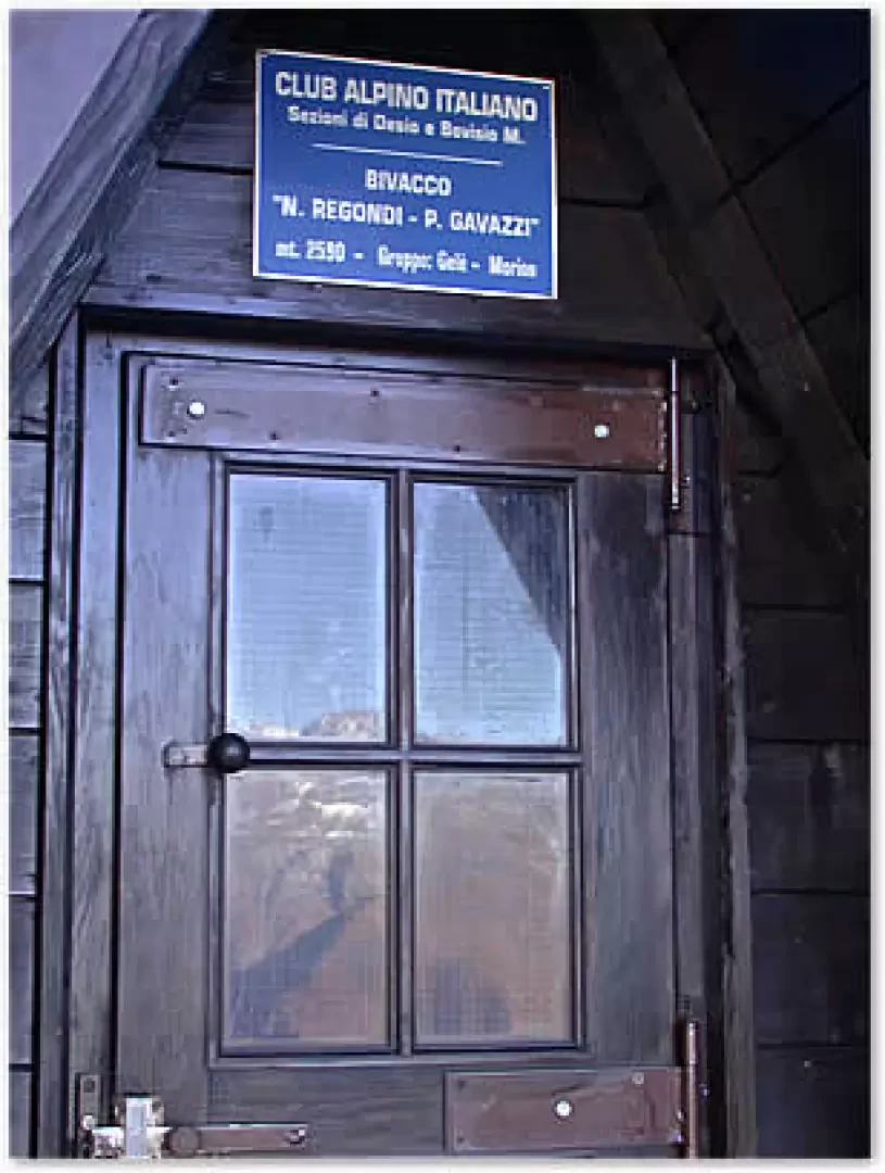
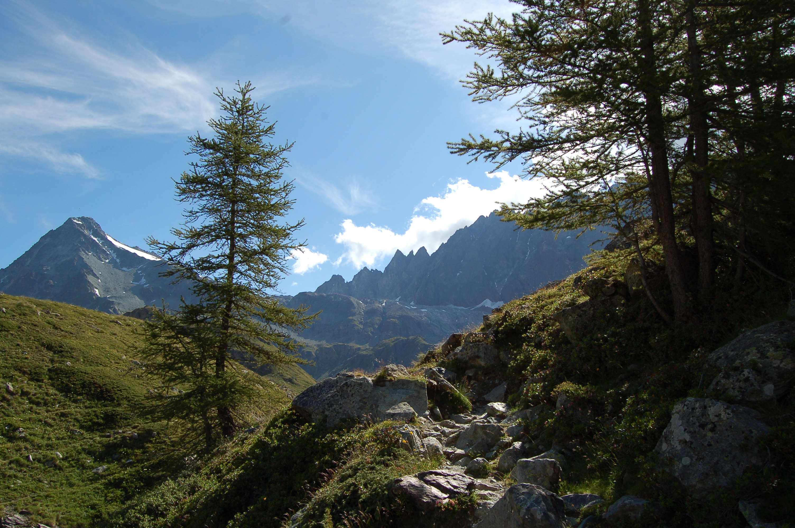
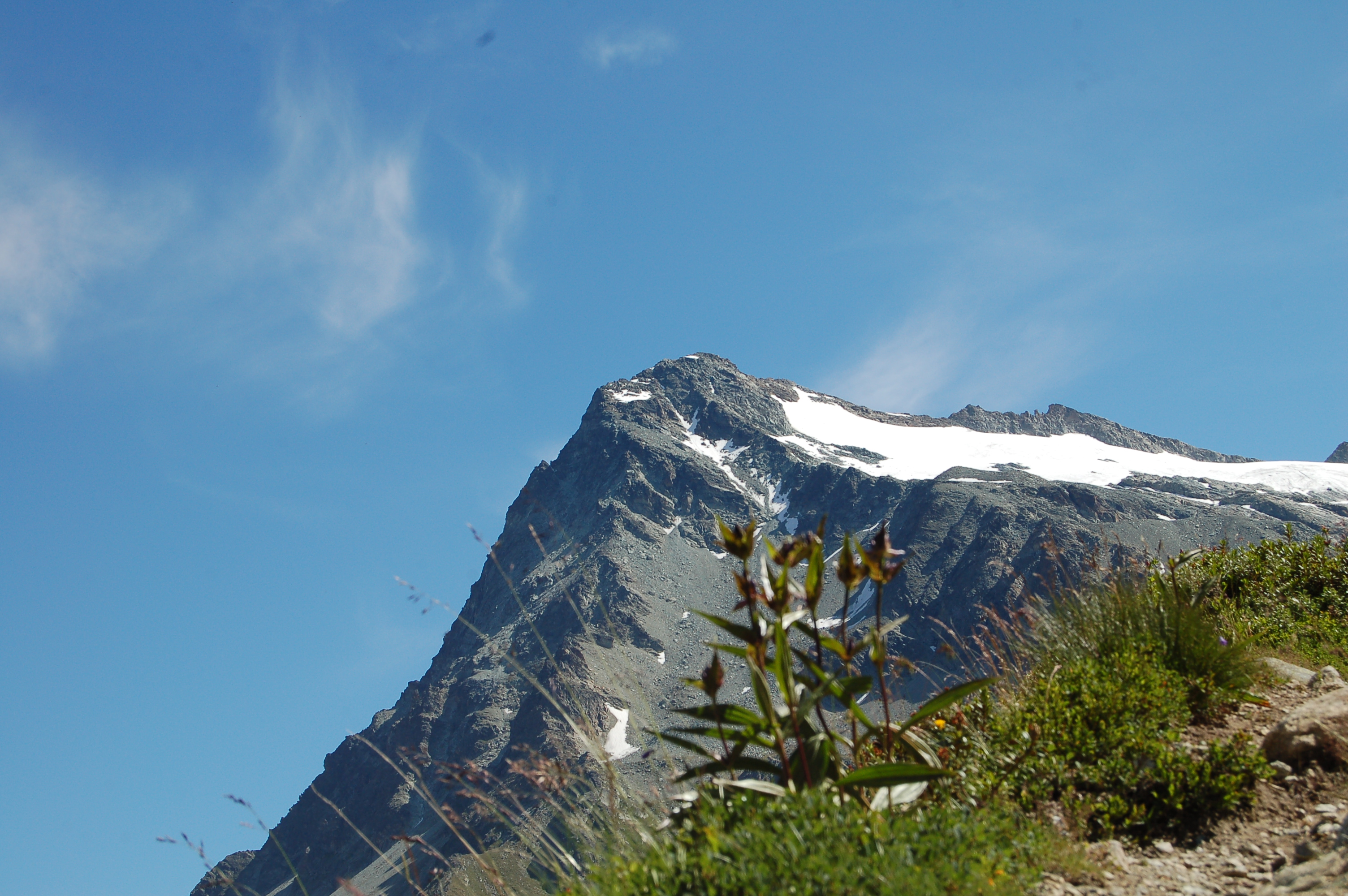
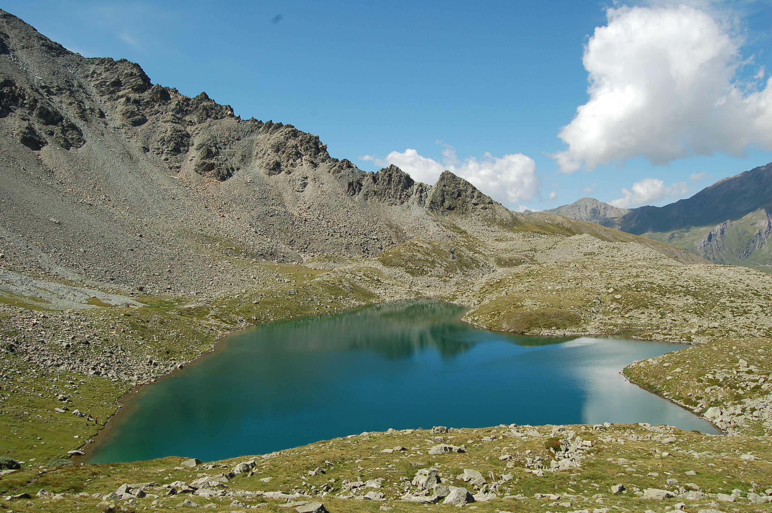
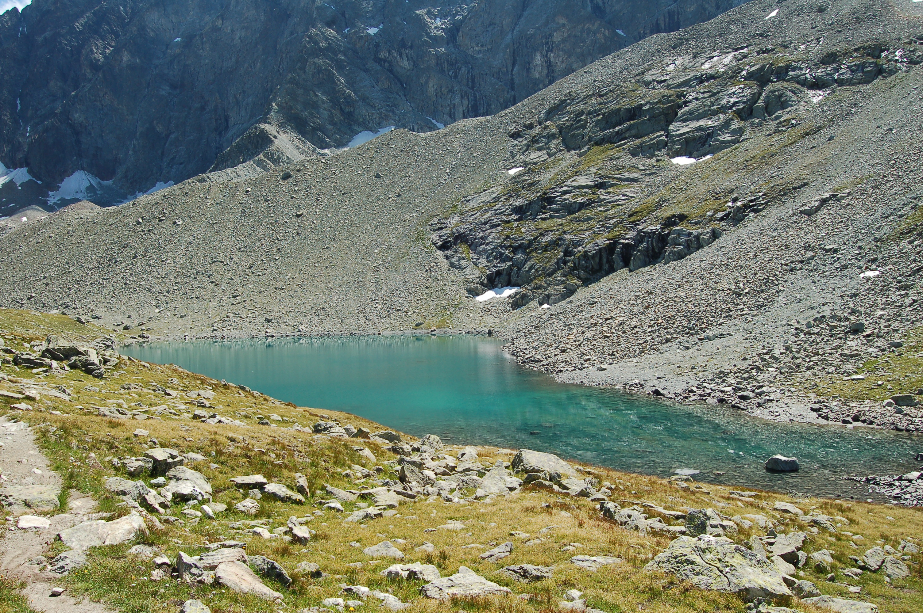
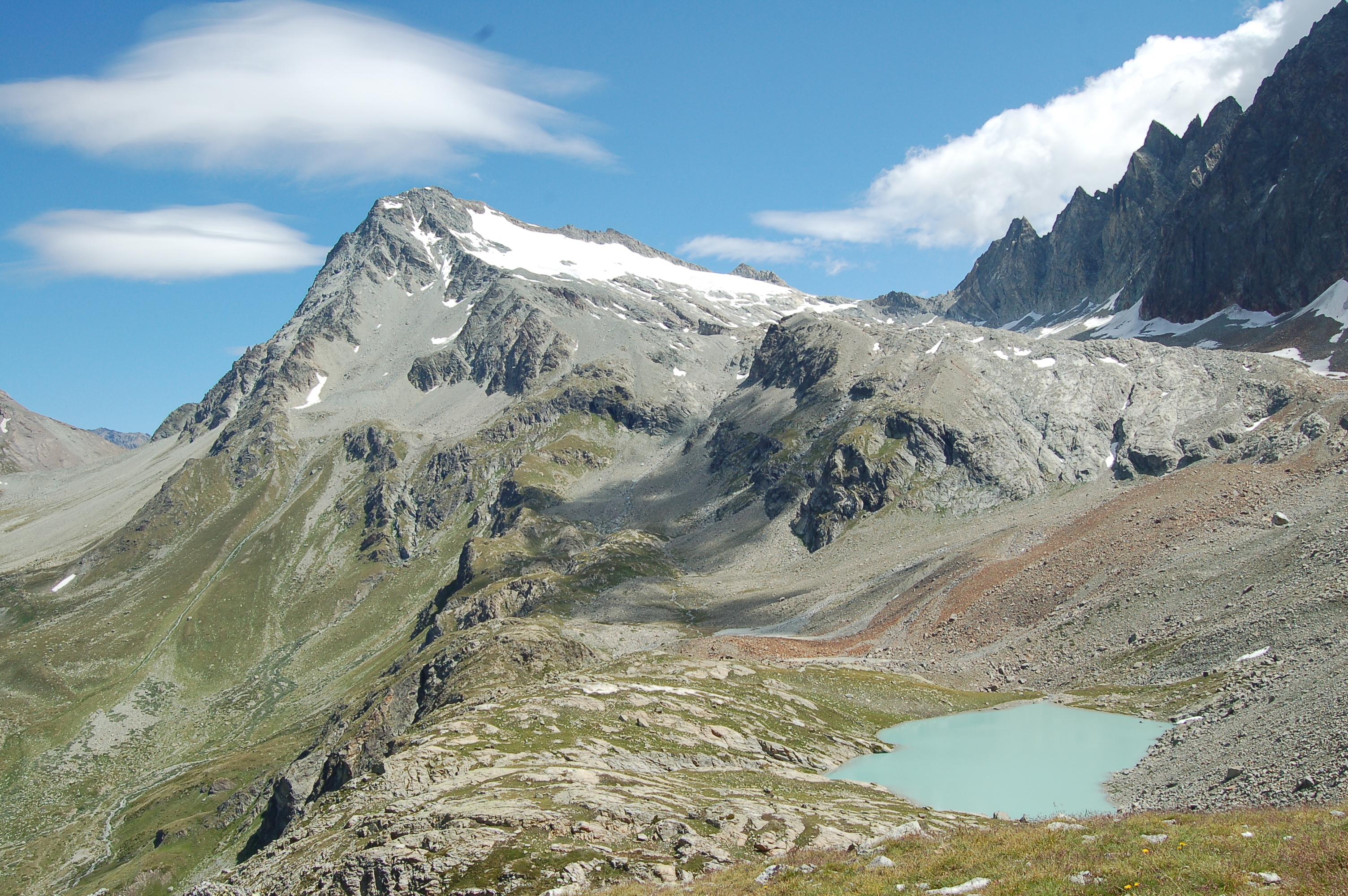
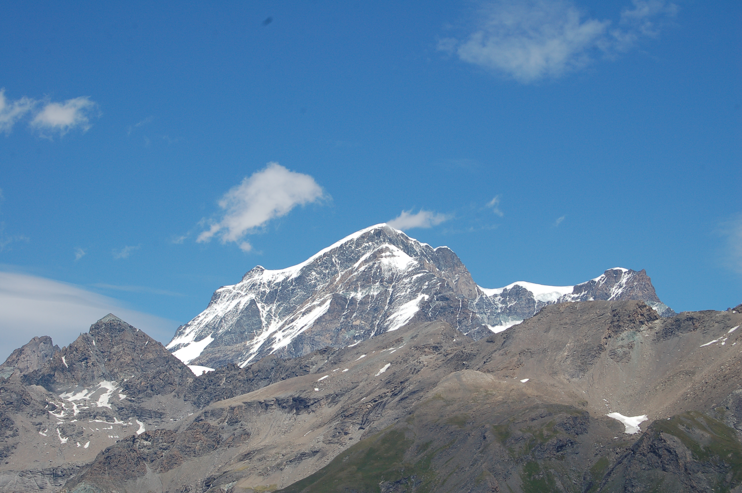
Following a stone with cairns, go up the little valley to the height of a small saddle (1h05'): from here, you can see Mont Gelé and Mont Avril. At this point there is a fork: both paths lead in the right direction, but we advise you to continue on the one that goes straight ahead (the other is on the right). Continue across a meadow and up a grassy ridge, amidst sparse larch trees, until, with a couple of hairpin bends, you reach the foot of the alpine pastures of les Places (1h25' - 2149 m). Having crossed the ruins and savoured the splendid view of the Grand Combin group and Mont Vélan, the trail advances without any particular incline. In front of us, we catch a glimpse of the Col Fenêtre Durand saddle between Mont Avril and Mont Gelé. We are now leaving the last isolated larches and the low-trunk vegetation (juniper and rhododendron) begins to thin out and after about 1h 30' we reach the Breuil plateau. From this marshy plain crossed by a placid stream, one can observe the rocky reliefs at the foot of the Mont Morion rampart, on which the bivouac was built. The path encounters a somewhat faded signpost indicating the bivouac and circumvents the plateau on its right, at the bottom of which one finds oneself at the foot of the rocky prominence. After crossing a couple of streams, one begins to climb it with rapid zigzags until reaching a new signpost. The path then tends to the right (towards the Valle di Ollomont) and reaches a slightly flat section before resuming its meandering course to the wide basin where the Inclousa Lake lies (2h10' - 2420 m). By now the bivouac is close by, enter a small valley leaving the lake on the right; go up to the left until you reach the wide rocky ridge visible from below; skirt the second lake, Lake Leitou (2h30' - 2538 m) and in a few minutes you will reach the bivouac (2h45' - 2590 m).
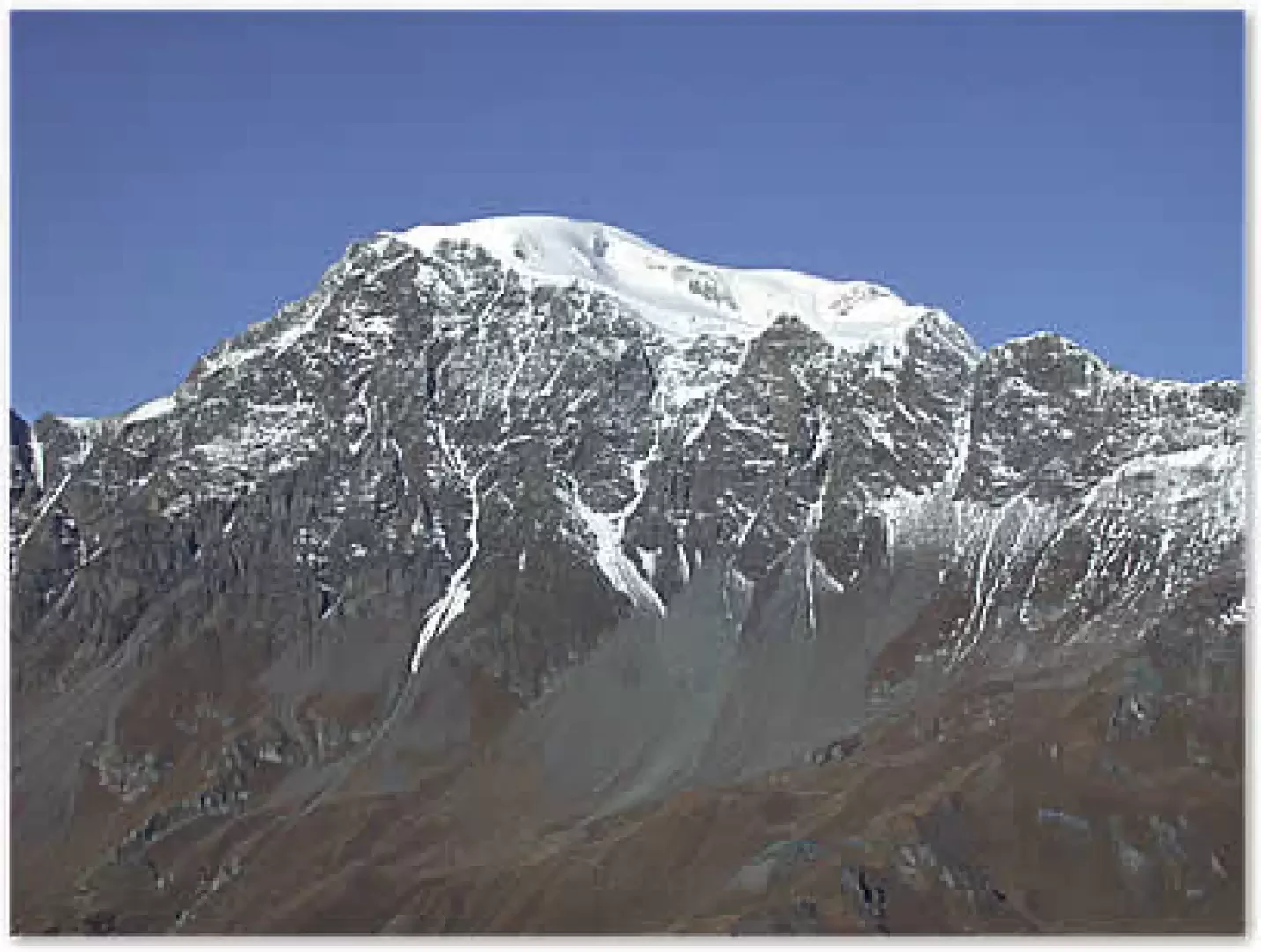
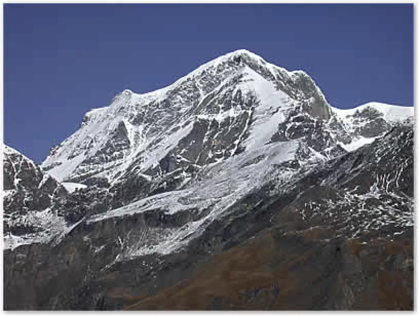
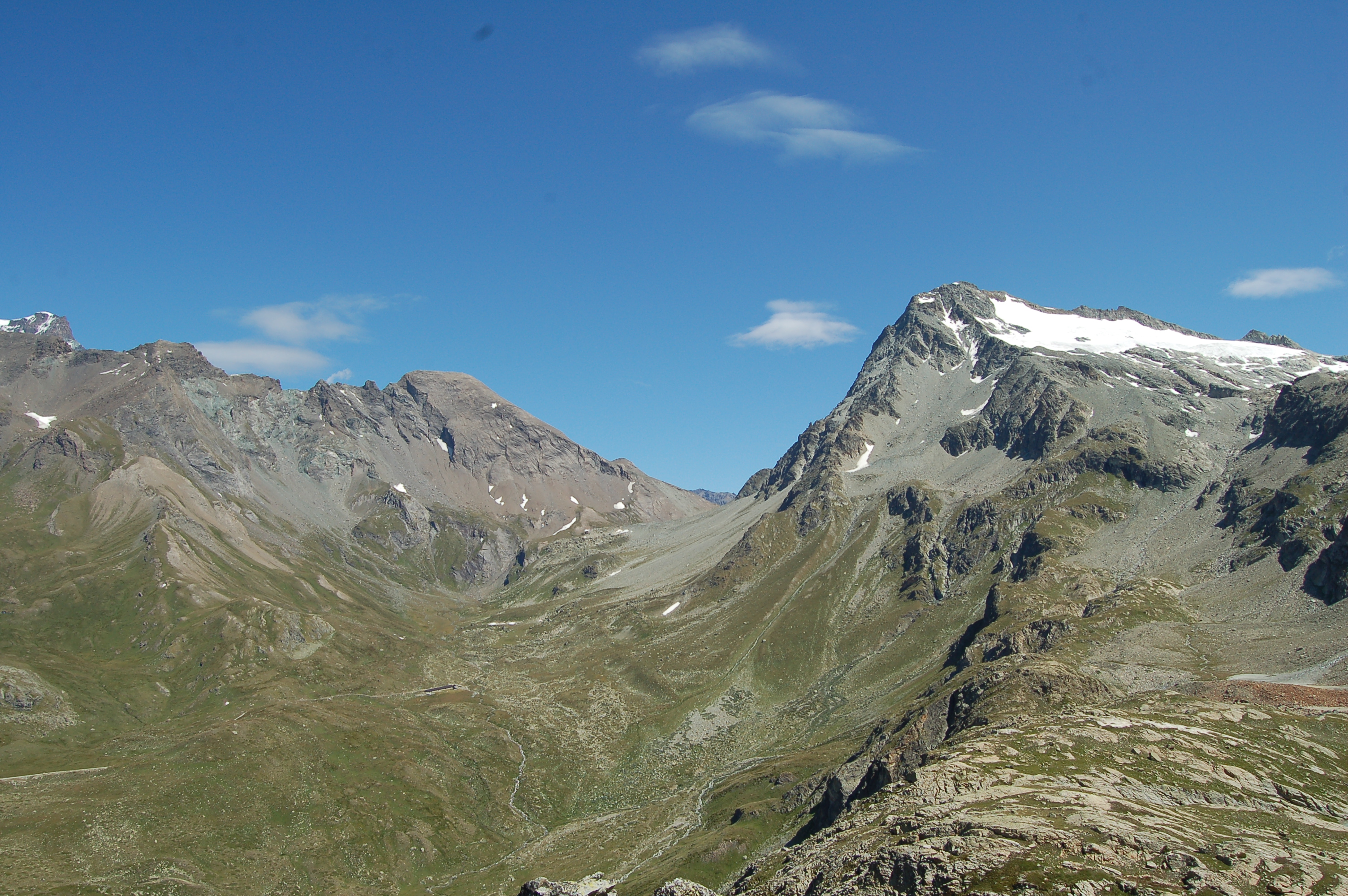
The view from up here is impressive: from Mont Vélan to the Grand Combin and finally Mont Gelé and Mont Morion, a breathtaking spectacle, especially following the beautiful ridges traversed in the summer of 2002 by Alpine Guides Claudio Bastrentaz and Paolo Comune in their Progetto Montagna.
The descent is along the same route as the ascent.
Galleria fotografica

We have been there

Edited by:
Ivo Giansetto
Bivacco Regondi - Gavazzi
Salito ad una meta agognata da tempo. Al Bivacco incontrato due escursionisti che provenivano dal Rifugio Cretes Seche ed uno che si apprestava ad andarci. Scendendo incontrato un gruppo di una trentina di ragazze del campeggio di Ollomont provenienti dalla città di Gorgonzola che salivano verso il lago Inclousa.Salito ad una meta agognata da tempo. Al Bivacco incontrato due escursionisti che provenivano dal Rifugio Cretes Seche ed uno che si apprestava ad andarci. Scendendo incontrato un gruppo di una trentina di ragazze del campeggio di Ollomont provenienti dalla città di Gorgonzola che salivano verso il lago Inclousa.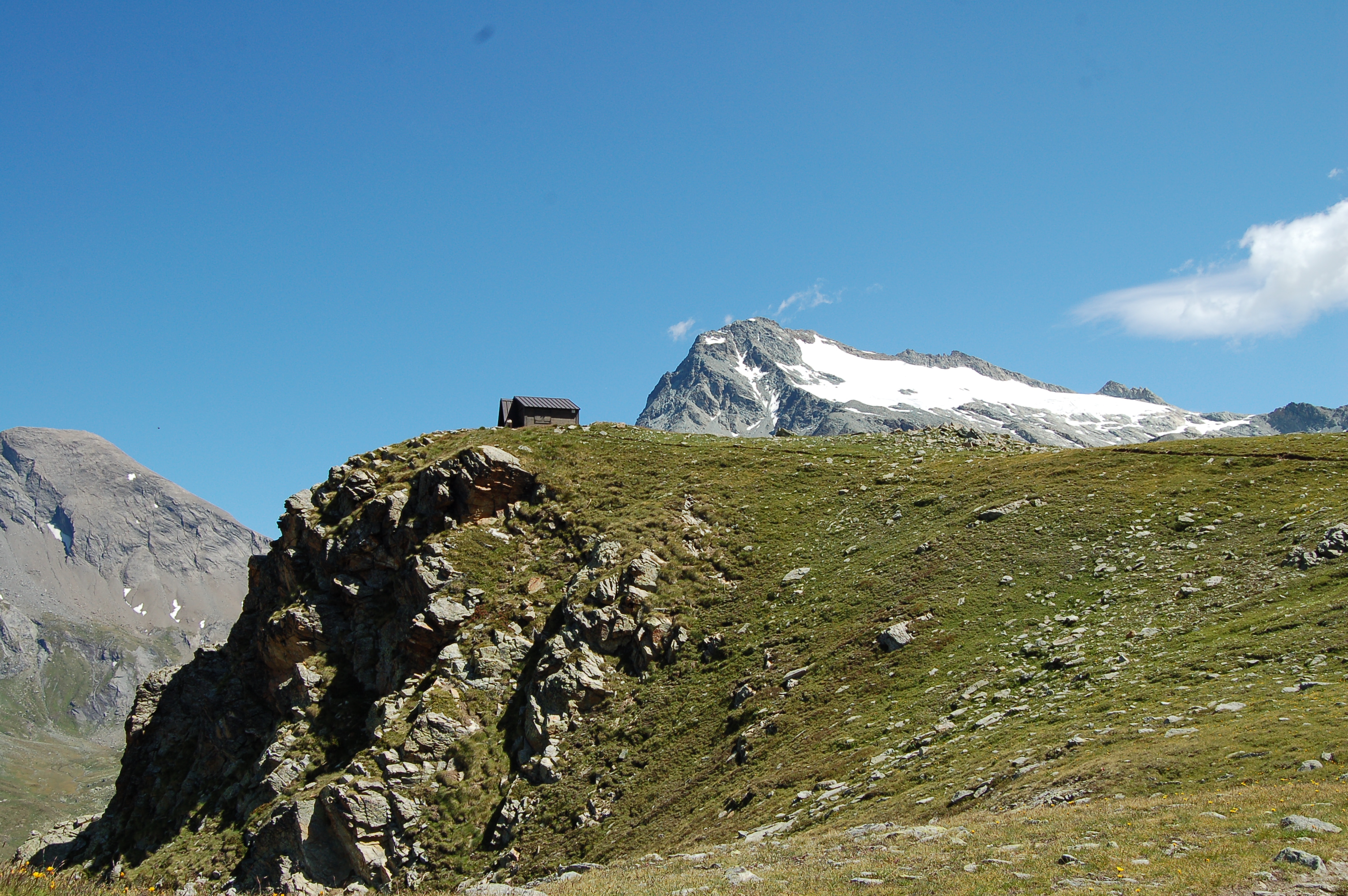
Edited by:
Massimo Martini