Grivola Bivouac, from Tignet

Edited by:
Massimo Martini
Updated at: 09/10/2025
Access
Leaving the motorway at Aosta West continue in the direction of Courmayeur on the SS26. At Villeneuve, turn left towards Valsavarenche. When you reach Dégioz, turn left, shortly after the petrol pump, and take the municipal road to Tignet. Follow the road for a few kilometres until you reach the large car park before the village of Tignet.
Introduction
The ascent to the Bivacco Grivola should normally only be the first stage of the rewarding ascent to the Punta Bianca della Grivola, in reality this hike is a wonderful experience to be had in a unique and unspoilt environment. The proposed itinerary is not easy to walk, good orientation skills and physical fitness are required, but it does not present any technical difficulties.
Description
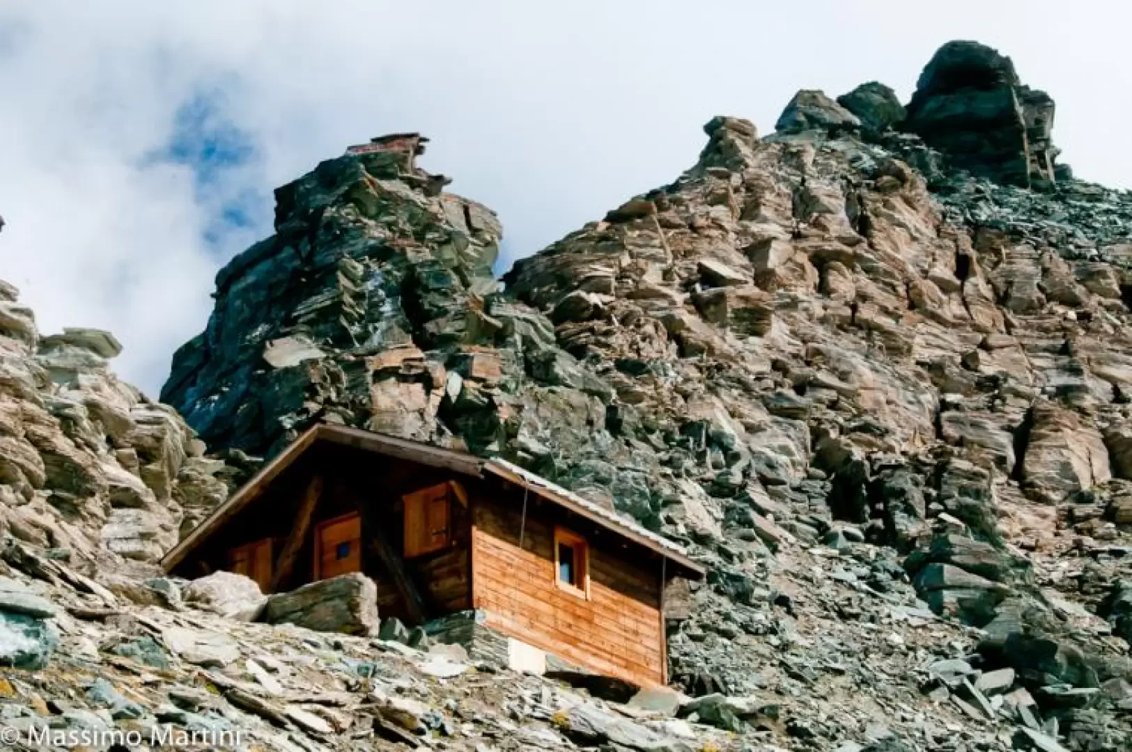
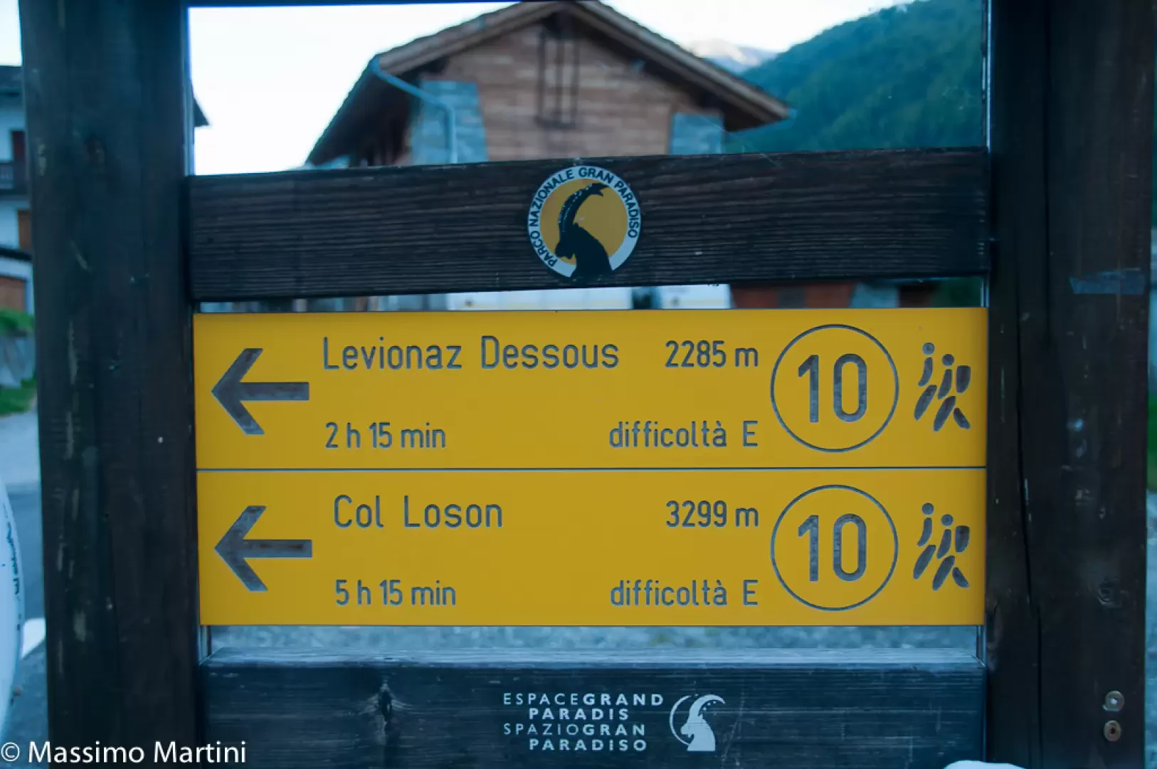
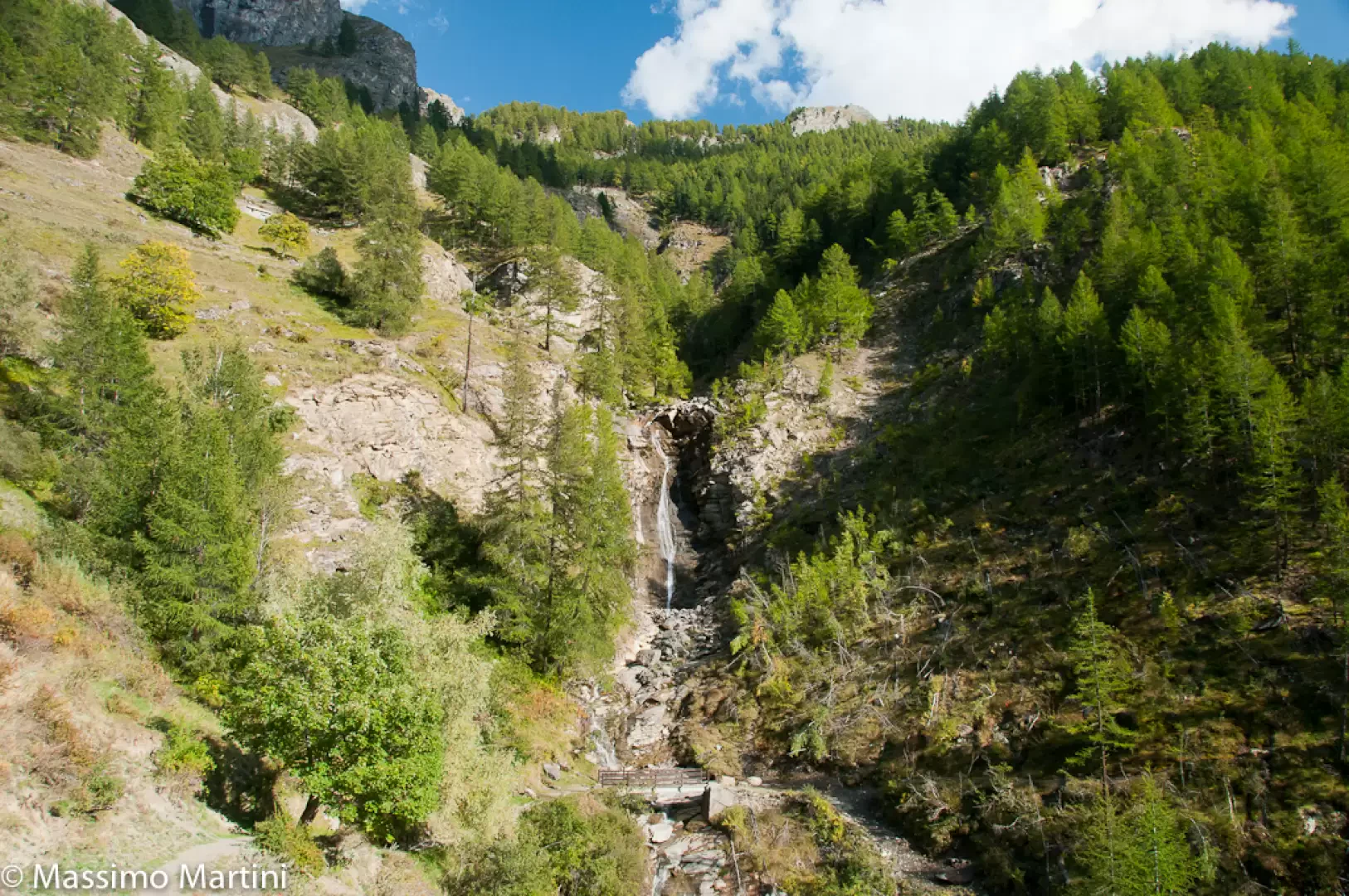
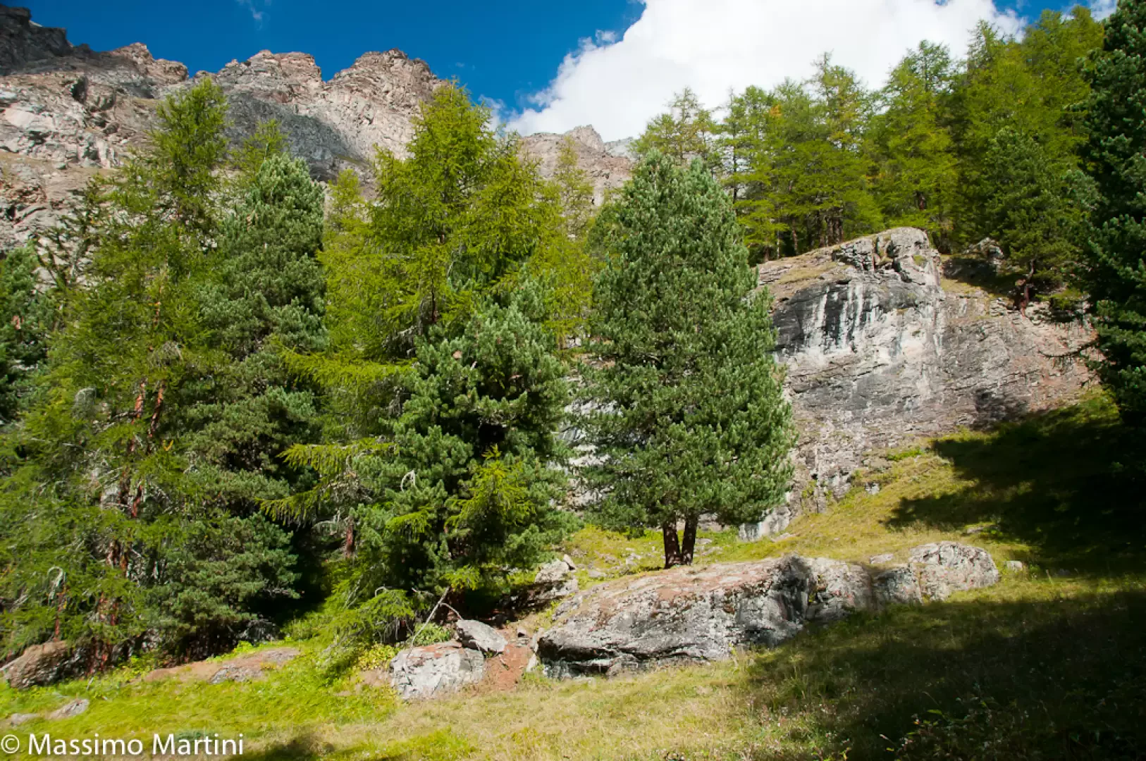
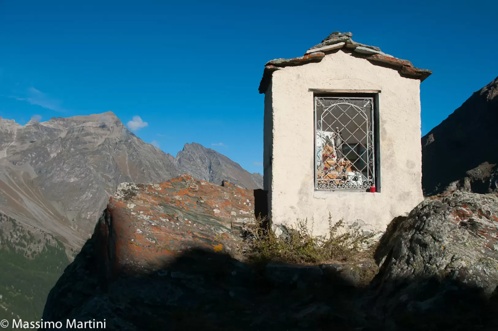
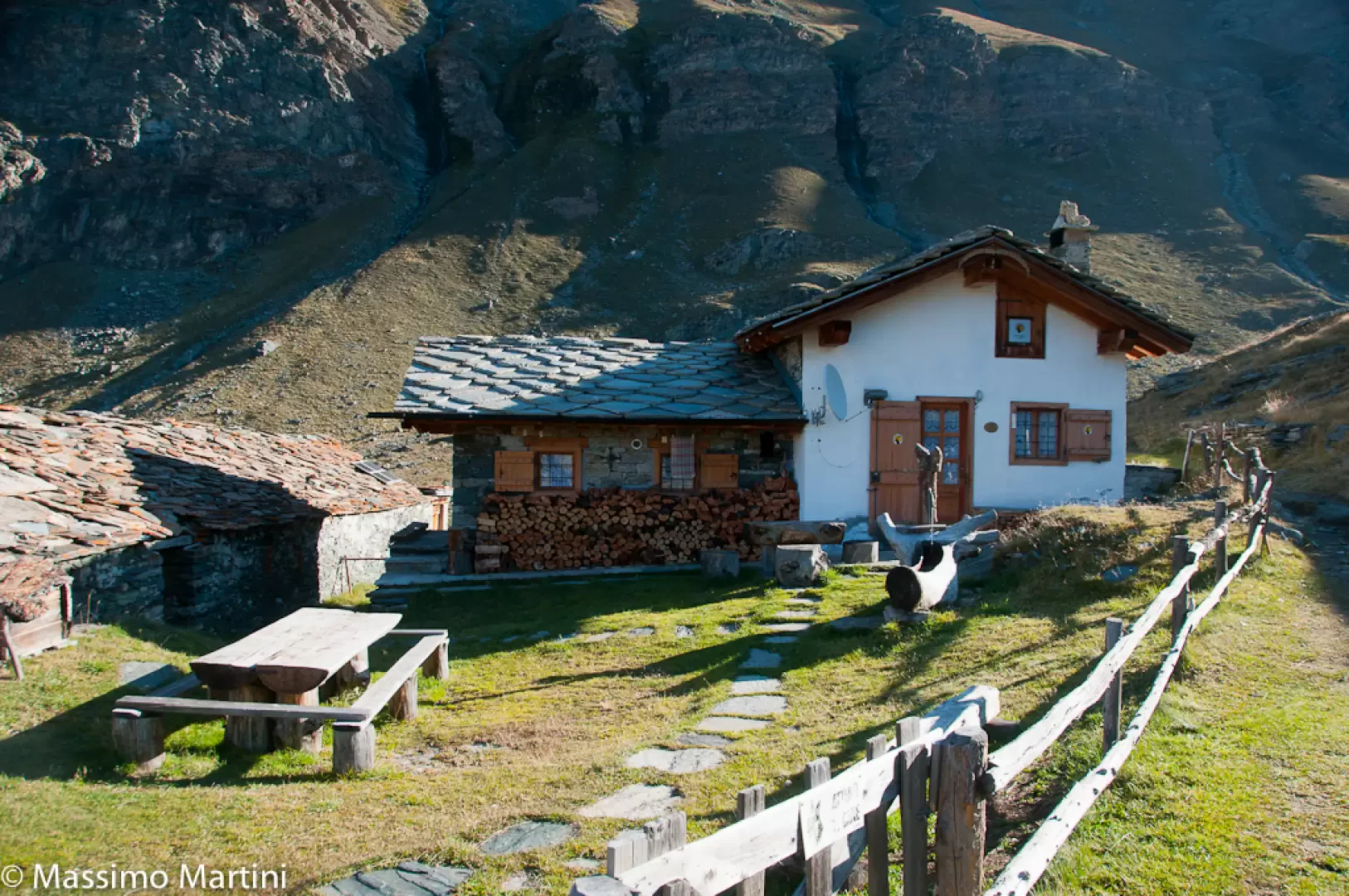
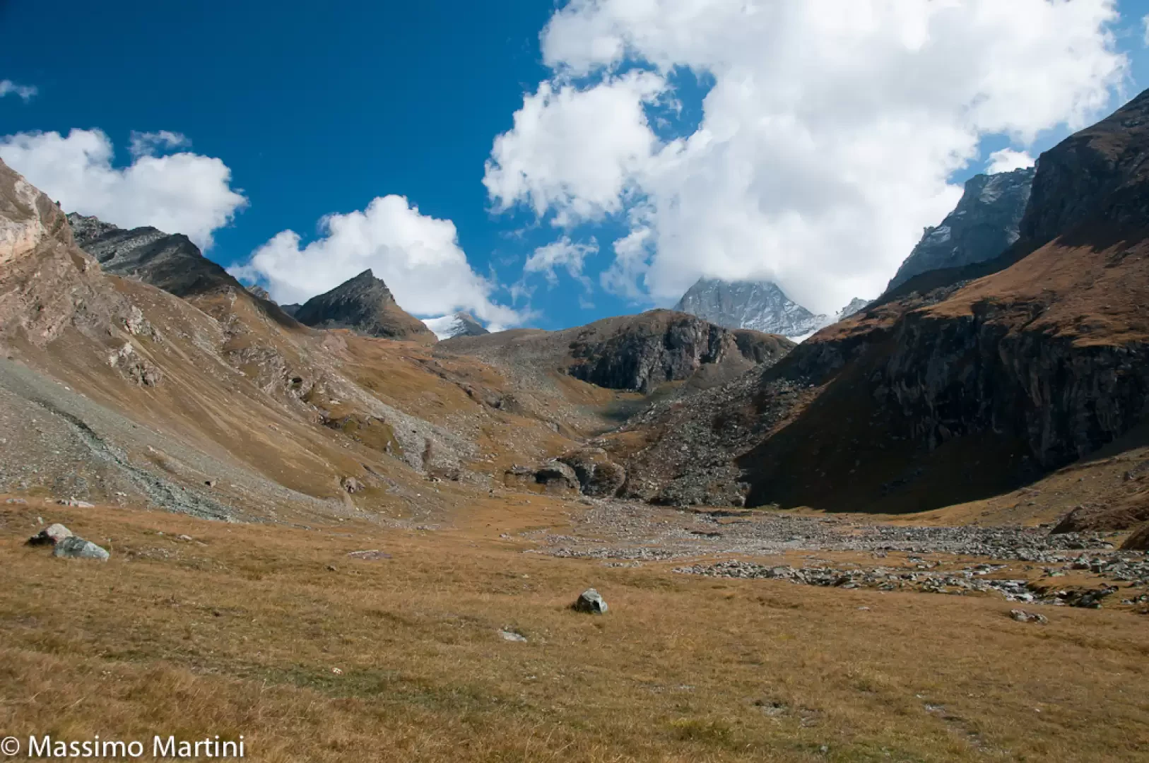
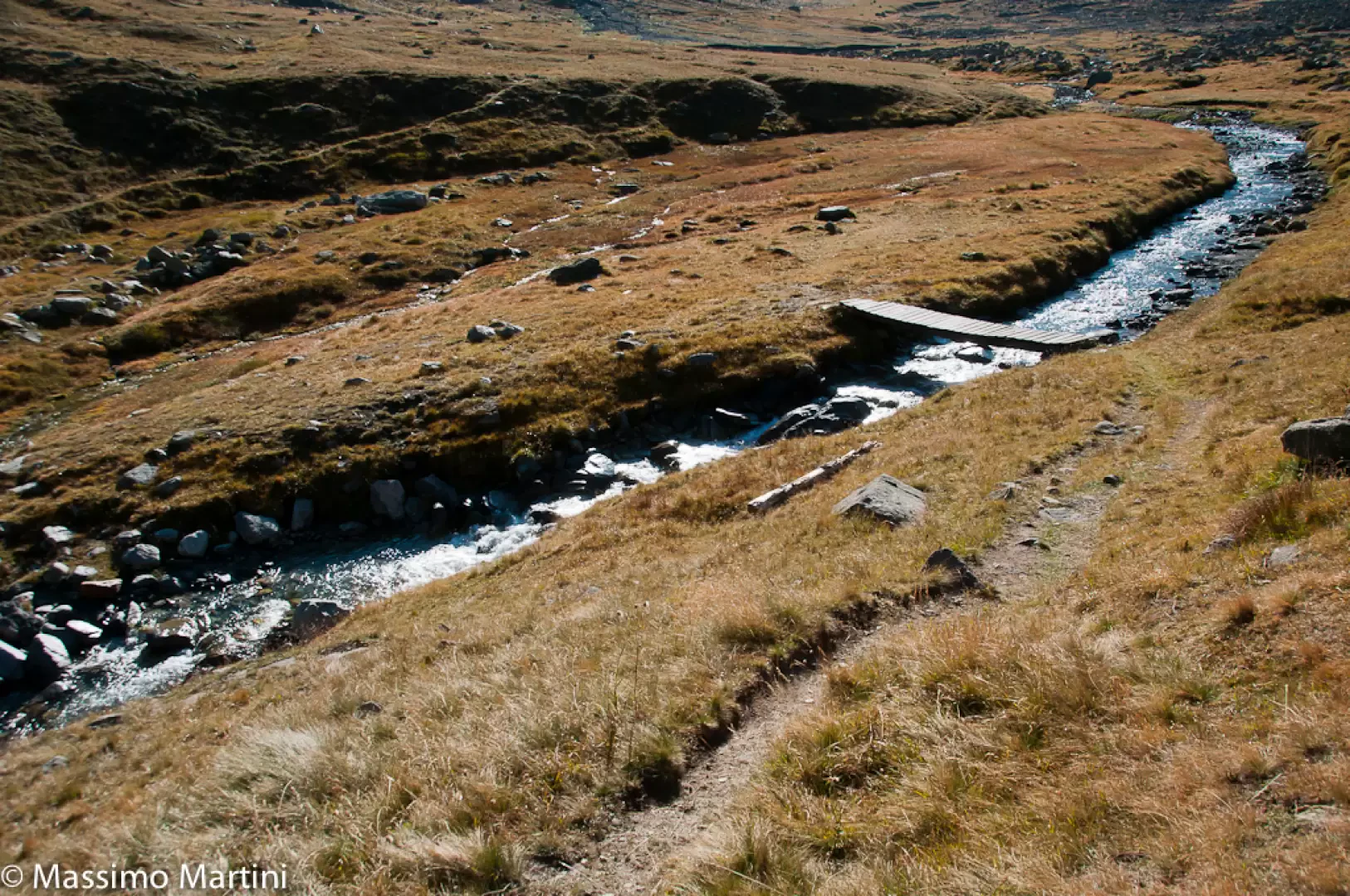
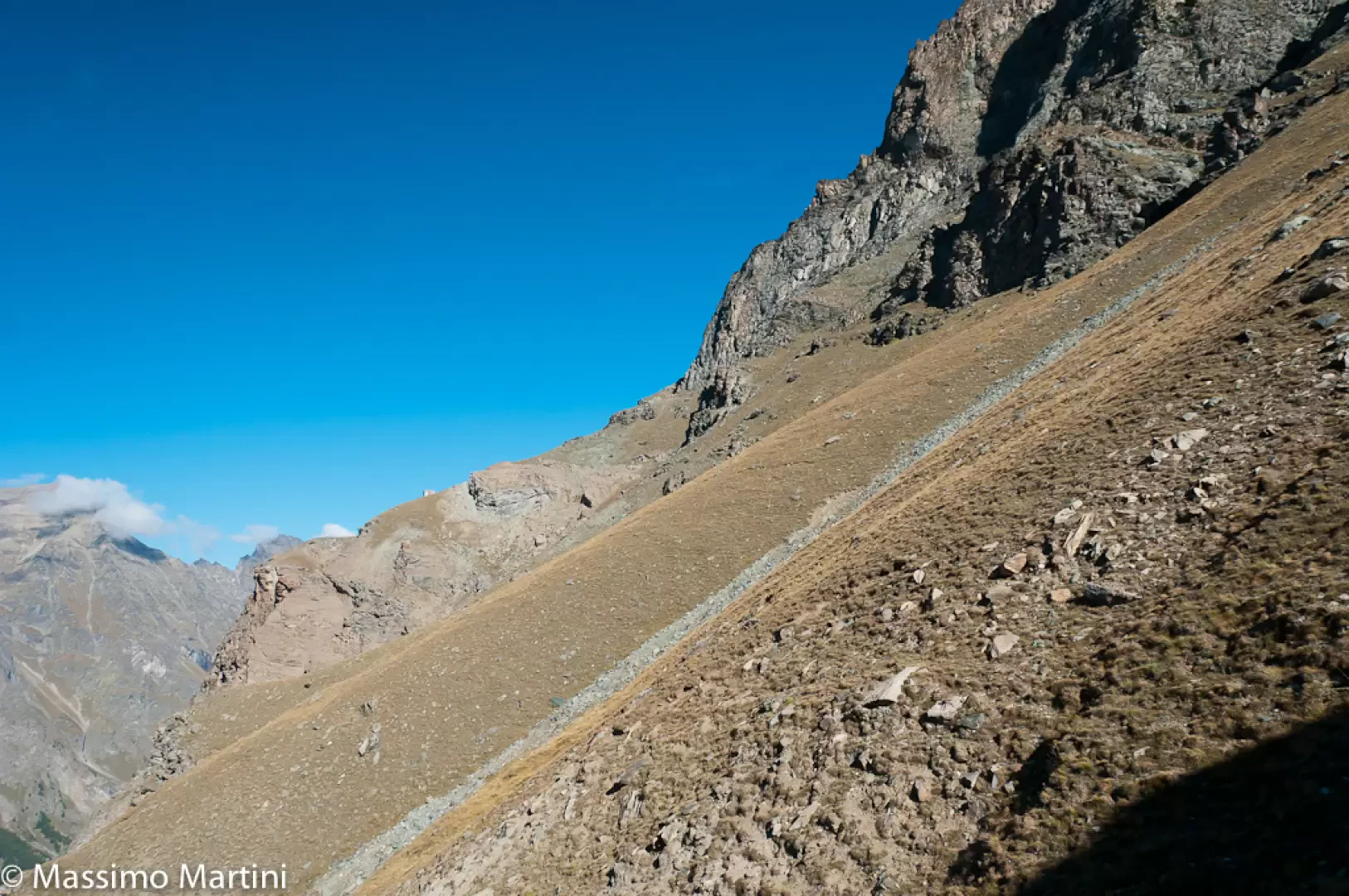
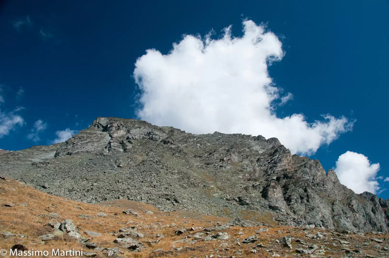
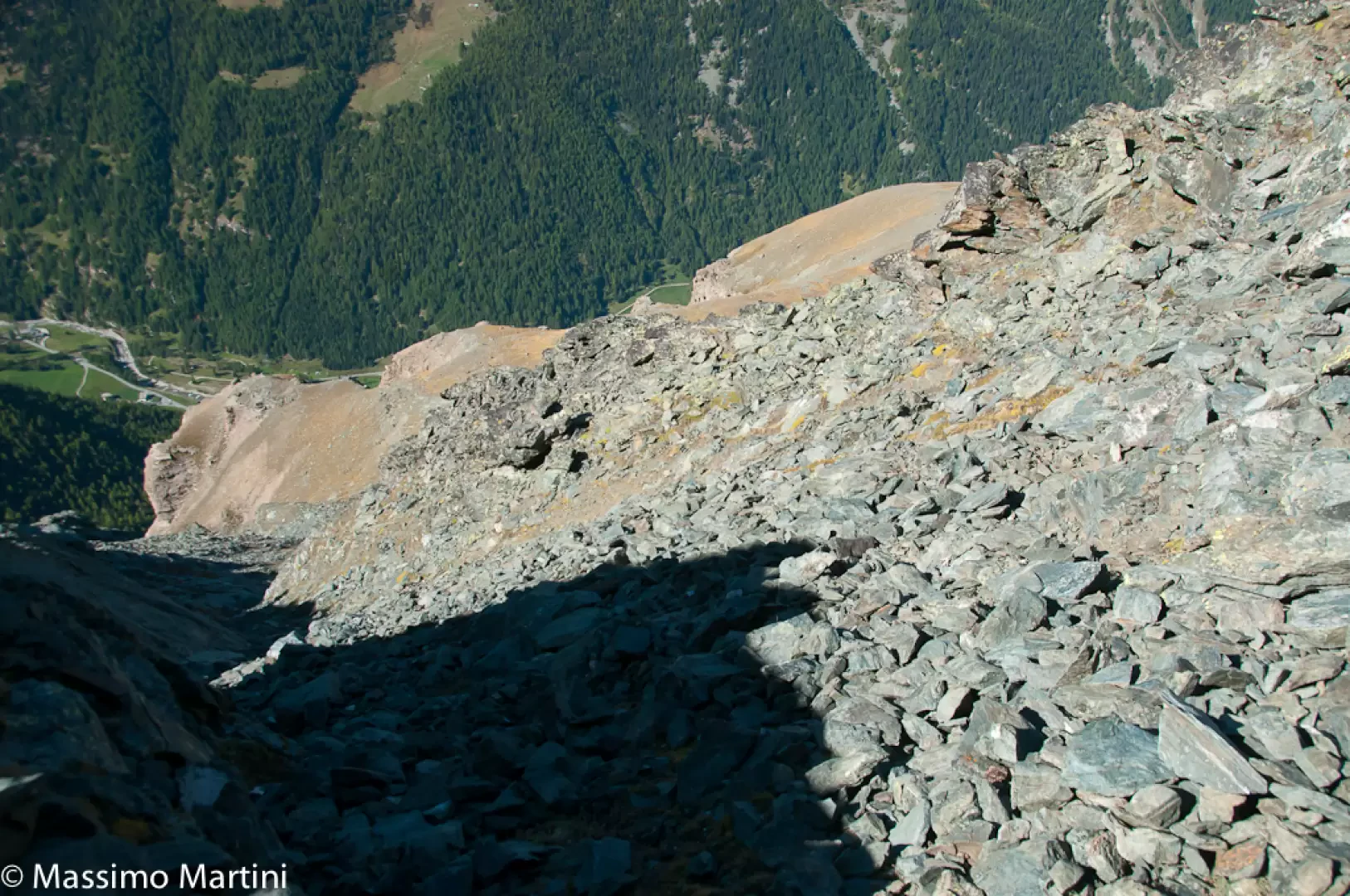
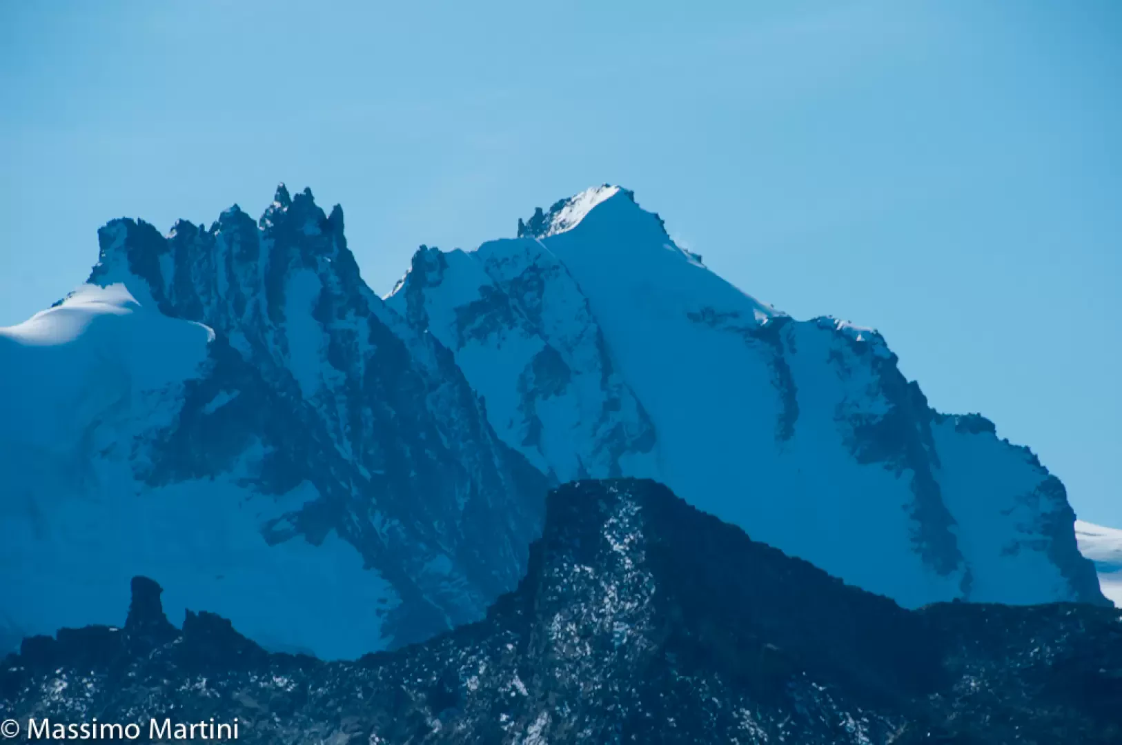
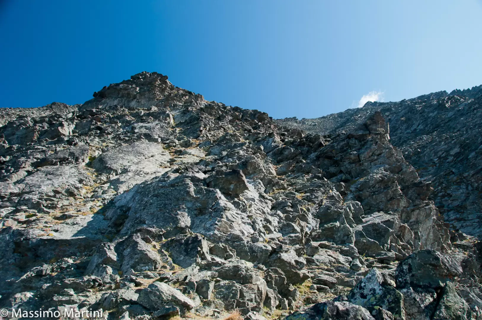
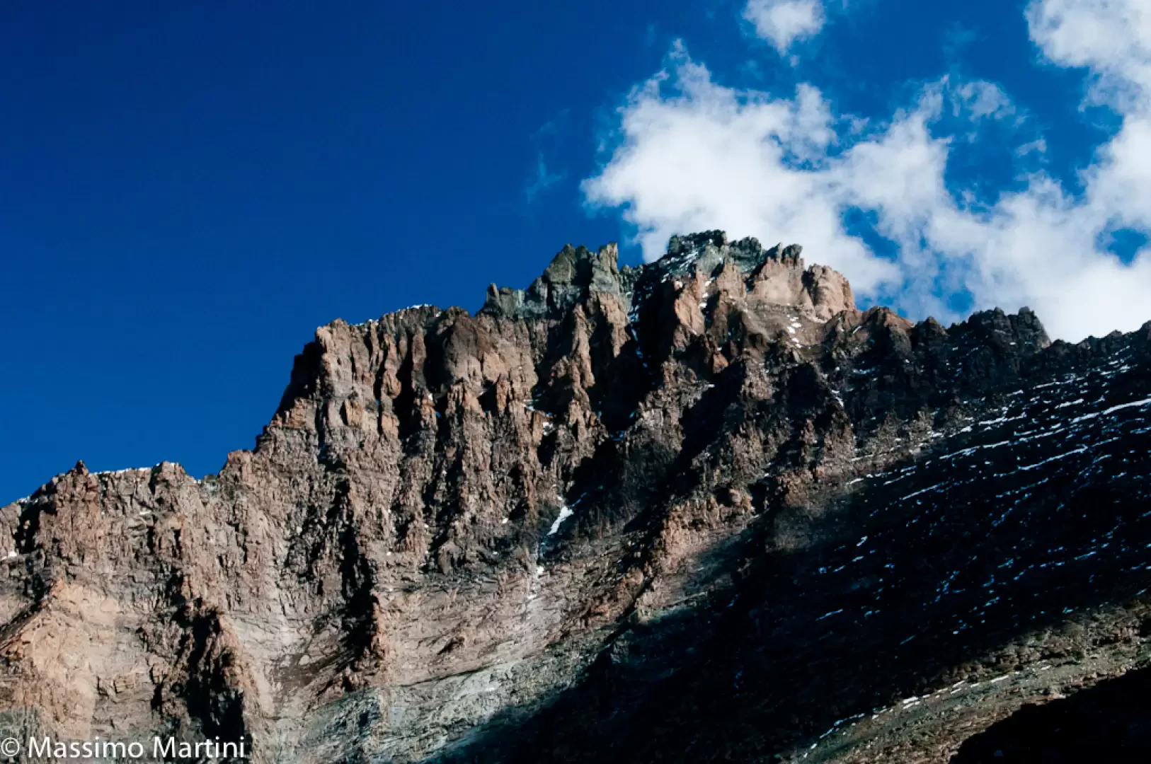
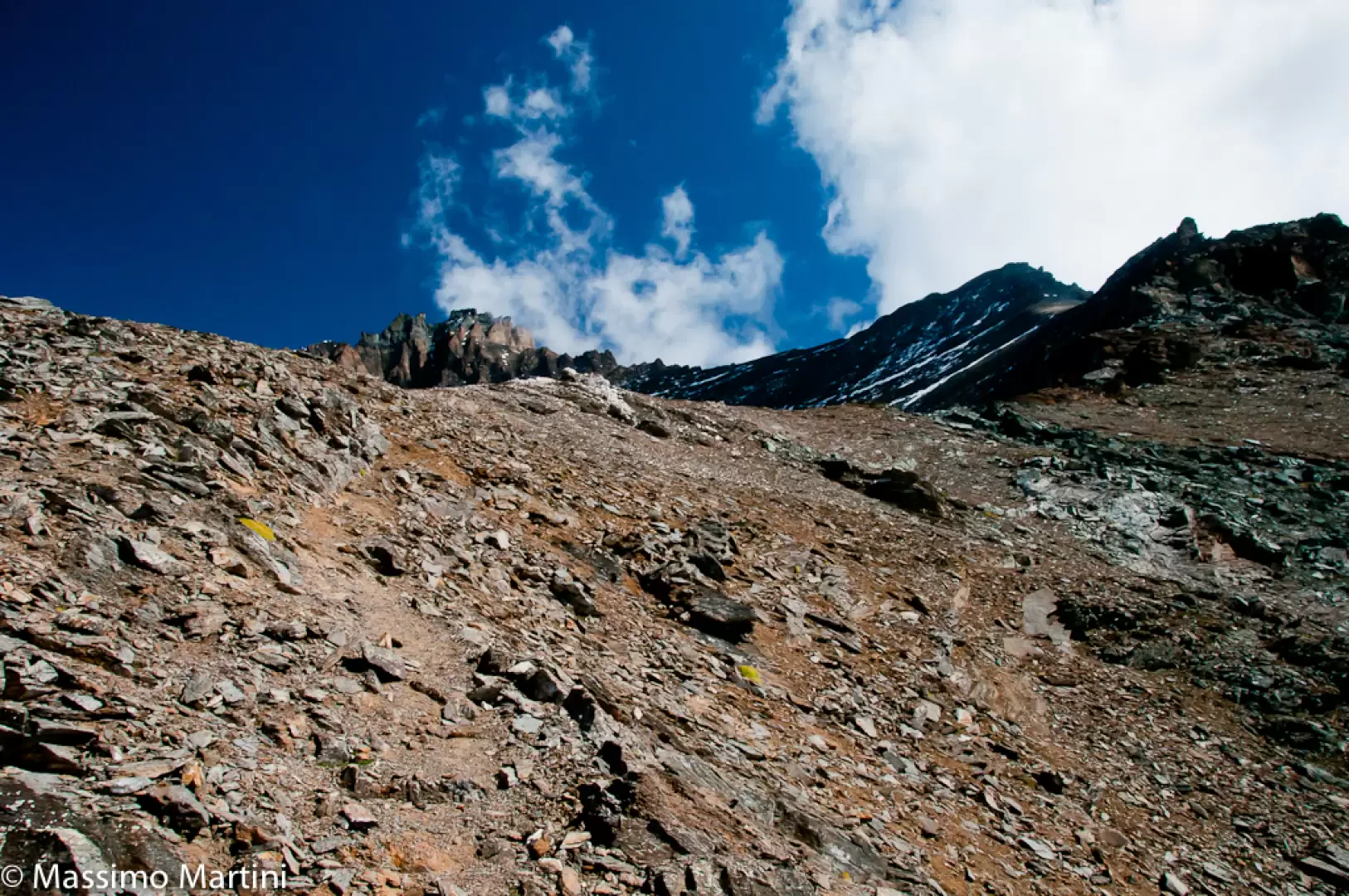
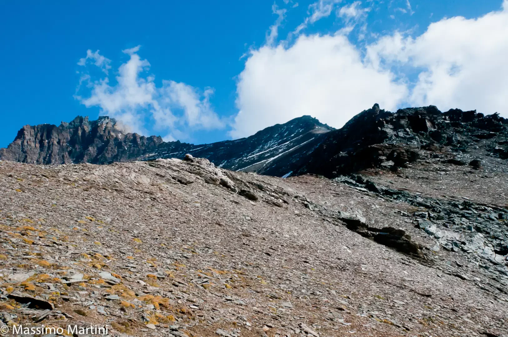
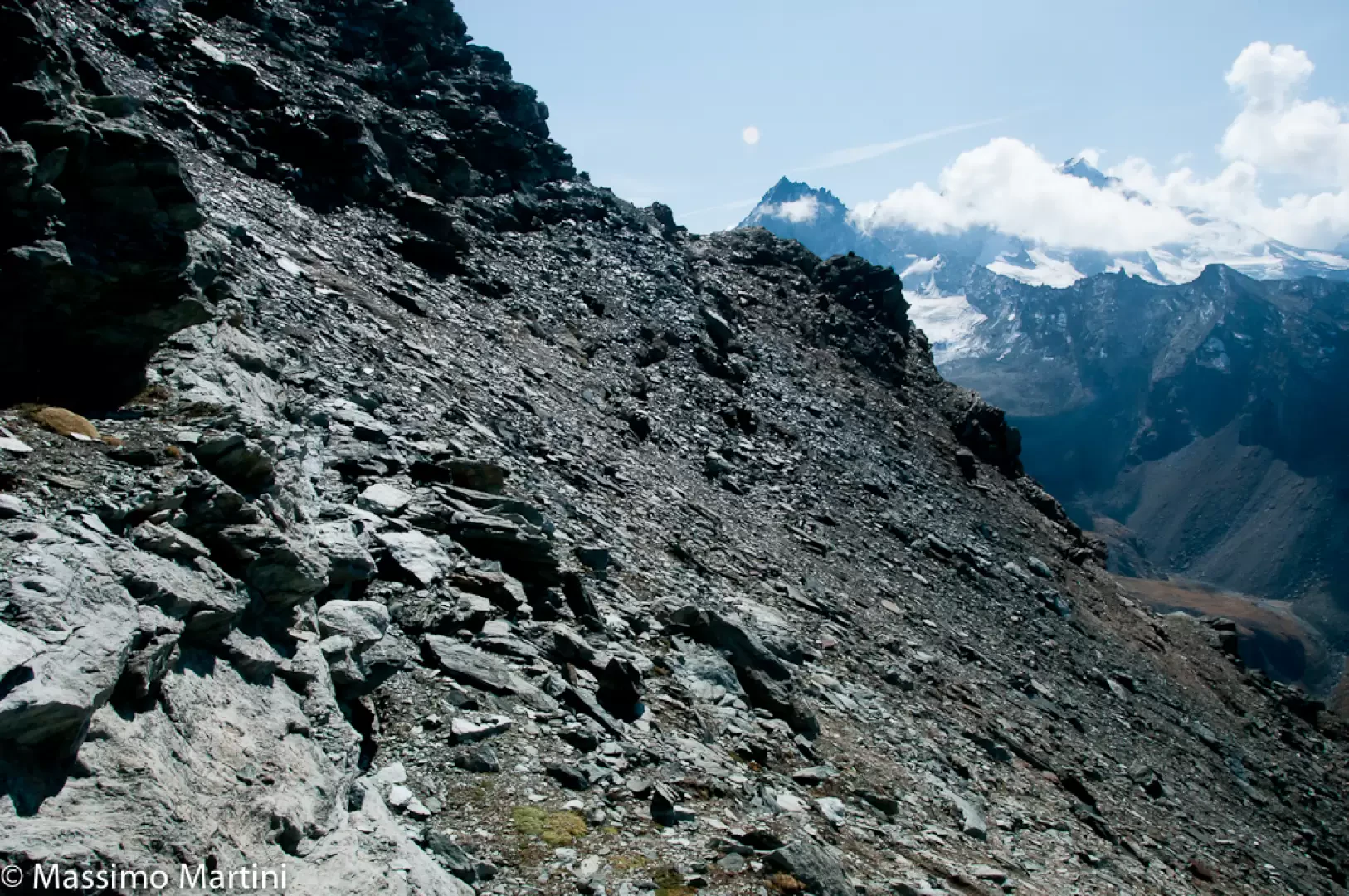
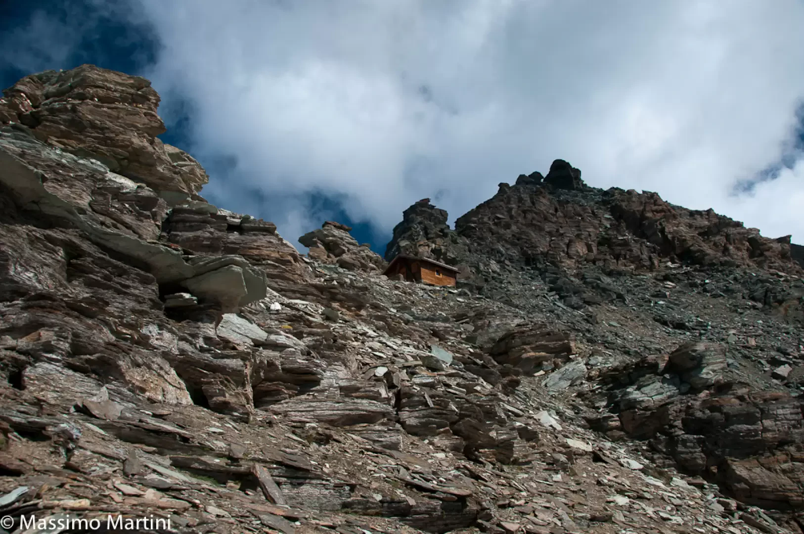
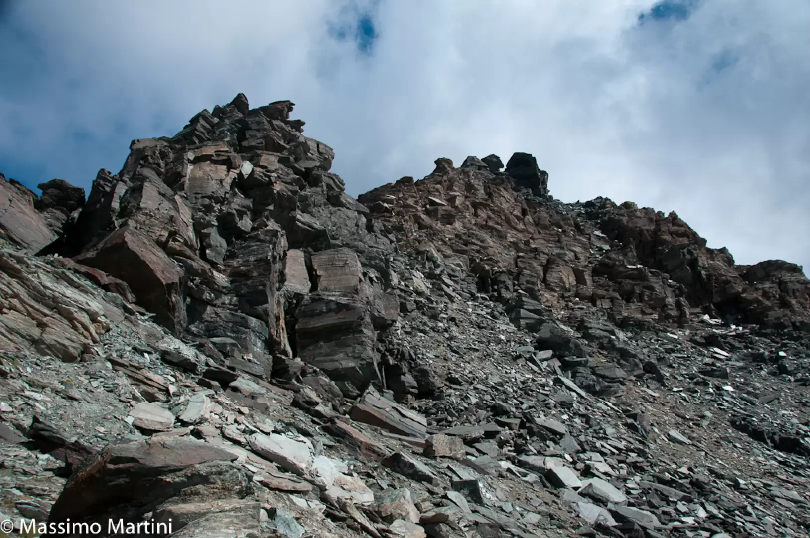
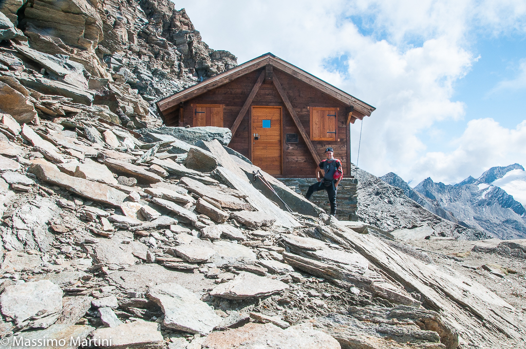
From the Tignet car park, continue along the little road in the direction of the village; when you reach the first house, you will come to an alleyway with a marker in the background. Turn left and reach the marker indicating Col Lauson at 5h15' with the path . Continue to the left on the path that begins a short descent until reaching a small bridge over the Levionaz stream, which forms a beautiful little waterfall just above. The path enters the forest and, having overlooked a small path on the right (leading to Pro Army), begins to climb with an ascending half slope accompanied by a beautiful dry stone wall. The turns soon lead to a charcoal kiln inside the larch wood; the walk continues along several long hairpin bends before reaching a pleasant clearing from which the rocky buttresses of the Punta Bianca della Grivola can be glimpsed. The path veers sharply to the right before joining, after a few bends, the wide mule track of Alta Via 2 della Valle d'Aosta. Continue in a northerly direction, soon reaching a votive shrine and the alpine pastures of Levionaz dessous (2285m, 1h 30') where there is a hut belonging to the Gran Paradiso National Park. Continue along the wide mule track of the Alta Via in an easterly direction, towards Col Lauson; you will lose altitude slightly until you reach a fork: turn left until you reach a footbridge, cross the wetland area and climb a grassy step before finding the path again, which is made evident by a double row of stones placed along the track. Slowly the path becomes more evident and begins to climb the steep grassy slope with a series of hairpin bends leading to a rocky prominence. Having passed the not-so-easy pass, the twists and turns resume for a few bends until a long upward slope to the left. The route becomes slightly more exposed, crossing a couple of torrential channels, before climbing the spur on which the Casa di Caccia (2569m, ) is located. Continue past the cottage along another drainage gully with a slight descent and then climb in a few minutes to a grassy shoulder where you will come across two cairns placed above a flat boulder: here, turn right and take the final path to the bivouac. Proceed across the pastureland following the line suggested by the cairns until you reach a large scree slope. As soon as you set foot on the scree, proceed to the right following the cairns, which are quite evident at this stage of the ascent, practically bringing you to the edge of the first gully visible on the right. The progression is fairly complex; the cairns are not always to be found, but in some sections with less debris, short tracks can be found. Climb the stony slope, leaving the scree gully to the right and then cross it at an altitude of around 2840m. A short traverse is made until reaching the base of a rocky ridge, barely noticeable, which descends from the summit. Continue along this ridge with fairly easy progression with many references for orientation. Gain height rapidly until abandoning this section of the ridge, leaving it to the left as you reach the summit ridge highlighted by a huge cairn. Go over the last descending ridge and turn left, taking you to the west ridge of the Punta Bianca della Grivola near the previously mentioned cairn. Now follow the ridge, passing a small step of white quartz, while to the left the western face of the Grivola appears in all its majesty. The destination is now not far away, and a new prominence is encountered with a few small rocks that can be overcome quite easily despite the detrital terrain. Make another diagonal turn until you reach the last of the ridges descending from the main ridge, turn left and you will finally catch a glimpse of the bivouac. One last short stretch between scree and boulder and you reach the Grivola bivouac (3300m, 5h00'). From the bivouac, the view is remarkable both on the Grivola side with the impressive reddish rocks of the south-west face and the unusual summit pinnacles, and a little further on the bold outline of the Grand Nomenon; on the Gran Paradiso and Valsavarenche side, the views are lost among the glaciers and the peaks bordering Piedmont. The descent follows the same route as on the outward journey (3h00'); on the descent there are a few white arrows (not very visible on the ascent) that help to keep the route trim.
Galleria fotografica
We have been there
Edited by:
Massimo Martini
Bivacco Grivola
Report della gita
Gita molto impegnativa per dislivello ed orientamento.
Informazioni generali
Condizioni via o sentiero:
Pericolo Oggettivo:
Tratti esposti:
Affollamento: ho incontrato due persone che salivano al bivacco mentre scendevo
Condizioni meteo
Cielo:
Temperatura:
Condizioni neve:
Condizioni ghiacciaio:
Avvistamenti
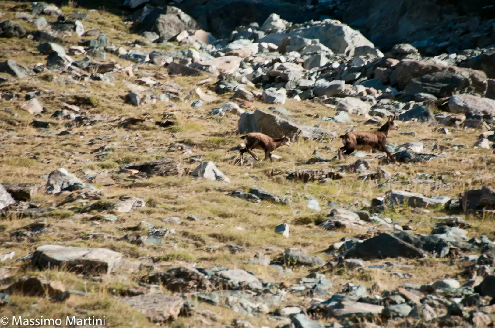
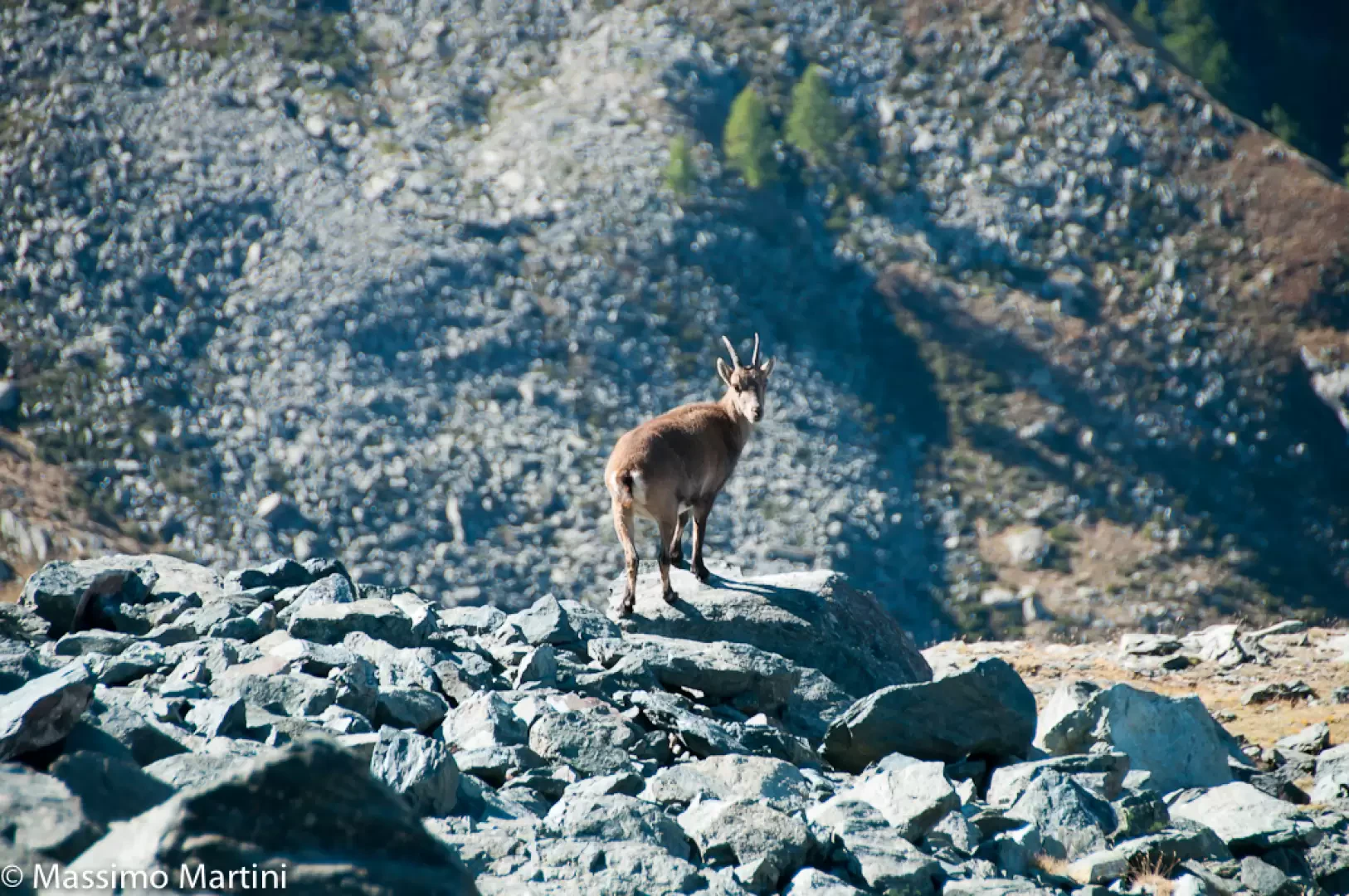
Fauna: Rupicapra rupicapra, Capra ibex
Flora:

Edited by:
leverogne