Mariano City Bivouac, from the Frachey car park

Edited by:
Maurizio Bergamini
Updated at: 04/03/2025
Access
At the motorway junction of Verrès, enter the roundabout and take the second exit. Proceed in the direction of the town centre and, after 300m, turn left onto the regional road for Val d'Ayas. Follow the regional road for 16.5 kilometres, passing the villages of Challand-Saint-Victor and Challand-Saint-Anselme, Brusson, Vollon, Extrapieraz, Periasc and Champoluc. After about 30 kilometres, you come to the large free car park 🅿️ in Frachey (where the Monterosa Ski rack starts): here there is a shuttle service that takes you to the small square in Saint-Jacques. If you arrive before 7.00 am, it is possible to go up for a short distance and leave your car in another free car park 🅿️ on the left of the road: in this case you have to add about 500m of walking.
[0h44'] - [30.1km]
How to get there with GMaps
How to get there with Apple Maps
The information provided here has been verified as of the date the route was surveyed. Before setting off, it is advisable to ensure that no substantial changes have occurred on the route to the starting point. We therefore recommend the use of the satellite navigation apps provided by Google or Apple for up-to-date and detailed directions.
Introduction
An interesting and highly satisfying route. The route winds its way through the initial section of the Cime Bianche valley. The ascent to the bivouac, located at the foot of the Gobba di Rollin, offers suggestive high mountain moments.
Description
Leaving the car in the little square of Saint-Jacques, continue to the end of the road at Blanchard and take the mule track to Pian di Verra. After a few metres, you cross a small bridge and begin to climb a beautiful larch forest on an extremely well-trodden path: the tracks seem endless! You soon reach a fork in the road accompanied by a signpost: turn left and in a few minutes you reach the characteristic village of Fiéry (1879m, 0h20') . You reach the former Hotel Bellevue and turn right through the tiny hamlet. After a few metres, you meet new signposts indicating to turn left. One enters the forest and, after encountering a plaque dedicated to Pier Giorgio Frassati, reaches a small bridge just before a bucolic clearing. The comfortable path now begins to climb and gain altitude, slowly opening up splendid views of the Castore (4226m); the path alternates between woodland and small pastures until it enters a small valley through which runs a small stream. When the path slopes slightly, you reach a fork in the path (2095m, 0h50'): turn right, cross the stream and climb up the ridge that separates the Cortod valley from the Tzère valley with a couple of bends. After a short steep climb, the path flattens out slightly and soon reaches the ruins that precede Alpe Ventina (2179m, 1h10').
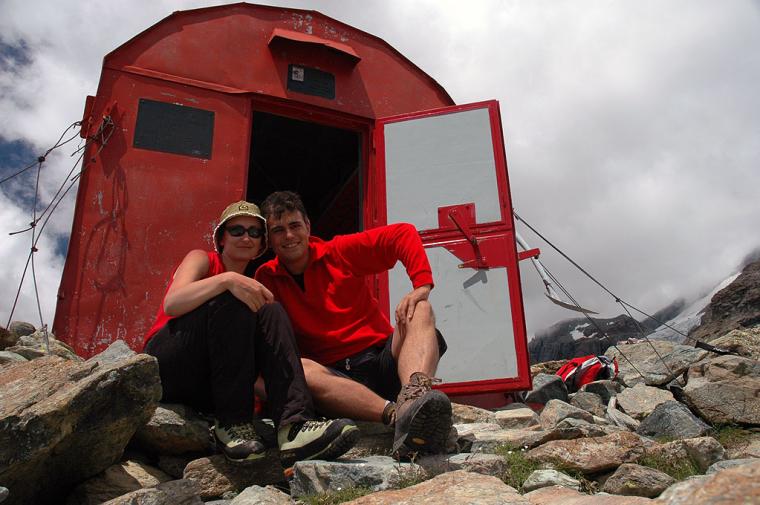
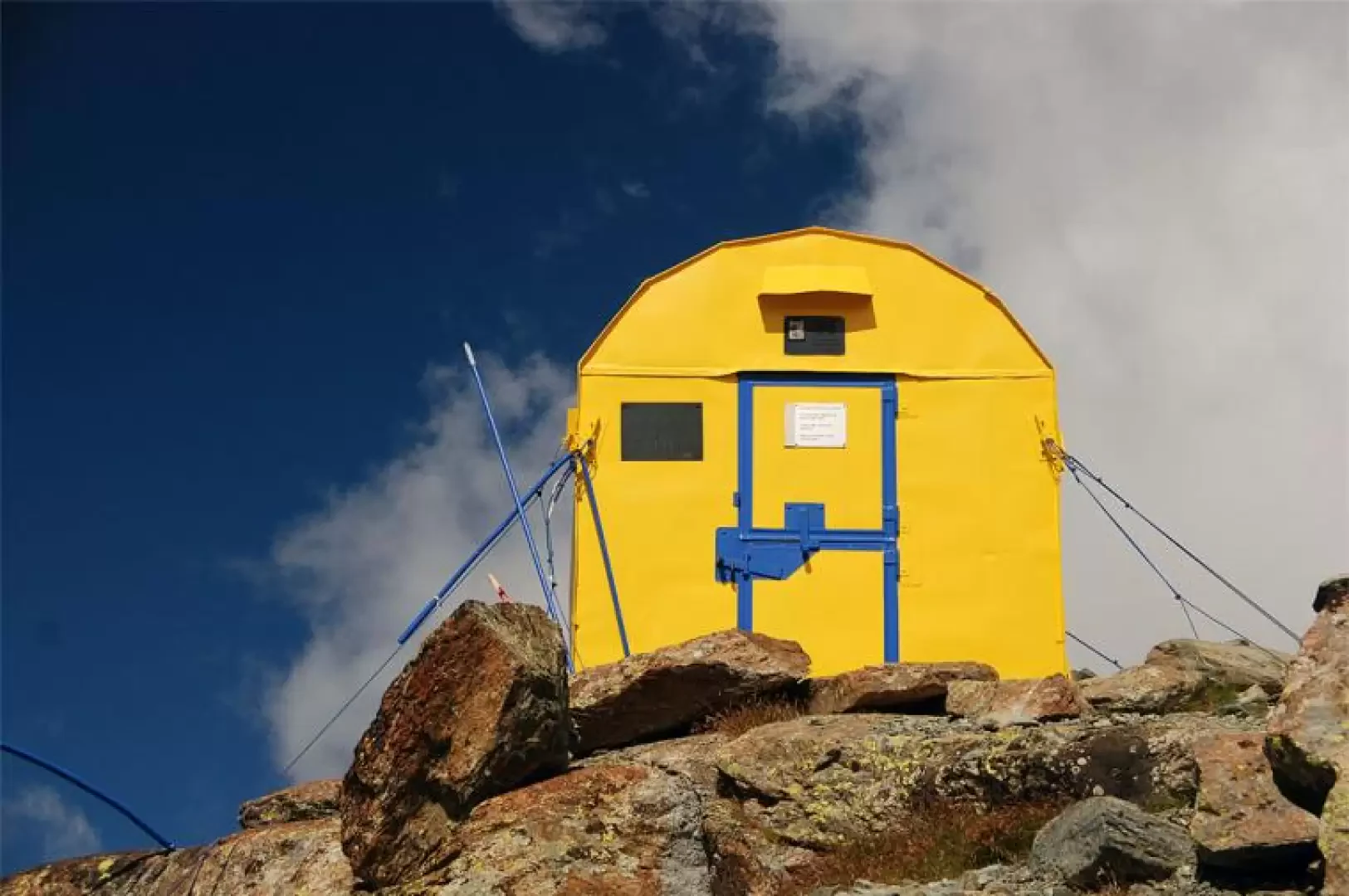
After the alp, the path climbs up the grassy slope with a couple of twists and turns until it joins a small plateau where a placid stream flows. A gentle climb leads to another plateau, the one preceding the Varda alp. After a short stretch, a signpost indicates to turn right in the direction of the bivouac (2343m, 1h30'). You cross a first stream and then pass the wide moorland plain below the Varda alpine pasture. Having crossed the stream that drains off the peat bog, start climbing again along the splendid grassy slopes that precede the Palon di Tzère; after an initial stretch of ascent along the hillside, you reach an undulating plateau from which there are interesting views of the distant Cime Bianche. Now head towards the bivouac, a red dot in the distance below the Gobba di Rollin; the path climbs up the eastern slope of the Palon di Tzère and reaches the ruins of the Alpe di Tzère (2532m, 2h15'). Once past the ruins, the trail begins to encounter a rougher environment, crossing scree until it reaches a small saddle: from here, after a few short turns, it takes a rocky gully to the right. Once over the gully, the itinerary proceeds alternating between stretches of path and passages on small rocks: the destination is now near, we turn left and finally reach the Bivacco Città di Mariano (2860m, 2h45').
From the hut, looking around, we can see a wide panorama of the valley we have climbed with a view of the Grand Tournalin and the Roisetta to the south and behind us the Gobba di Rollin.
The return journey follows the same route as the outward journey.
The last part of the ascent is recommended for slightly more experienced hikers: the predominantly rocky terrain can become treacherous in wet weather.
Along the last rocky passages below the bivouac it is not unusual to encounter chamois (Rupicapra rupicapra).
We have been there

Edited by:
Massimo Martini
Bivacco Città di Mariano
Edited by:
Massimo Martini
Bivacco Città di Mariano
Abbiamo percorso questo itinerario domenica 3 luglio 2005. In una bella giornata estiva sono tornato dopo qualche anno in questo angolo sperduto della Val d'Ayas (questa volta seguendo bene il sentiero Wink ). Una bella escursione che merita di essere estesa, se si ha ancora un po' di forza nelle gambe, al non lontano Gran Lago di Tzère.