Becca Traversière, from Thumel

Edited by:
Giancarlo Beretta
Updated at: 25/08/2025
Access
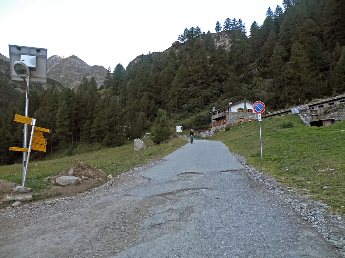
Lasciare l'autostrada allo svincolo di Aosta Ovest e proseguire fino all’innesto con la strada statale . Svoltare a sinistra al semaforo e procedere in direzione Courmayeur. Superati gli abitati di Saint-Pierre e Villeneuve, dopo 6,6 chilometri imboccare sulla destra la strada regionale della Valsavarenche, che attraversa rapidamente Introd e, dopo altri 4,7 chilometri, si dirama diventando la strada regionale della Valle di Rhêmes. Risalire la vallata per 14,9 chilometri, oltrepassando Rhêmes-Saint-Georges, fino a raggiungere Bruil, capoluogo del comune di Rhêmes-Notre-Dame. La strada si inoltra nel fondovalle, supera il piccolo villaggio di Pellaud e prosegue ancora per qualche minuto, fino a raggiungere l’ampio parcheggio 🅿️ a pagamento di Thumel, situato all’inizio dei principali sentieri della zona.
La tariffa è di 50 centesimi per la prima ora e di 15 centesimi per ogni ora successiva.
Distanza e tempo di percorrenza
🕒 Tempo di percorrenza: 39 minuti
📏 Distanza: 29,6 km
Navigazione GPS
📍 Come arrivare con Google Maps
📍 Come arrivare con Apple Maps
ℹ️ Nota importante
Le indicazioni fornite sono state verificate alla data del rilievo dell’itinerario. Prima della partenza, è consigliabile verificare eventuali variazioni del percorso. Per ottenere indicazioni aggiornate e dettagliate, si consiglia l’uso di Google Maps o Apple Maps.
Introduction
A long but highly satisfying hike with a changing environment: from the pastures of the lower valley to the characteristic environments of the high mountains.
Description
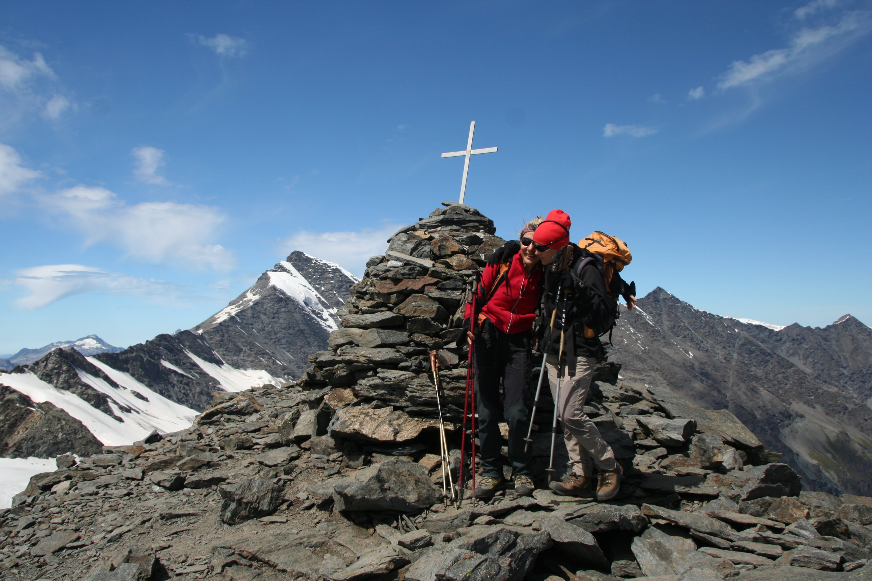
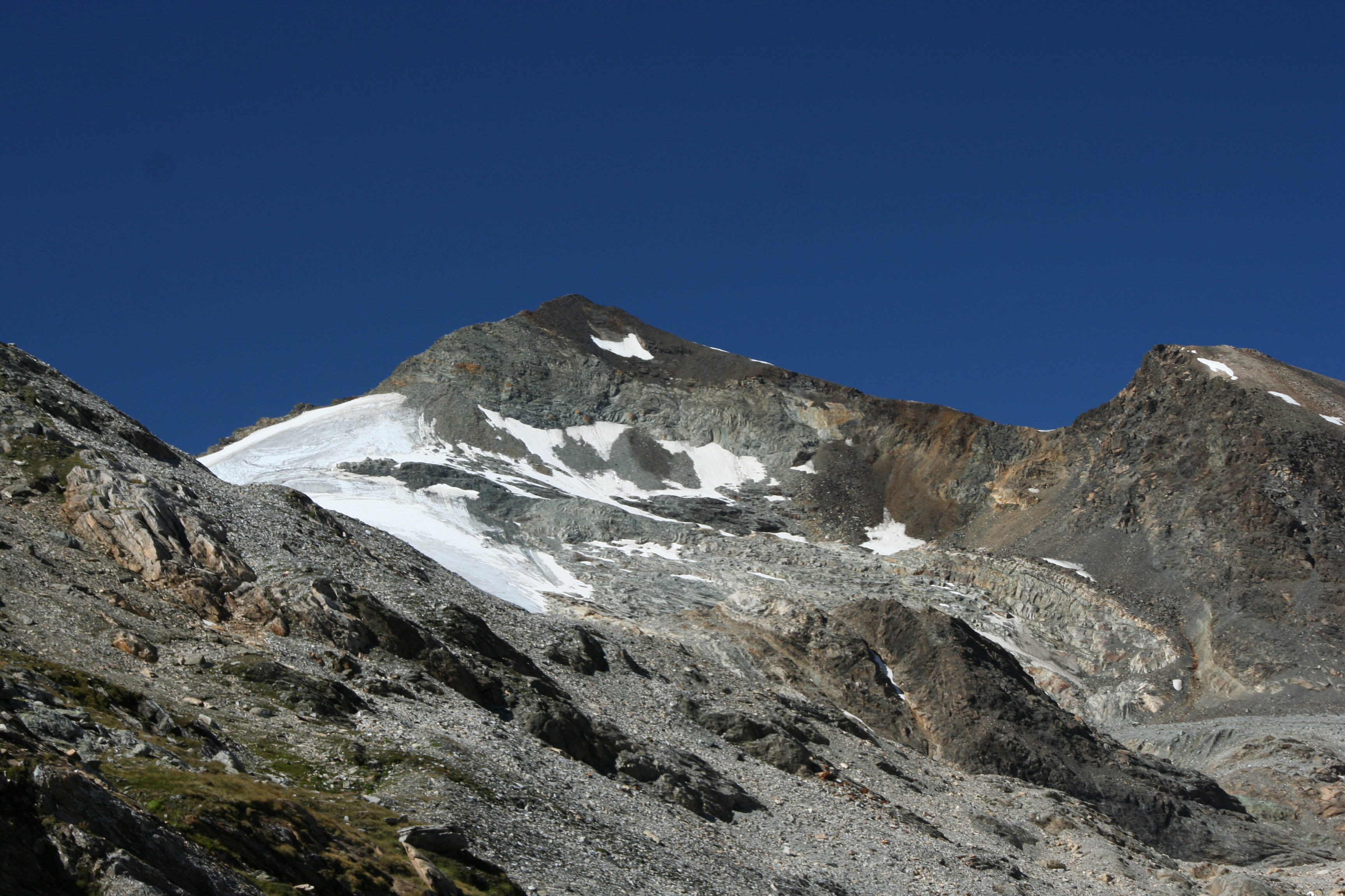
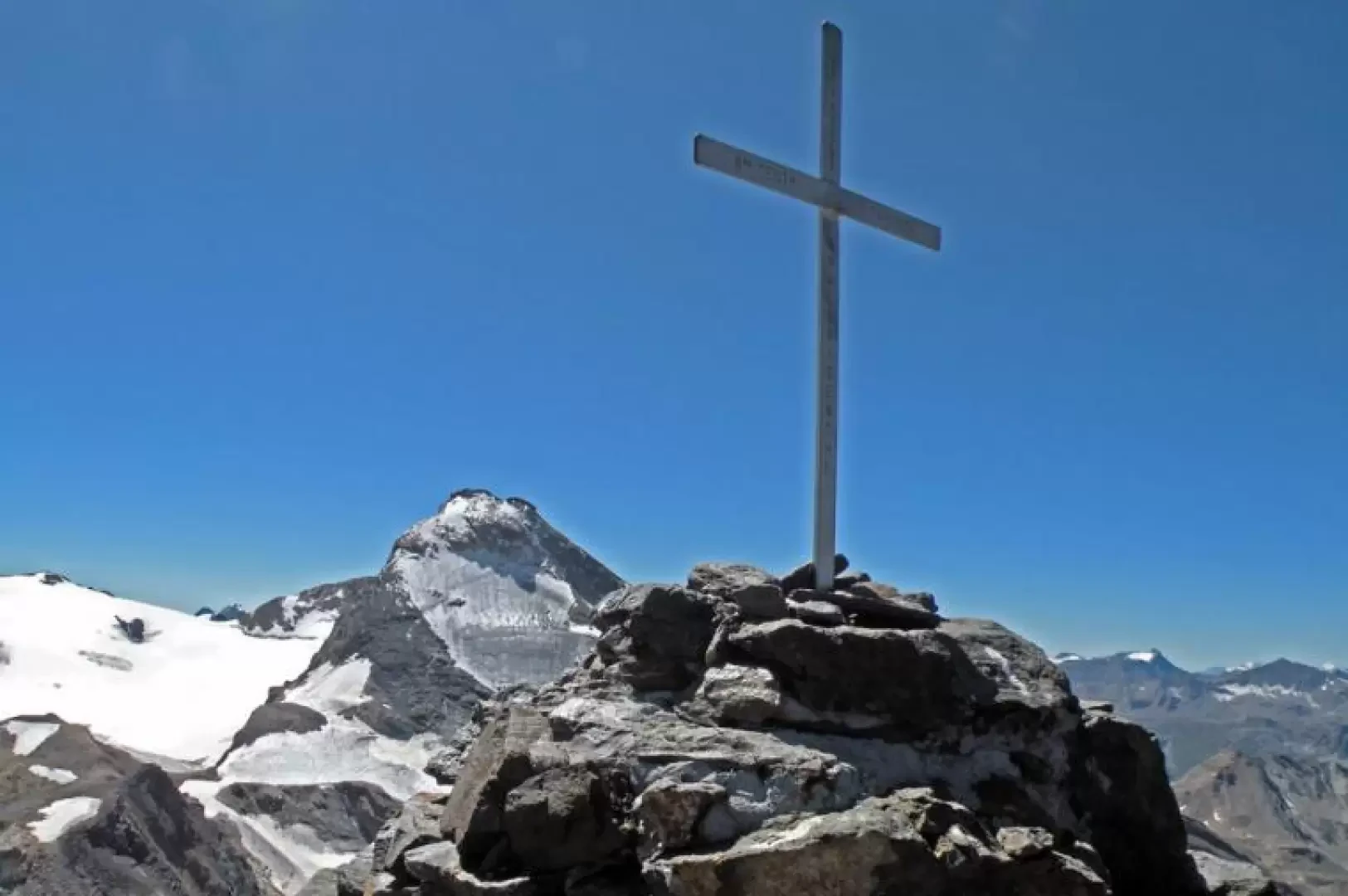
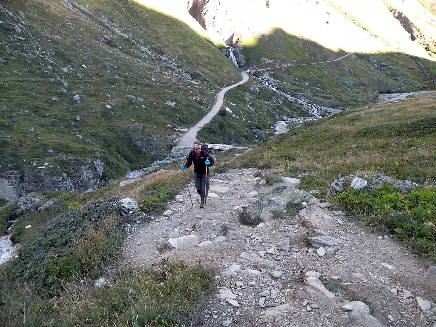
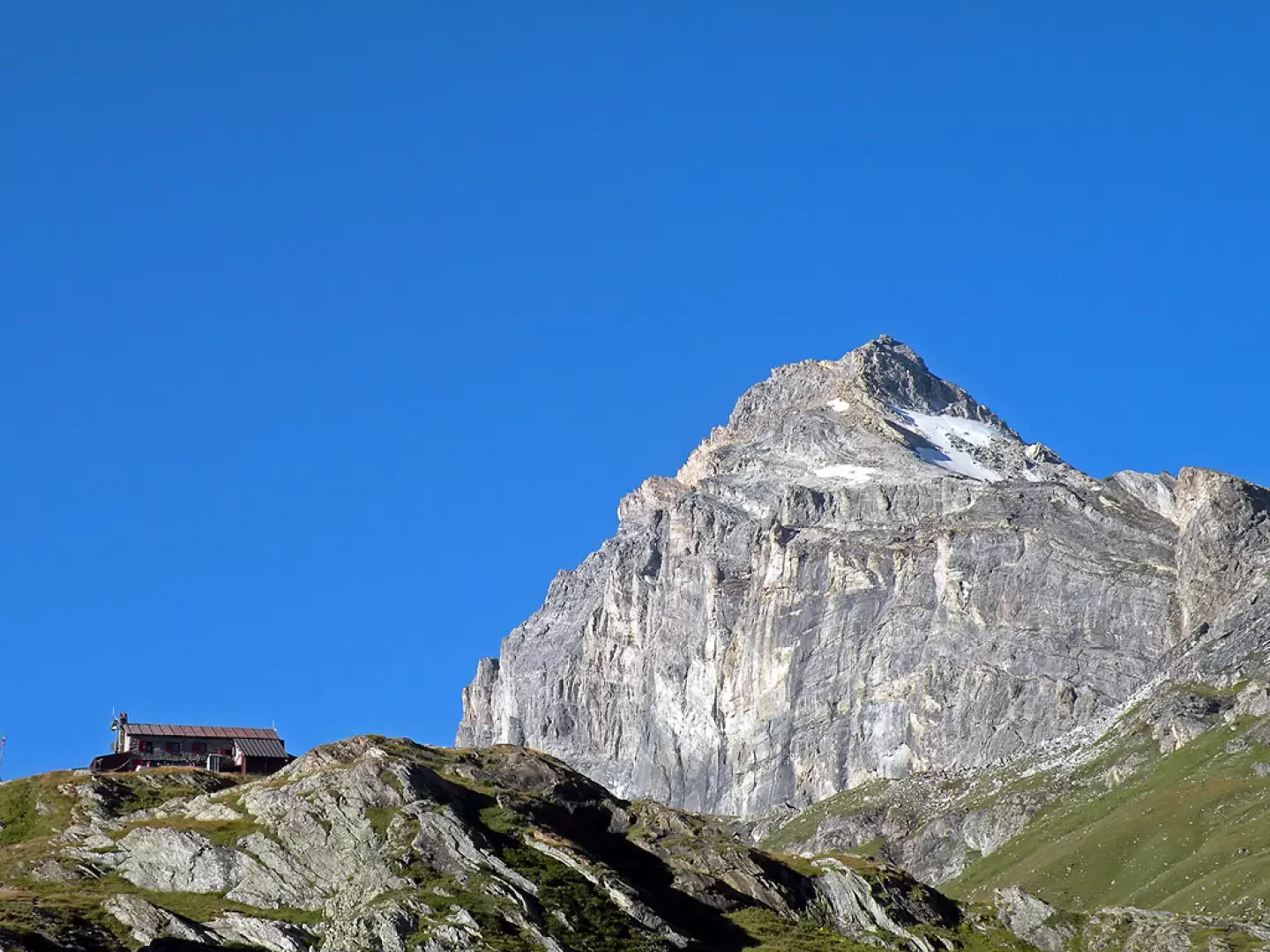
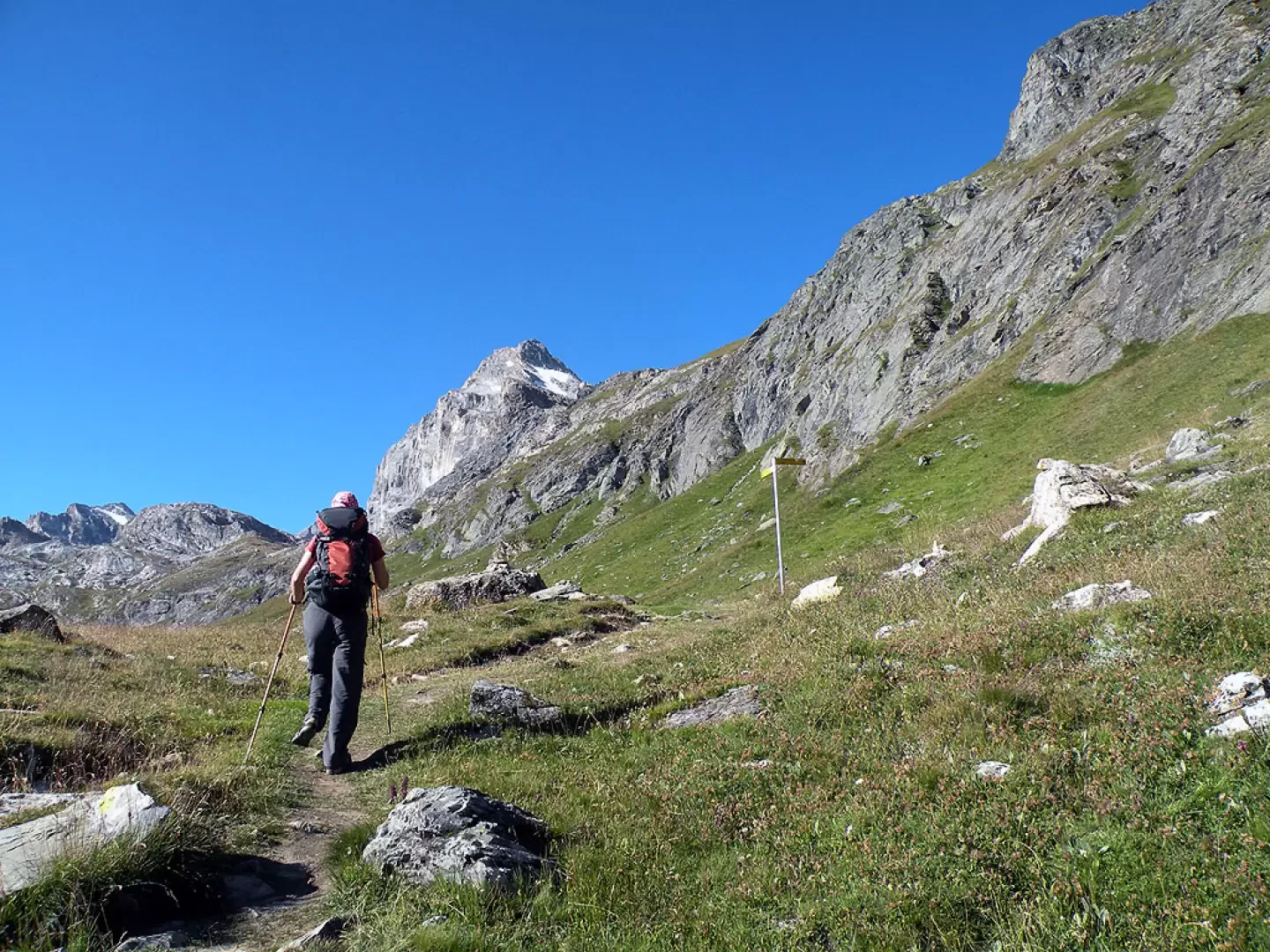
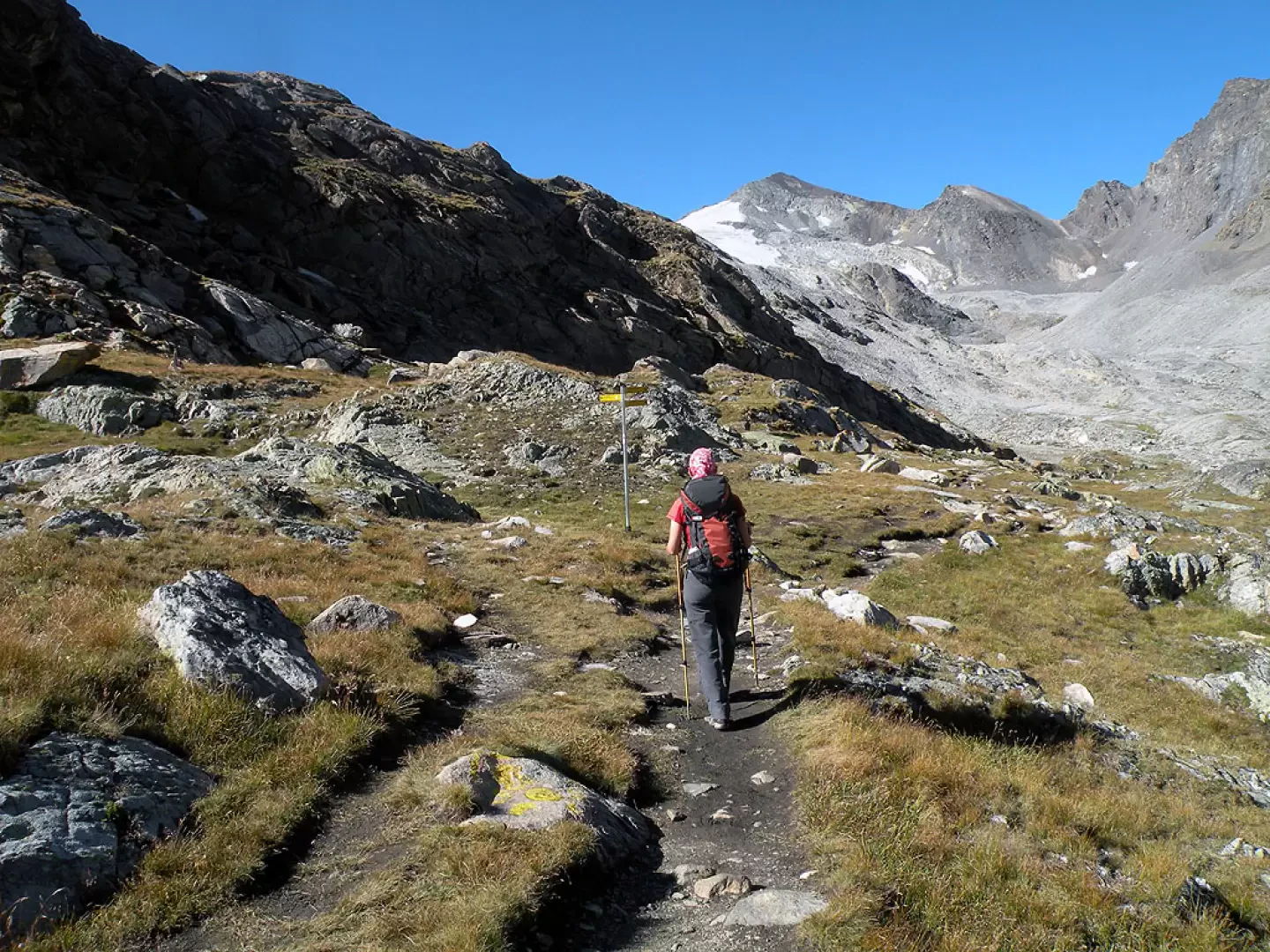
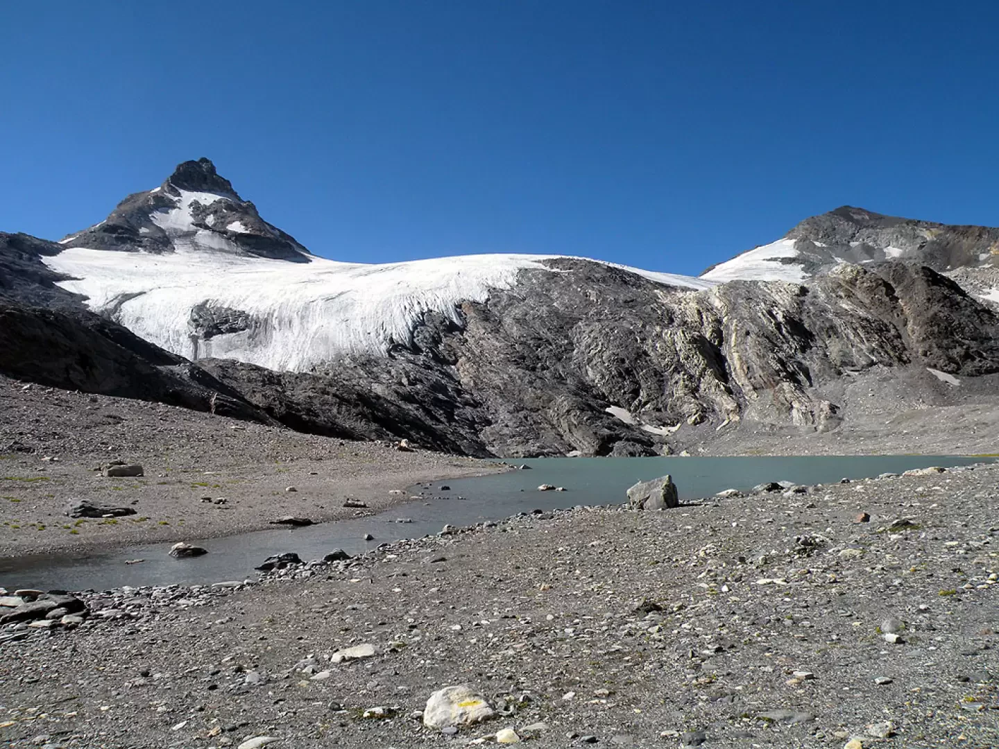
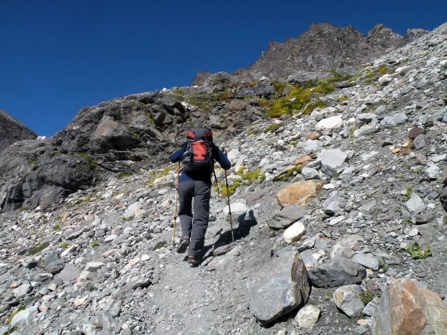
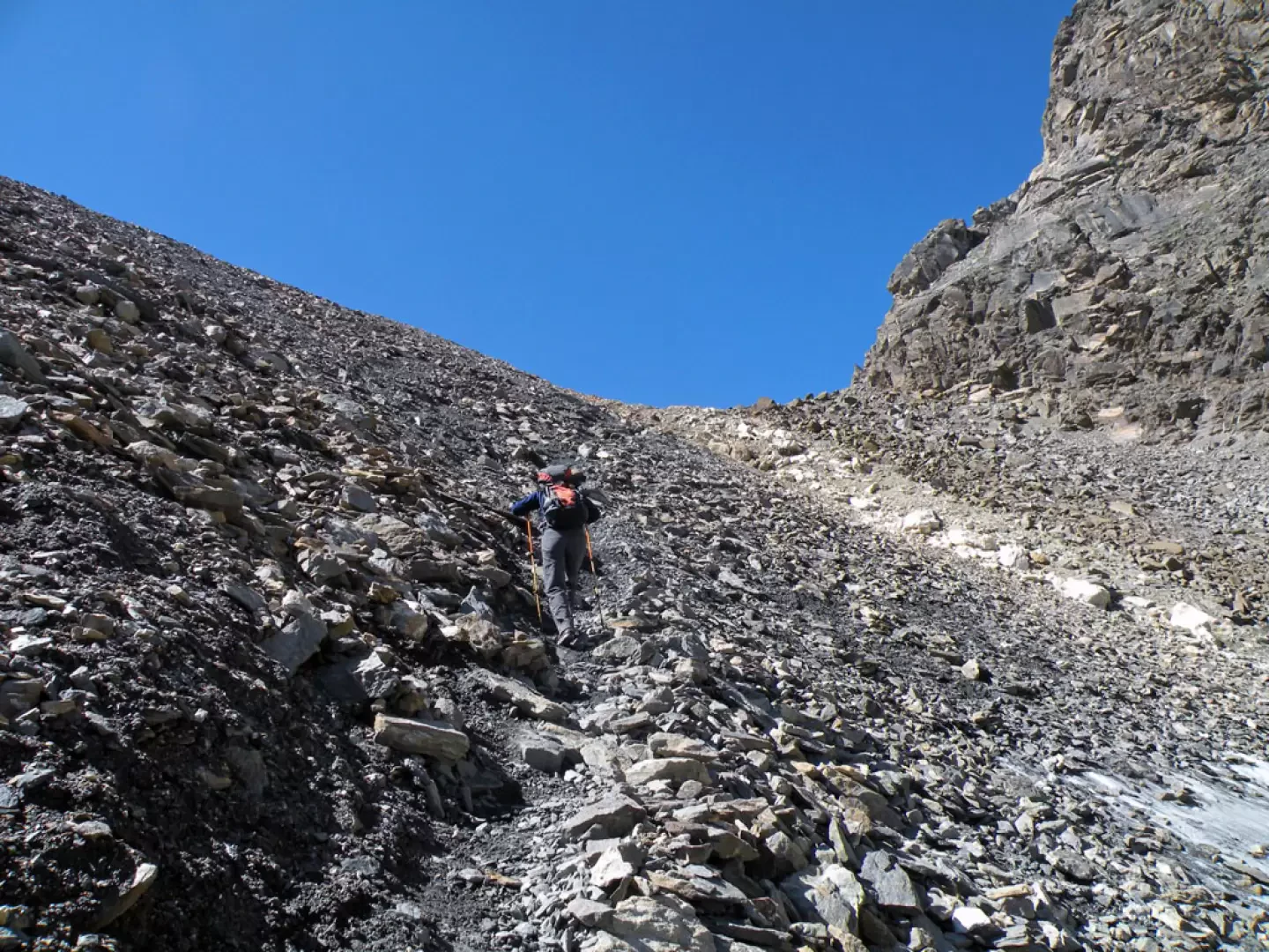
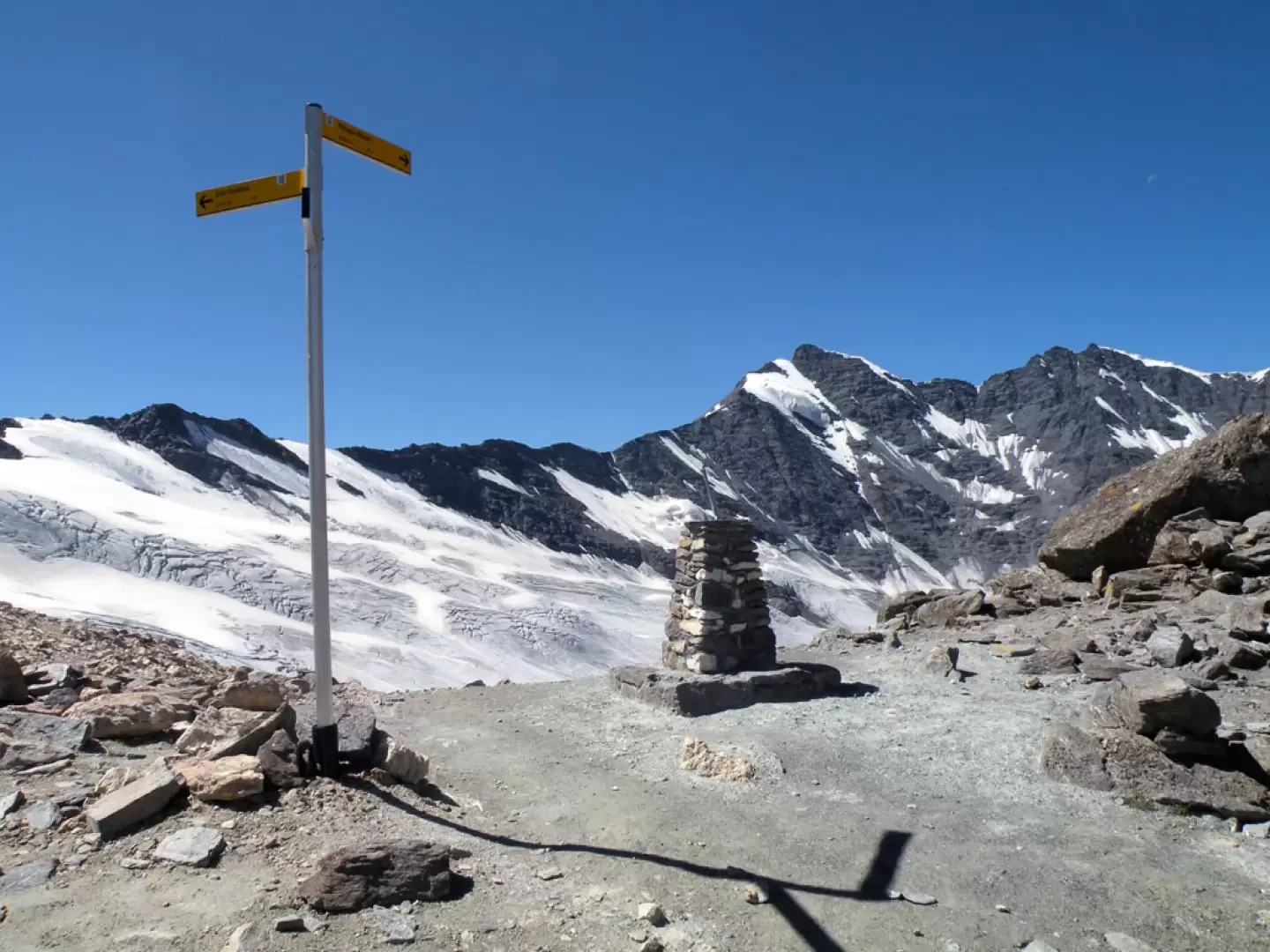
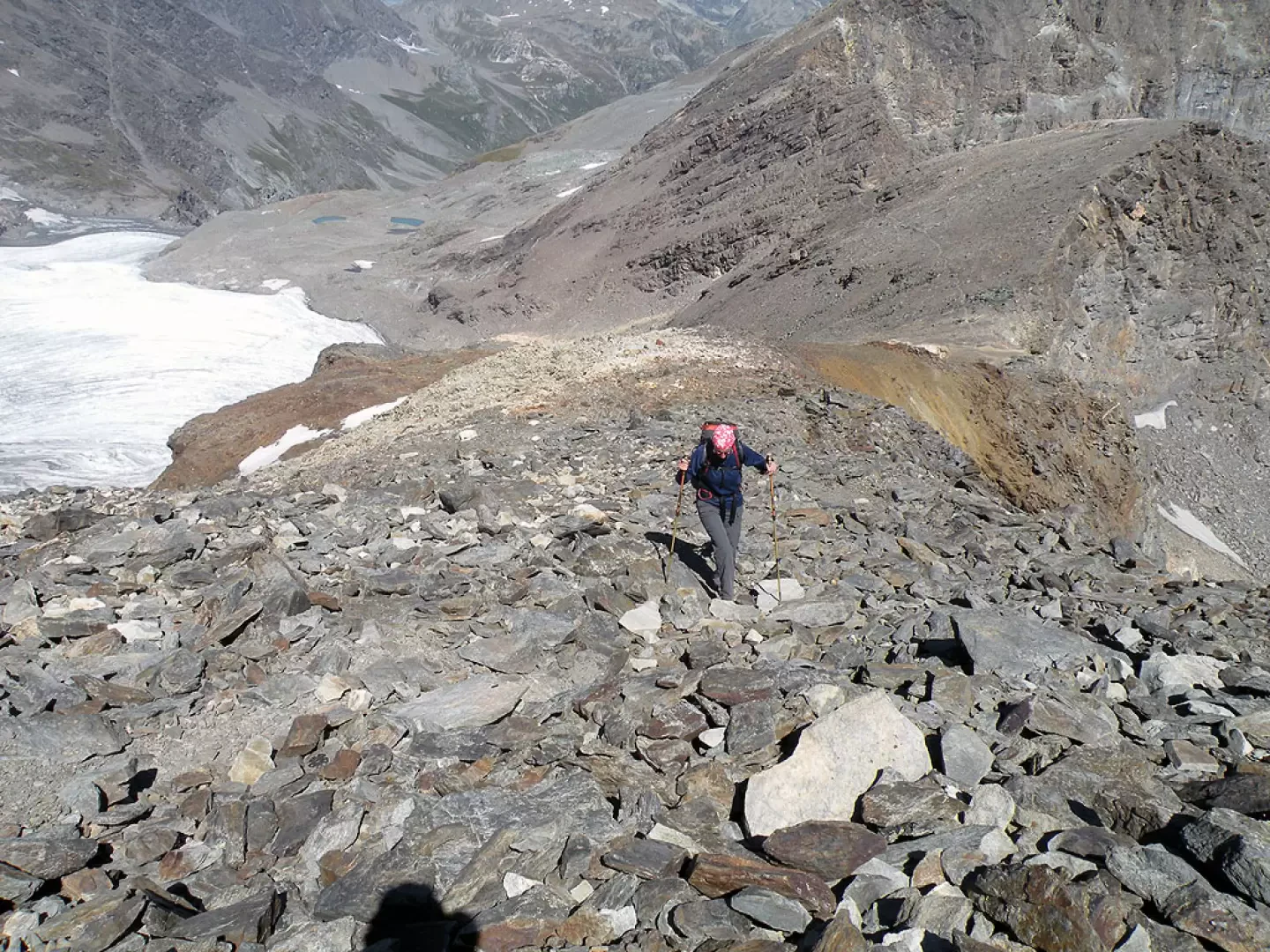
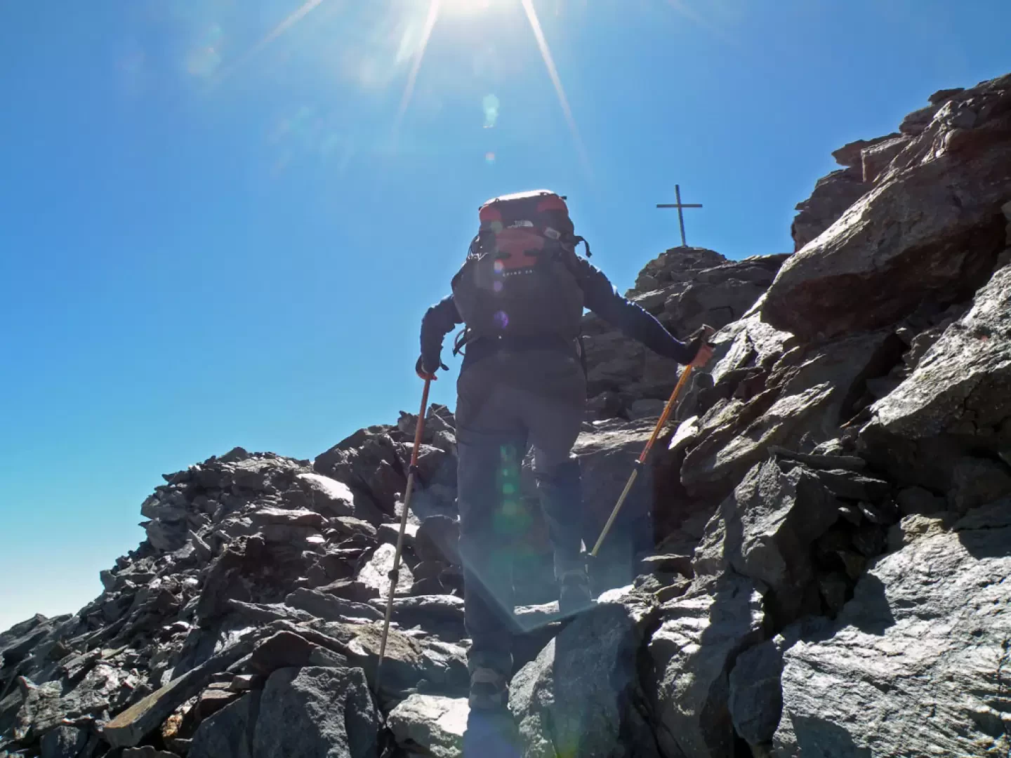
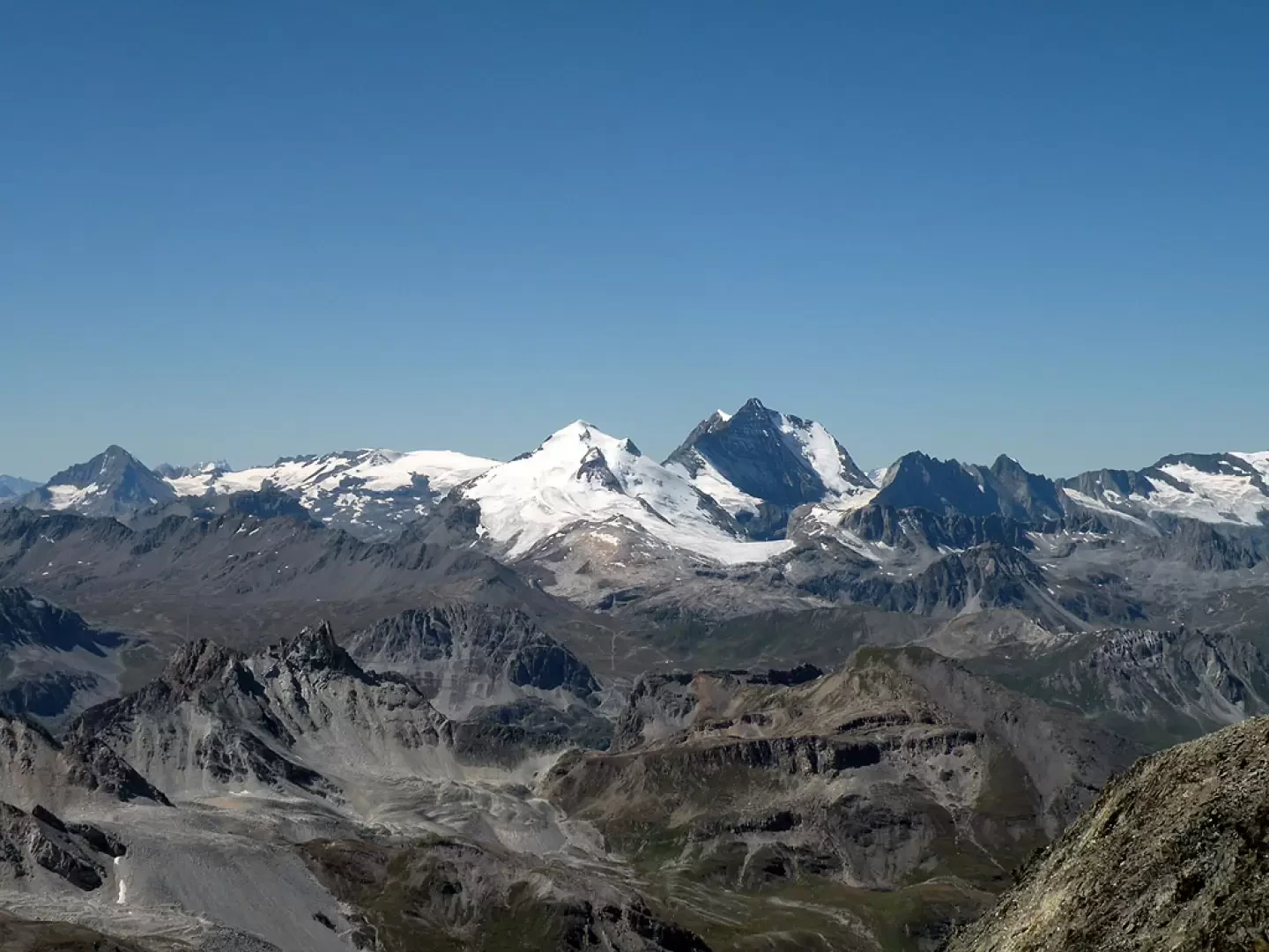
From the car park, continue along the road until you find the posts at the start of the itinerary on the left. Climb up following the signs for the Benevolo Refuge, passing by a small votive chapel and immediately after a park ranger's hut. The path continues on a false level, skirting the orographic left bank of the Dora di Rhêmes, descends a little to cross a stream and then climbs up a concrete ladder to pass over the terraced crags of the valley. Without an excessive gradient, it passes some recent water works and reaches the dirt road coming from the bottom of the valley; climb it to the left, pass in front of a high waterfall and, near a bend, turn right onto a path that cuts, with a more accentuated gradient, some hairpin bends in the road: now you can see above a rocky promontory the Benevolo refuge and further down the imposing Granta Parei. After having taken another shortcut, climb up the path to the last meadows before the refuge. To the left of this, there are markers indicating that we should continue towards a rocky hump where the path, descending slightly, crosses a small bridge and leads towards the ruined alpine pasture of Des Sauches (2313m). From here, the trail heads halfway up the mountain spurs and arrives at a fork signposted by a post, where it is necessary to turn right and climb the numerous hairpin bends that become a little steeper towards the end and lead to the grassy ridge that forms the watershed with the Comba de Golette. Continue along the comfortable ridge with a few ups and downs and you will reach another fork signposted by a small pole where you must take the track to the right. From this point, we walk on scree and stones, abandoning the beaten earth track for the stony one typical of moraine areas. In front of us we can clearly see the notch of Col Bassac Derè and to the left of it the development of the ridge that leads to the summit of Becca Traversiére. Following the stone cairns, the track, which, after climbing over a few modest morainic knolls and blending in with the rubble at times, reaches the Lac de Golette; we cross its estuary on a stone bridge and skirt it on its right side, passing at the edge of a marshy area. To our left stands the Granta Parei and, below it, the tongue of the Golette glacier, which descends almost to the shores of the lake, while to our right stands the Grande Traversière and the Punta Bassac Sud. After skirting the lake, the track ascends obliquely on the moraine and heads towards a low rocky rampart from where water is flowing down: we climb it with a short steep section to the right to reach a moraine plateau of light-coloured rocks. The stone cairns and yellow markers, which are always clearly visible, lead us towards a strip of darker rock that we climb over with a few hairpin bends and, after a short flat section that crosses an area of slightly coarser stones, we arrive below the vertical of the hill. Very laboriously, one ascends the gully on the left without hairpin bends but with an almost direct route made difficult not only by the slope but also by the ground made slippery by the fine debris and unstable stones. This brings us to the narrow pass of Col Bassac Derè (3082m), where there is a signpost and an orientation table of the surrounding peaks; in front we can see Grande Sassière with the large hanging serac and below the crevassed Glairetta glacier. From the col to the south (left), a track starts out and goes around the stony west slope of the 3109m-high anticima, climbing it in a slightly exposed manner, and with a few slightly steep hairpin bends you reach the col that precedes the summit. Still on somewhat unstable stones and with the track that seems to disappear, you arrive under the wide ridge below the summit: you climb up laboriously even in this case without too many hairpin bends, remaining now on the Rhêmes slope, on somewhat unstable stones and on a steeper path and in a short time, after having passed a couple of stone steps, you reach the large stone cairn surmounted by a metal cross on the summit. Photo gallery
Galleria fotografica
We have been there

Edited by:
Ermanno Panara
Becca Traversiere
bellissima e lunga escursione, al cospetto della Granta Parei, che viene aggirata quasi completamente, e che dalla vetta della Traversiere risulta meno imponente. Dalla vetta il panorama è a dir poco spettacolare, spazie su tutte le Alpi, ma colpiscono le vicine Grande Sassiere e la bellissima Punta Tsanteleina, sorprendente per la sua maestosità. Al ritorno siamo passati da un affollatissimo Rifugio Benevolo.bellissima e lunga escursione, al cospetto della Granta Parei, che viene aggirata quasi completamente, e che dalla vetta della Traversiere risulta meno imponente. Dalla vetta il panorama è a dir poco spettacolare, spazie su tutte le Alpi, ma colpiscono le vicine Grande Sassiere e la bellissima Punta Tsanteleina, sorprendente per la sua maestosità. Al ritorno siamo passati da un affollatissimo Rifugio Benevolo.