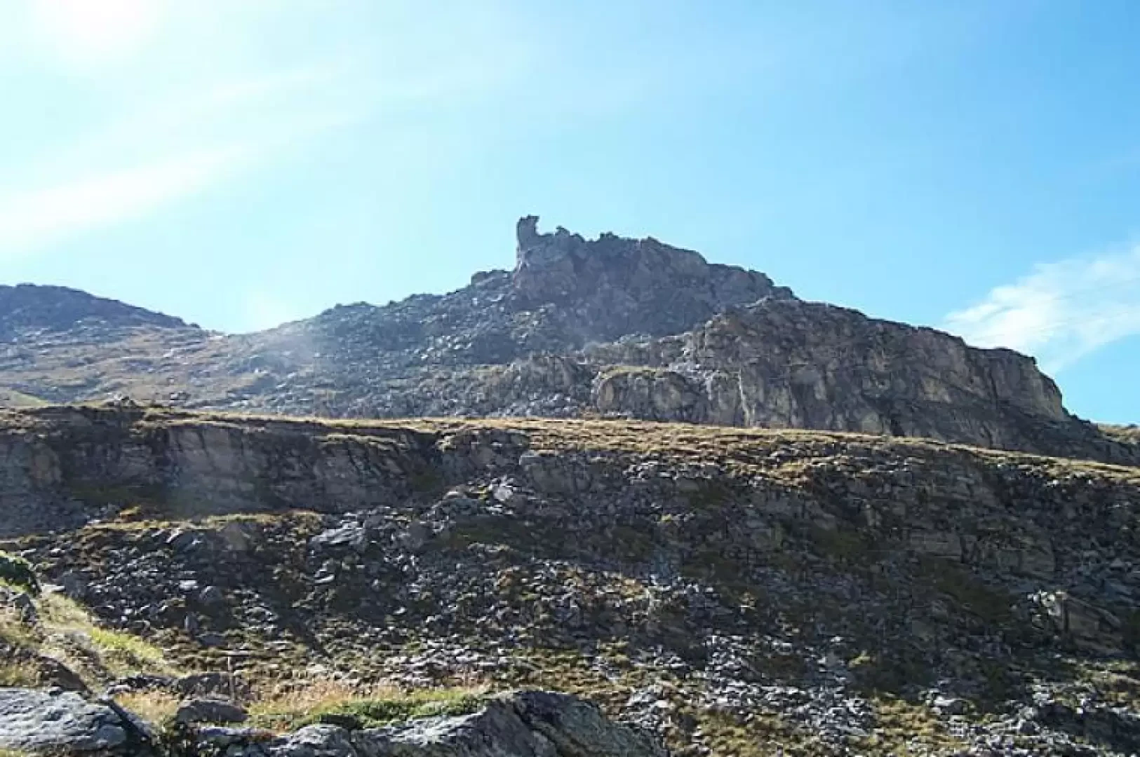
Bec du Pio Merlo, from Cielo Alto

Edited by:
Giancarlo Beretta
Updated at: 11/03/2025
Access
At the A5 motorway exit of Chatillon - Saint Vincent, follow the signs for Breuil-Cervinia. Just before entering Breuil-Cervinia, turn right at the caravan park and follow the road in the direction of "Cielo Alto". After passing the Club Med complex and making two bends, you can leave your car on the road where a recess in the retaining wall marks the start of the route.
Introduction
Short hike that leads to a privileged vantage point for those who want to enjoy the wide panorama of the mountain range from the Breithorn to Punta Tsan. With the help of a map, you can also see the location of all the huts and bivouacs from the Furggen to the Château des Dames. Indispensable, needless to say, good binoculars!
.Description
0h00' From the road, an evident path with a yellow marker bearing the number branches off to the right, going uphill, which with a turn to the left and another to the right climbs up an easy mule track that joins up a little above with a wide ski slope. Turn right, marked on the rocks opposite, up a fairly steep stretch and you come to a fork in the ski slope from which you have a view of our destination right in front of you; continue to the right to arrive at a track of a farm road which you follow to the right and you reach a small creek with the track now continuing to the left (marked on cement blocks of an old ski lift). At the next fork in the road (signpost on a boulder on the ground), turn right and head towards an old farm track that climbs with wide hairpin bends and intersects with a small railway. This one, now disused for several years, was built between the two world wars, when the road to Cervinia did not yet exist, by the Breda company and was used to transport construction and maintenance materials for the Lake Goillet dam: it left from the hamlet of Maen, below Valtournenche, to arrive at the Perrères power station and from there to the lake. Cross the railway in a perpendicular direction and, before arriving near the arrival of a chairlift, turn right towards a small high-tension pylon and, immediately to the right of this, begins the path leading to the summit. Climb the grass for a short distance and then the track, ascending more steeply, goes along the scree below the summit with an itinerary that is always evident and signposted, reaching a small col and, a few metres to the right is the summit cross.
The return journey is along the same route as the ascent.