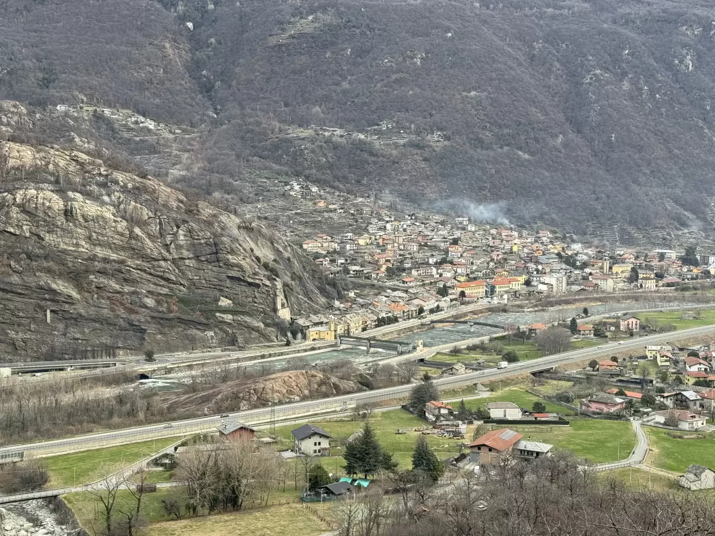
Donnas

Introduction
It is one of the first municipalities one encounters going up the Valle d'Aosta from the Canavese: it extends on both sides of the course of the Dora Baltea, dividing into two parishes, the one on the orographic left (adret) of the river, corresponding to the ancient medieval village, and the one on the right, larger in area (envers), which is headed by the hamlet of Vert.
Description
Between 1693 and 1783, Donnas and Vert were also administratively separated, forming two different municipalities. The village is rich in vestiges of the past, ranging from rock engravings to mysterious cup-marked boulders, traces of ancient times of which almost everything is unknown. The Roman conquerors, on the other hand, left a significant imprint of their passage (beyond the very name of Latin derivation): in fact, a stretch of the Via delle Gallie, the road that from Rome reached Aosta, and then forked off in the direction of the two passes known today as the Piccolo and Gran San Bernardo, has been preserved. It is about two hundred metres of road that runs alongside an overhanging rock, specially cut to make way for the roadway. There is also an archway four metres high and as many metres thick, which in medieval times was used as a gateway to the village. As evidence of the Roman road system, there is also, not far away, a milestone column showing the distance to the capital Augusta Praetoria (36 miles).
As with all Valdostan municipalities, the subsequent history, from the Middle Ages to the 19th century, is full of contrasts between noble families, both among themselves and with the Savoy sovereigns. However, an important characteristic of the municipality concerns the nature of its territory, which enjoys, at least as far as the Adret side is concerned, a particularly mild microclimate, enriched by rainfall above the regional average. These are therefore particularly favourable conditions for agricultural activity, which is however nowadays rather seen as a way of supplementing income earned in other sectors. The wine-growing sector is an exception: for more than thirty years now, the recovery and exploitation of the characteristic terraces on the sunniest slopes has been underway, rewarded with the recognition of Denominazione d'Origine Controllata for Donnas, the red wine made from the grapes of a local vine variety.
Reference indexes
- Refuges
- Bivouacs
- Vette
- Hills
- lakes
- Geosites
- Geosites
- Cultural Goods
- Articles
- Reviews
- Biographies
- Legends
- Tags
- Authors
Information sheet
Area: 34.24 sq km
Altitude: 322m
Maximum elevation: Mont Debat (2622m)
Number of inhabitants: 2534
Name in dialect:
Inhabitant name:donnassins
Patron Saint: San Pietro in Vincoli (1 August)
Internet site: www.comunedidonnas.info
Webcam:
Neighbouring communes: Arnad, Bard, Carema, Hône, Perloz, Pont-Saint-Martin, Pontboset, Quincinetto, Trausella, Traversella
Villages and hamlets: Albard, Artada, Balmasse, Barat, Barme, Berriu, Beuby, Bodonne, Bondon, Chanton, Chelevrinne, Chenail, Cignas, Clapey, Coudrette, Fabrique, Fioley, Glaires, Grand-Vert, I Pian, La Balma, La Cerva, Lilla, Lius, Mamy, Montat, Montey, La Moya, Novesse, Outrefer, Paians, Painfey, Pampery, Perroz, Peyron, Place, Planet, Piole, Pomerou, Porcelette, Pramotton, Praposa, Prelle, Reisen, Ronc, Rondevacca, Rossignod, Rovarey
Alpeggi: Bonze
Information
Superficie: 34,24 kmq
Altitudine: 322 m
Maggior elevazione: Mont Debat (2622m)
Numero abitanti: 2.408 (31.12.2020)
Nome in dialetto: Dounàs
Nome abitanti: donnassins
Santo Patrono: San Pietro in Vincoli (1° agosto)
Sito internet: www.comunedidonnas.info
Comuni confinanti: Arnad, Bard, Carema, Hône, Perloz, Pont-Saint-Martin, Pontboset, Quincinetto, Trausella, Traversella