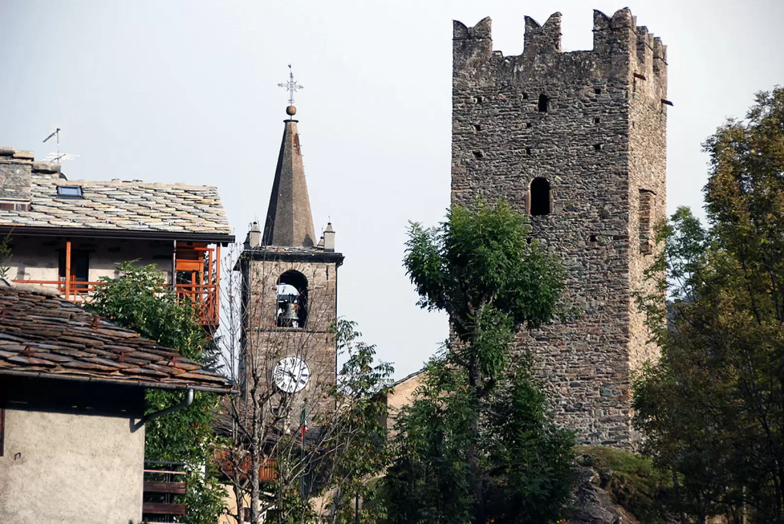
Champorcher

Access
Champorcher, situato nella Valle d’Aosta a 1.427 metri di altitudine, è facilmente raggiungibile da diverse località del Nord Italia e oltre grazie a una rete viaria e ferroviaria ben strutturata. Il comune si trova lungo la prima vallata sulla destra orografica della Dora Baltea per chi entra in Valle d'Aosta dal Canavese, ed è collegato al fondovalle da una strada regionale che risale l’intera vallata.
Gli aeroporti più vicini sono quelli di Torino-Caselle, situato a circa 80 km di distanza, e Milano-Malpensa, che dista circa 150 km. Entrambi gli scali offrono collegamenti nazionali e internazionali e sono dotati di servizi di autonoleggio e collegamenti ferroviari verso le principali città del Nord Italia. Per chi arriva in aereo, Torino rappresenta la soluzione più comoda, con la possibilità di proseguire in treno o in auto fino alla Valle d’Aosta.
Il sistema ferroviario permette di avvicinarsi a Champorcher con una certa facilità. La stazione più vicina è quella di Pont-Saint-Martin, situata lungo la linea ferroviaria Chivasso – Aosta. Questa tratta è servita da treni regionali con collegamenti diretti da Torino, mentre per chi proviene da Milano è necessario un cambio a Chivasso. Una volta giunti a Pont-Saint-Martin, il tragitto verso Champorcher può proseguire in autobus o in auto privata.
L’accesso stradale principale avviene attraverso l’autostrada Torino-Aosta, con uscita consigliata a Pont-Saint-Martin per chi proviene da Torino o da Milano. Dopo l’uscita autostradale, si segue la Strada Statale in direzione Aosta fino a Hône, dove si imbocca la Strada Regionale di Champorcher, che risale la valle per circa 14 km fino al capoluogo Château. Il percorso è agevole e ben segnalato, con una carreggiata asfaltata che attraversa diverse frazioni e borghi caratteristici della vallata.
Per chi desidera utilizzare i mezzi pubblici, il servizio di autobus collega Pont-Saint-Martin a Champorcher con corse giornaliere gestite dalla compagnia di trasporti locale. Gli orari variano a seconda della stagione, con una maggiore frequenza nei periodi di alta affluenza turistica.
La rete viaria provinciale garantisce un buon livello di accessibilità, con strade che, pur essendo di montagna, sono generalmente ben mantenute e percorribili durante tutto l’anno. Durante l’inverno è consigliabile montare pneumatici da neve o avere catene a bordo, specialmente in caso di nevicate abbondanti. Per chi prosegue oltre il capoluogo, la strada si restringe e diventa sterrata in alcuni tratti, conducendo fino alla località Dondena, punto di partenza per escursioni verso il Lago Miserin e il Parco Naturale del Mont Avic.
Champorcher, grazie alla sua posizione strategica, è facilmente accessibile sia per chi viaggia in auto che per coloro che preferiscono i mezzi pubblici. La combinazione di autostrade, strade regionali e trasporti ferroviari e autobus rende questa destinazione montana raggiungibile da diverse parti d’Italia e dell’Europa.
Introduction
Municipality located at an altitude of 1427m, which gives its name to the entire valley in which it is situated: the first on the orographic right of the Dora Baltea for those entering Valle d'Aosta from Canavese.
Description
It has always been of military interest due to its isolation (a real mule track was only built by King Victor Emmanuel II): at first presumed to be the last Salasso stronghold (Dondena valley), then from the 12th century the site of a castle whose ruins are still preserved today, and finally the gateway for the partisan forces of non-autonomist inspiration during the last world war.
For a long time a royal hunting ground, it is now a village with a mixed agricultural and tourist vocation, with 25km of downhill runs and an 8km cross-country skiing loop.
.Information
Area: 68.46 square km
Altitude: 1427m
Maximum elevation: Mont Glacier (3186m)
Number of inhabitants: 406
Name in dialect:
Inhabitants:
Patron Saint:St. Nicholas (6 December)
Website: www.comune.champorcher.ao.it
Webcam: Locality Laris
Neighbouring municipalities: Champdepraz, Cogne, Fénis, Issogne, Pontboset, Valprato Soana, Vico Canavese
Villages and hamlets:
Alps: