Bionaz

Edited by:
Maurizio Bergamini
Introduction
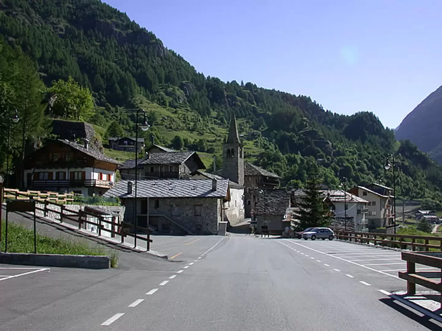
A mountain commune at the end of the Valpelline; it has a rather large surface area (142 square kilometres), but a very small population spread over several villages. Its history has always been linked to that of the two passes that connect with the Swiss Valais: the Crête Sèche pass and the Collon pass. Already the Salassi and the Romans frequented them, but it is from the 14th century that they took on greater importance, since the Savoy gradually lost their possessions in the Valais, thus making Bionaz a border commune. The result was a trickle of more or less licit trade (salt, tobacco, cattle), with the associated establishment of border guards (until 1972).Description
Information sheet
Area: 142.09 square km
Altitude: 1600m
Maximum elevation: Dent d'Herens (4171m)
Number of inhabitants: 233
Name in dialect:
Inhabitant name:
Patron Saint:
Internet site:
Webcam:
Neighbouring municipalities: Bagnes, Evolène, Nus, Ollomont, Oyace, Torgnon, Valtournenche, Zermatt
Villages and hamlets: Balmes, Chamin, Chentre, Chez Badin, Chez Chenoux, Chez les Merloz, Chez Noyer, Clou Neuf, Crêtes, Dzovennoz, La Ferrère, La Léchère, La Quellod, Lexert, Ley, Lo Vianoz, Moulin, Perquis, Places, Places, Plan de Veyne (main town), Pouillayes, Prarayer, Propéraz, Rey, Rû, Vagère
Highlands:
Description
A mountain municipality located at the end of Valpelline; it has a fairly large surface area (142 square kilometres), but a very small population spread over several villages. Its history has always been linked to that of the two passes that connect it with the Swiss Valais: the Crête Sèche pass and the Collon pass. Already the Salassi and the Romans frequented them, but it is from the 14th century that they took on greater importance, since the Savoy gradually lost their possessions in the Valais, thus making Bionaz a border commune. This resulted in a trickle of more or less licit trade (salt, tobacco, livestock), with the associated establishment of border guards (until 1972).
The second half of the 20th century saw the emergence of a new border town.
The second half of the 20th century saw a turning point with the construction of the Place Moulin dam. Conceived for the hydroelectric exploitation of the waters of the emerging Buthier, it also proved to be an attractive tourist attraction, thanks to its enormous size (155m high and 680m long) and the reservoir that holds up to 110 million cubic metres of water.
The Bionaz area is a destination for tourists.
The Bionaz area has been a destination for high-mountain tourists since the 19th century, when a tiny hotel was built in Prarayer, in the pastures now buried by the reservoir, to cope with the demand. There are many famous peaks in the municipality, shared with the neighbouring valleys and the destination of wonderful hikes: the Crête Sèche, the Mont Collon, the Pointe de Tsan, the Château des Dames, culminating at the 4171m Dent d'Hérens.
A mountain commune at the end of the Valpelline; it has a fairly large surface area (142 square km), but a very small population spread over several villages. Its history has always been linked to that of the two passes that connect it with the Swiss Valais: the Crête Sèche pass and the Collon pass. Already the Salassi and the Romans frequented them, but it is from the 14th century that they took on greater importance, since the Savoy gradually lost their possessions in the Valais, thus making Bionaz a border commune. The result was a trickle of more or less licit trade (salt, tobacco, cattle), with the associated establishment of border guards (until 1972). The second half of the 20th century saw an epoch-making change with the construction of the Place Moulin dam. Conceived for the hydroelectric exploitation of the waters of the emerging Buthier, it also proved to be an interesting tourist attraction, thanks to its enormous dimensions (155m high and 680m long) and the reservoir containing up to 110 million cubic metres of water. The Bionaz area has been a destination for high-mountain tourists since the 19th century, when a tiny hotel was built in Prarayer, in the pastures now buried by the reservoir, to cope with the demand. There are numerous famous peaks on the municipal territory, shared with the neighbouring valleys and the destination of stupendous hikes: the Crête Sèche, the Mont Collon, the Pointe de Tsan, the Château des Dames, culminating at the 4171 m Dent d'Hérens.
Information
Superficie: 142,09 kmq
Altitudine: 1600m
Maggior elevazione: Dent d'Herens (4171m)
Numero abitanti: 233
Nome in dialetto:
Nome abitanti:
Santo Patrono:
Sito internet:
Webcam:
Comuni confinanti: Bagnes, Evolène, Nus, Ollomont, Oyace, Torgnon, Valtournenche, Zermatt
Villaggi e frazioni: Balmes, Chamin, Chentre, Chez Badin, Chez Chenoux, Chez les Merloz, Chez Noyer, Clou Neuf, Crêtes, Dzovennoz, La Ferrère, La Léchère, La Quellod, Lexert, Ley, Lo Vianoz, Moulin, Perquis, Places, Plan de Veyne (capoluogo), Pouillayes, Prarayer, Propéraz, Rey, Rû, Vagère
Alpeggi: