Arnad

Introduction
A valley bottom municipality, located on the plain of the same name in the lower Aosta Valley. It extends on both orographic sides of the Dora Baltea river, once connected by the beautiful Romanesque Echallod bridge, now partially collapsed during the last flood.Description
Information sheet
Area: 28.73 square km
Altitude: 361m
Maximum elevation: Mont Crabun (2710m)
Number of inhabitants: 1323
Name in dialect: Arnà
Inhabitant name: Arnadins - Arnayot, Arnayotte or Arnadin, Arnadine
Patron Saint: Saint Martin (11 November)
Website:www.comune.arnad.ao.it
Webcam:
Neighbouring municipalities: Bard, Challand-Saint-Victor, Donnas, Hône, Issime, Issogne, Perloz, Pontboset, Verrès
Villages and hamlets: Anvyey, Arnad-Le-Vieux, Bonavesse, Champagnolaz, Château, Chez Fornelle, Clapey, Clos de Barme, Costa, Echallod, Echallogne, Extraz, Les Vachères, Machaby, Pied-de-Ville, Prouve, Revre, Rollety, Sisan, Torretta, Ville
Highlands:
Description
Municipality at the bottom of the valley, located on the plain of the same name in the lower Valle d'Aosta. It extends on both orographic sides of the Dora Baltea river, once connected by the beautiful Romanesque Echallod bridge, now partially collapsed during the last flood.
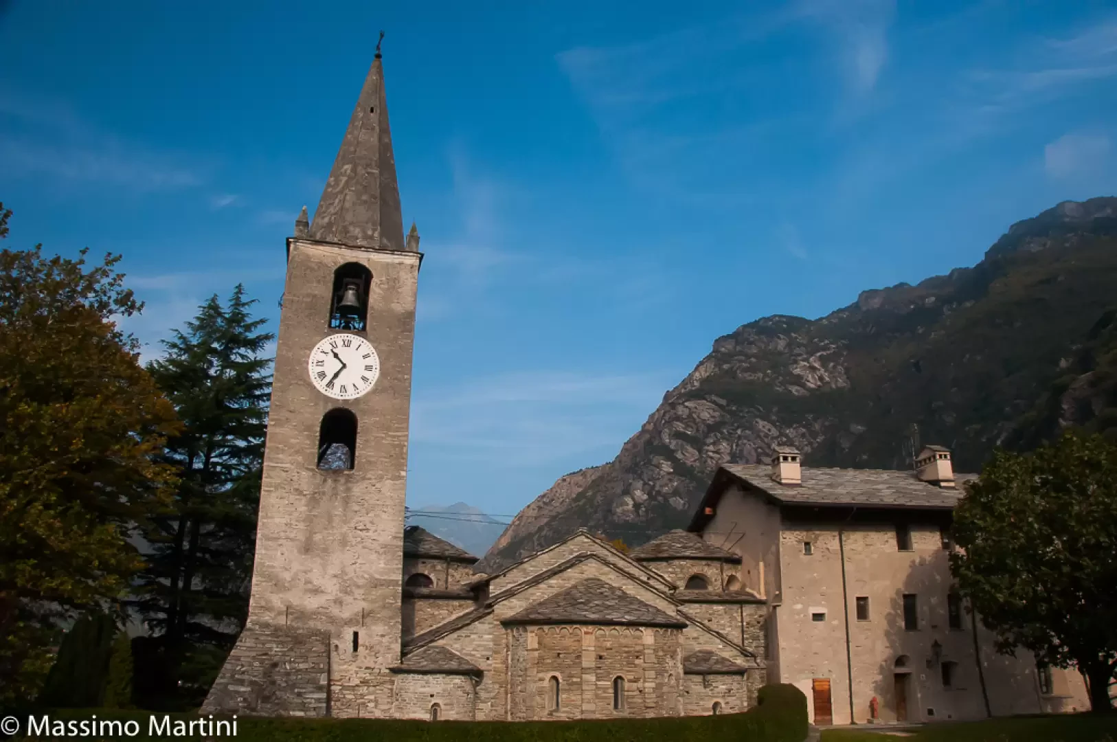
The name is thought to be linked to the name of the town. The place name is said to be related to the Latin word arena, meaning sand: in fact, the town's history is punctuated by floods, starting in the 11th century, when the parish church of San Germano was swept away by the waters, until 15 October 2000, when the river did considerable damage to private homes and various artisan and industrial infrastructures. In the Middle Ages, the municipality was of great importance, as evidenced by the presence of no less than three castles and a tower on its territory. Originally a feud of the De Arnado family, the seigniory then passed largely to the Vallaise, one of the most important noble families in Valle d'Aosta. The castle that bears their name, however, dates only from the 17th century and is still privately owned. Of particular historical and architectural interest are the current parish church of San Martino, built between the 11th and 12th centuries after the previous one had been swept away by the Dora, and the Machaby sanctuary, which rises above the village in the thick of the chestnut forest. Although the modernisation of the economy has imposed industrial settlements, Arnad retains some of its agricultural traditions, at least the most famous ones: wine-growing, the production of typical sausages, to which is added that of the now famous aromatised lard (the last Sunday in August sees the now classic 'Féhta dou lar', one of the region's main food and wine festivals). Finally, it is worth noting the presence of several rock walls in the municipality equipped for sports climbing.
A valley bottom municipality, located on the plain of the same name in the lower Aosta Valley. It extends on both orographic sides of the Dora Baltea river, once connected by the beautiful Romanesque Echallod bridge, now partially collapsed during the last flood. The place name is said to be related to the Latin word arena, meaning sand: in fact, the town's history is studded with floods, starting in the 11th century, when the parish church of San Germano was swept away by the waters, until 15 October 2000, when the river did considerable damage to private homes and various craft and industrial infrastructures. In the Middle Ages, the municipality was of great importance, as evidenced by the presence of no less than three castles and a tower on its territory. Originally a feud of the De Arnado family, the seigniory then passed largely to the Vallaise, one of the most important noble families in Valle d'Aosta. The castle that bears their name, however, dates only from the 17th century and is still privately owned. Of particular historical and architectural interest are the current parish church of San Martino, built between the 11th and 12th centuries after the previous one had been swept away by the Dora, and the Machaby sanctuary, which rises above the village in the thick of the chestnut forest. Although the modernisation of the economy has imposed industrial settlements, Arnad retains some of its agricultural traditions, at least the most famous ones: wine-growing, the production of typical sausages, to which is added that of the now famous aromatised lard (the last Sunday in August sees the now classic 'Féhta dou lar', one of the region's main food and wine festivals). Lastly, it is worth noting the presence in the municipality of several rock walls equipped for sports climbing.
Information
Superficie: 28,73 kmq
Altitudine: 361m
Maggior elevazione: Mont Crabun (2710m)
Numero abitanti: 1323
Nome in dialetto: Arnà
Nome abitanti: Arnadins - Arnayot, Arnayotte o Arnadin, Arnadine
Santo Patrono: San Martino (11 novembre)
Sito internet: www.comune.arnad.ao.it
Webcam:
Comuni confinanti: Bard, Challand-Saint-Victor, Donnas, Hône, Issime, Issogne, Perloz, Pontboset, Verrès
Villaggi e frazioni: Anvyey, Arnad-Le-Vieux, Bonavesse, Champagnolaz, Château, Chez Fornelle, Clapey, Clos de Barme, Costa, Echallod, Echallogne, Extraz, Les Vachères, Machaby, Pied-de-Ville, Prouve, Revire, Rollety, Sisan, Torretta, Ville