Allein

Access
To reach Allein, several transport solutions are available. The nearest airport is Turin-Caselle, about 130 km away, while Milan-Malpensa is 180 km away. From both airports one can continue by train or hire car. The main railway station is Aosta, which is connected to the Piedmontese centres by regional trains: from the capital it is possible to reach Allein by local bus or taxi. The Aosta-Ivrea railway line is temporarily non-operational until December 2026 for electrification works. By car, access is via the Turin-Aosta motorway, exit Aosta East, continuing on the state road towards the Great St. Bernard Pass, until the signposted junction for Allein after Etroubles. The provincial road network is smooth but, during the winter, may be subject to adverse weather conditions that slow down travel. Always check the transport situation and updated connections before setting off.
.Introduction
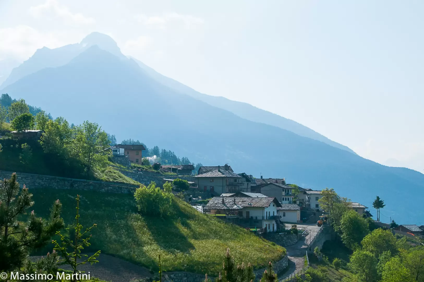
Allein is a small mountain village in the Gran San Bernardo Valley, nestled on the orographic left of the valley at an altitude of 1,190 metres, near the Artanavaz stream and about 14 km from the regional capital Aosta. The geographical context is marked by the profile of Mount Saron, which offers a suggestive backdrop of meadows, mixed forests and pastures, typical of the Aosta Valley alpine environment. Historically, its dominant position along State Road 27, which connects Italy to Switzerland via the Great St Bernard Pass, has played a key role in transit and communication since ancient times. The village is distinguished by the preservation of centuries-old traditions, a lively rural culture and archaeological evidence from Roman times, such as republican silver coins, a sign of its importance as a historical crossroads.
Description
The municipal territory is spread out between grassy ridges and gentle hills, offering a panoramic view encompassing the middle and upper valley. Important natural elements are the minor watercourses and vast wooded areas, with Mount Saron (2,681 m) acting as a bulwark. The presence of prairies, larch and birch forests and pastures that are still actively managed gives an Alpine landscape in balance between agricultural activity and respect for the environment. The centre presents itself as a sequence of small rural hamlets (Ville is the main one) where stone architecture and slate roofs preserve the local historical and landscape value. Allein's origins can be traced back to Roman times, a period when the road to Octodurus (Martigny) passed through the area; during the Middle Ages, the village was part of the Lordship of Gignod, then of the Savoy and the Pallavicino-La Crête family. A wall fragment in the hamlet of Ville, dated 1007, also testifies to the presence of leper hospitals in ancient times. Prominent figures include Piergiorgio Collomb, known for his commitment to the promotion of local heritage and the foundation of the Carnival Museum. Allein's economy has traditionally been based on cattle breeding, dairy production and forest management; artisanal woodworking, linked to knowledge handed down over the centuries, is still an element of identity in the village. The Carnival of Coumba Freida is the most heartfelt occasion: the costumes, called Landzettes, recall Napoleon's uniforms and are made with embroidery and symbolic details that reflect the light and drive out spirits, imitating spring rebirth. Collective moments such as the Fëta di Trifolle (dedicated to potato soup) and the baking of black bread in the community oven keep the social bond between residents alive.
Allein offers a wide range of opportunities for hiking and nature tourism. The network of marked trails leads through forests, pastures and marginal grazing areas to panoramic views of the valley floor and surrounding peaks. Points of interest include the parish church of Santo Stefano, dating back to the 15th century and characterised by a pointed bell tower, the house-fort of Ayez (Meison di Carnaval de la Coumba Freida), which houses the ethnographic museum of Carnival, and medieval remains scattered among the hamlets. The traditions linked to festivals, wood crafts and gastronomic festivals (such as those dedicated to the products of the land) contribute to enriching the experience of those who visit this Alpine 'gateway'. Historical curiosities link the municipality's past to legends about the transit of pilgrims and troops, while modernisation has left traces of Alpine civilisation intact.
Information
Area: 7.96 km²
Altitude: 1,190m
Maximum elevation: 2,681m - Mont Saron
Number of inhabitants: 208 (as of 1.01.2024)
Name in dialect: Alèn
Inhabitants' name: Allençois
Patron Saint: Saint Stephen (26 December)
Neighbouring communes: Doues, Étroubles, Gignod
Network site: comune.allein.ao.it
Points-of-interest
- alpeggi - map
- bivouacs - map
- villages - map
- colli - map
- vette - map
- cultural heritage - map
- lplaces of worship - map